
MAINE, USA — Wow, it's been a while since I've gotten to write a weather blog!
This summer has been pretty quiet so far, all things considered. Other than a couple of rogue tornado-warned storms and a couple of stronger wind gusts, the severe season has not been too active.
That changes Thursday, I think, as a cold front rolls through. Hot, humid air will provide plenty of fuel for thunderstorms as the front approaches.
While there have been some isolated damage reports from other storms across Maine and New Hampshire this summer, Thursday's potential seems a bit more widespread.
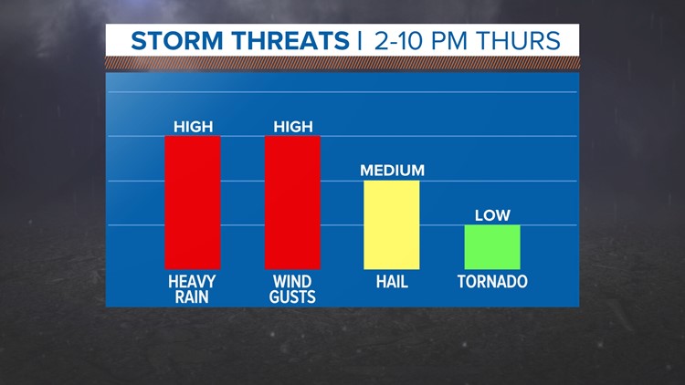
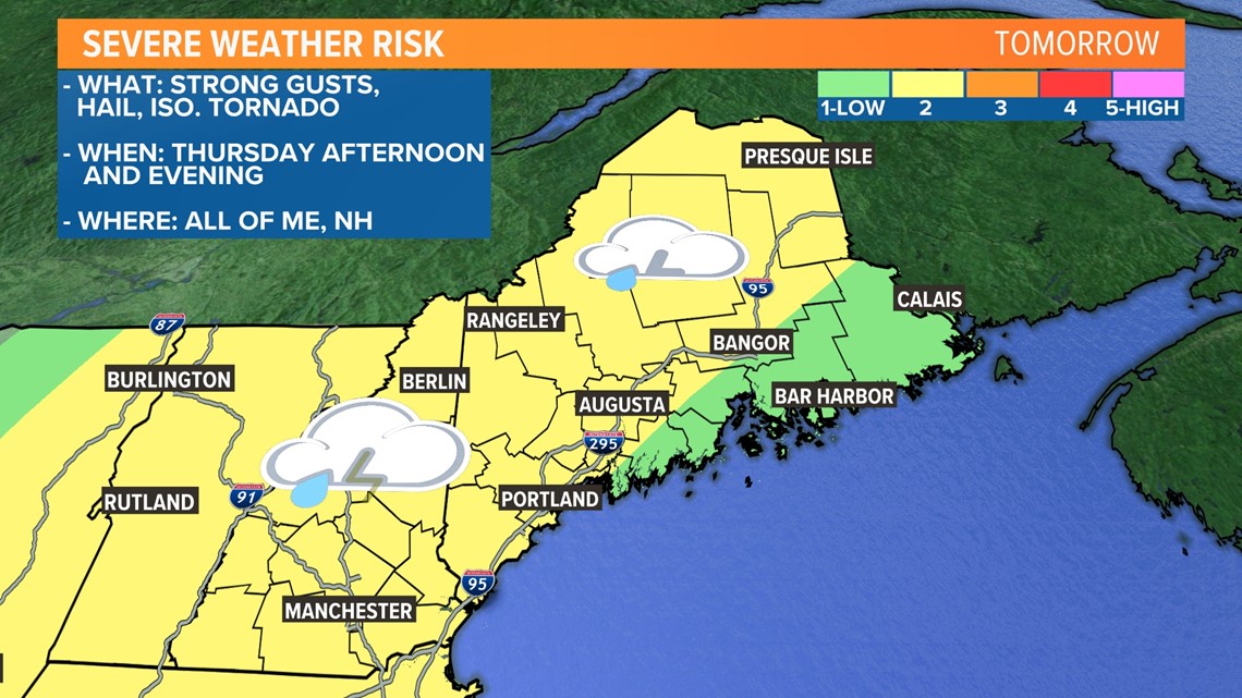
Strong wind gusts, hail, and even an isolated tornado are all possible Thursday afternoon.

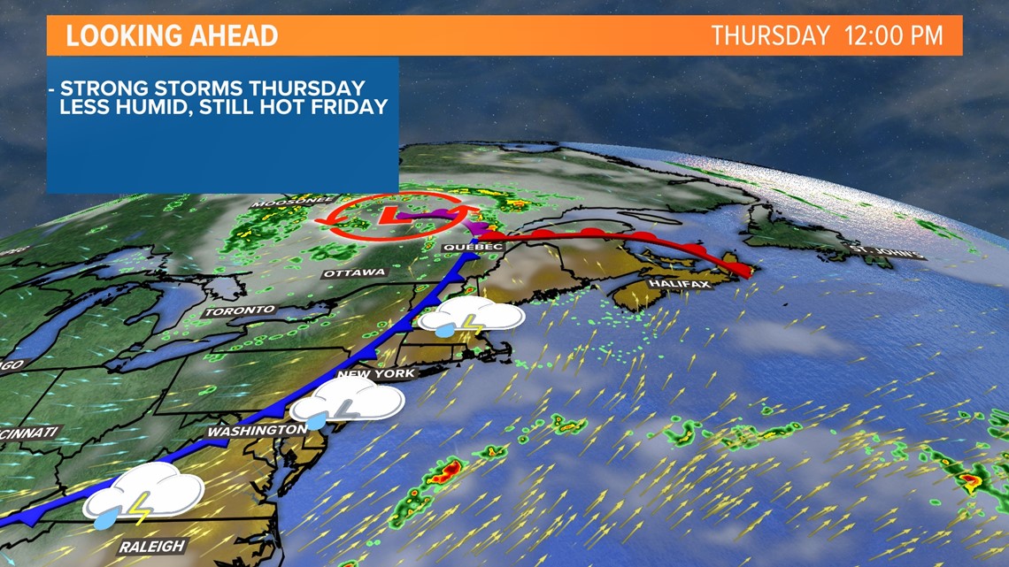
Temperatures spike into the upper 80s and low 90s on Thursday out ahead of a cold front.
That front will be the spark for storms, with the first ones firing off in the early afternoon across western New Hampshire.

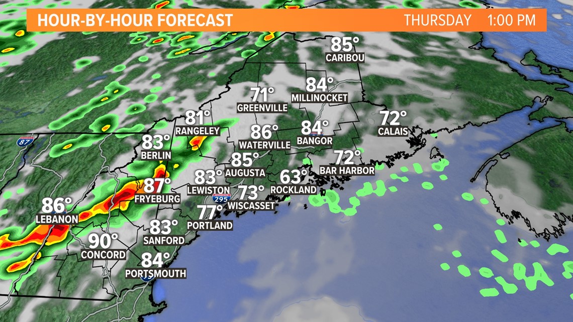
By 2 p.m., storms will move into western Maine.
Temperatures and dew points will be plenty high for supporting some pretty impressive storms.

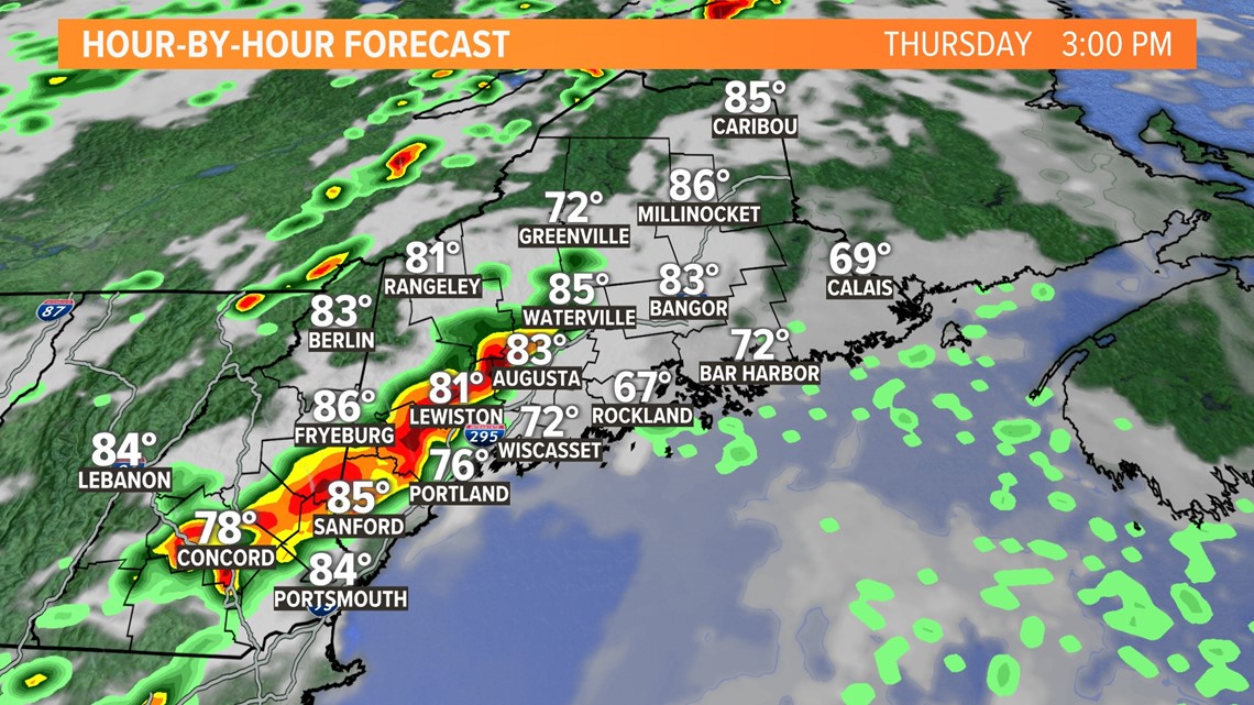
As the afternoon progresses, storms become more numerous.
A line of storms is expected along the front, with a couple of isolated cells out ahead of the main line. These isolated storms are the ones that are most likely to rotate.
Expect the line to cross central Maine through the middle of the afternoon.

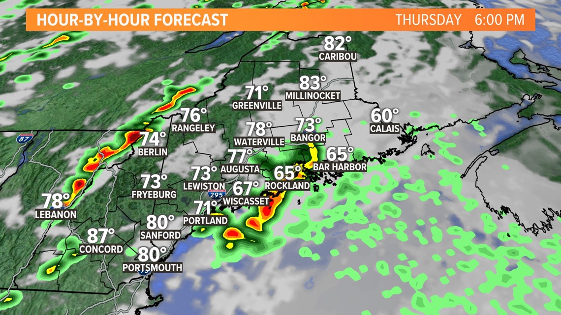
By 7 p.m., the line of storms will have crossed Bangor and will be moving Downeast.
Storms will still have plenty of fuel, although some marine influence will cut down on the severe risk a little.


All storms will clear out by 10 p.m. Thursday.


The biggest risk with storms will be torrential downpours, possibly leading to some localized flash flooding.
Dry, compacted soils from the ongoing drought will cause increased runoff and could lead to some issues.
Strong wind gusts are also expected as storms pass through. Gusts could exceed 60 mph under the strongest storms.
Remember, straight-line winds can be just as damaging as a weak tornado.
Hail is a bit less likely under some of these storms but is certainly still possible.
The tornado risk is quite low, but not zero. Again, any storms that pop up ahead of the main line of storms will have a higher chance of rotating a bit.

On the bright side, the rain will be much welcomed. Moderate drought conditions are still found across almost all of New Hampshire and over half of Maine.
Hopefully, we can get welcomed rain without much in the way of damaging weather.
Wednesday is the best time to prepare. It's a good idea to have a plan should any severe weather impact you on Thursday.
You can always track Thursday's storms on the NEWS CENTER Maine radar, available both online and on our app.
If you can safely take pictures of storm damage, send them in through the "Near Me" section of our app.
Follow our team on social media for more updates throughout the next couple of days.
You can always get the latest from me, too.
- Mike Slifer, @MikeSliferWX
RELATED: NEWS CENTER Maine Weather Forecast
