
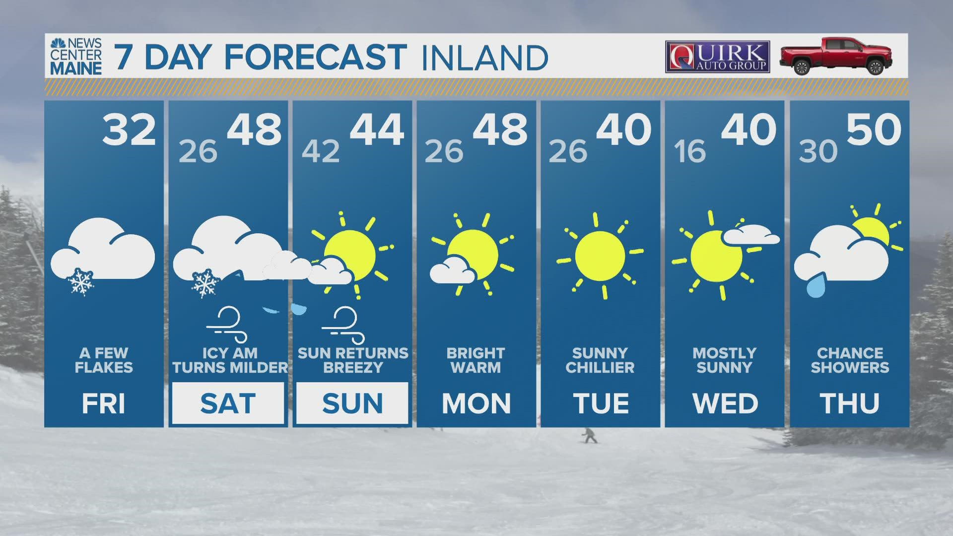
MAINE, USA — Another complex, warm storm system is slated for Saturday in Maine. Sorry, snow lovers. This isn't the storm you've been waiting for.
The reason this will be a complex storm is due to the cold air wedged in place. This process referred to as "cold air damming" in the weather world, means that the terrain helps to lock the cold air in as warmer air rises above it.
Warmer air is less dense than cold air, so it also helps keep the cold air locked in place. This overrunning — which is what we call the warm air moving in on top of the cold air — helps form rain showers, which then freeze on contact with the sub-freezing ground.


While these setups aren't really uncommon, there's still an impressive amount of warmth with this system in particular. Eventually, that warm air does win, but this whole process takes time.

Timing and impacts to Maine and New Hampshire:
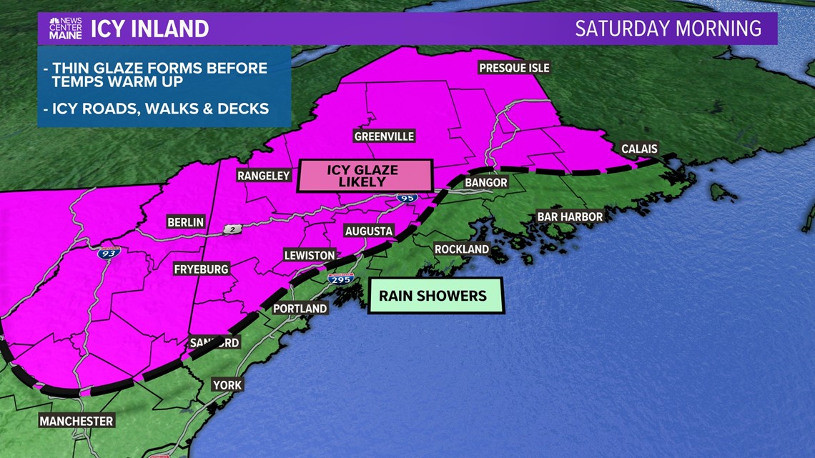
Everyone starts off early Saturday morning with at least some form of wintry mix.
By sunrise, the entire coastline and most of the greater Bangor region will have seen a switch to just plain rain. Temperatures will likely climb into the 40s or even 50s pretty early on.


The issue is that it will take a while for the cold air to be scoured out inland.
Freezing rain is most likely given this setup, with a lot of warm air just above the sub-freezing surface.
An icy glaze is expected on most surfaces, including roads. Bridges, decks, and other elevated objects will freeze first. It can be tough to tell when they've frozen, so exercise caution.
I think the biggest risk for impacts from ice accretion will be from Fryeburg to Lewiston to Waterville to Skowhegan and then along route 2. This rough outline is where I anticipate the worst road conditions. A few sneaky spots along interior Midcoast counties are possible, but these would only be for the far inland reaches.


By 2 or 3 p.m., warm air will win. Expect a dramatic jump in temperatures when the cold air finally breaks, with temperatures jumping from near 30 degrees up to the mid or even upper 40s.
Any showers that pass through will be plain rain at this point in time.


Late Saturday, a cold front will pass through. Ahead of it, it's going to be really mild for December. In fact, temperatures may keep climbing even after the sun sets on Saturday!
The front will bring a round of rain showers, potentially heavy at times.


Wind gusts will also pick up ahead of the front, especially at the coastline.
Some areas along the Midcoast and Downeast will see gusts top out near 40 mph, if not a little higher.
After the front passes, wind gusts will switch to be out of the northwest. This time, the high peaks will be in for strong gusts. I think some of the higher peaks could see gusts approach 50 mph, but lower elevations (where most people actually live) will likely be in the 30-40 mph range.


Sunday remains breezy, but at least sunshine returns.
This will kick off a stretch of pretty nice days, by December standards. High temperatures will generally be above normal and there's quite a bit of sunshine in the forecast next week.
For more forecast info, follow me on Twitter, @MikeSliferWX.
RELATED: Icy start to the weekend
RELATED: NEWS CENTER Maine Weather Forecast