
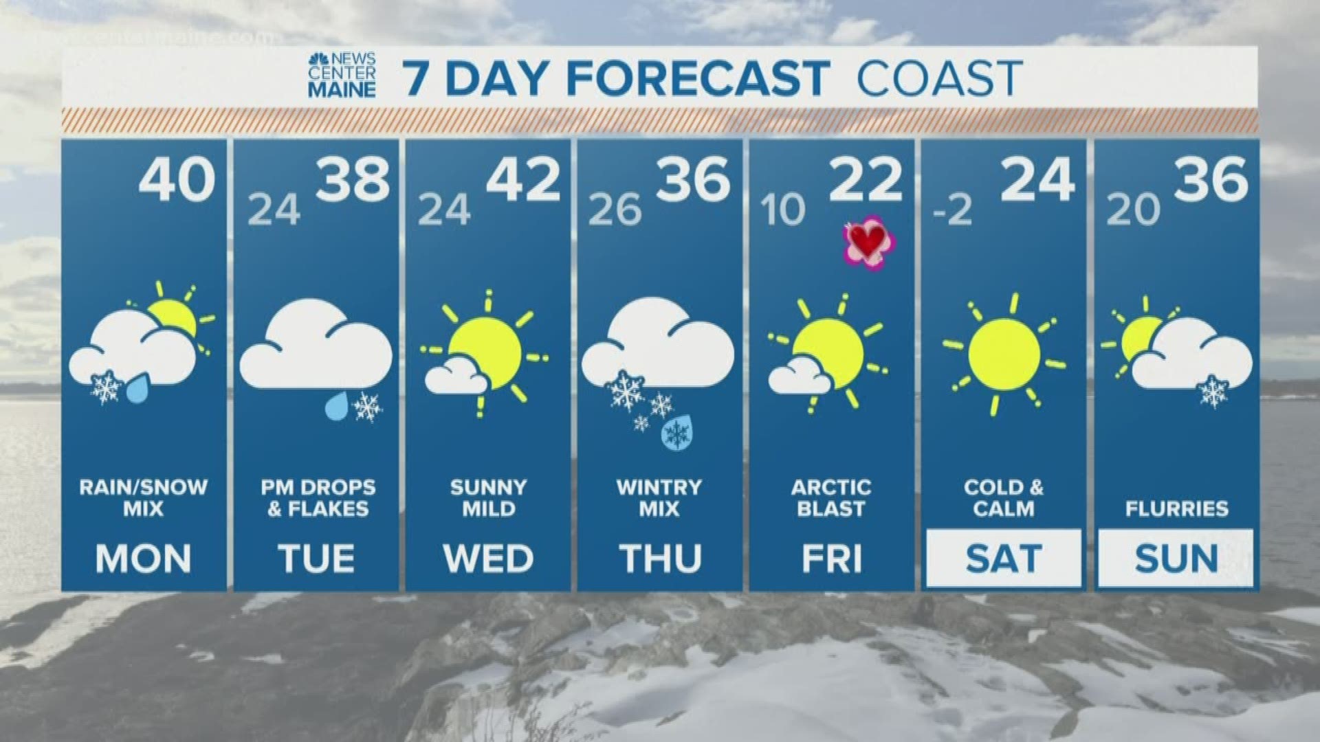
MAINE, USA — Time flies when you're having fun! At least, that has been the theme here in the weather office since we started the new month. We've already had some really warm days, some nights below zero, ice, and snow, and that was just in the first week!
The second full week of February is shaping up to be similar, and the long range forecast toward the end of the month shows no signs of this slowing down. I'm fairly sure this is payback for our complaints about boring weather at the end of January.
SNOW CHANCE #1:
Our first wintry system is already underway and will continue into Monday morning.

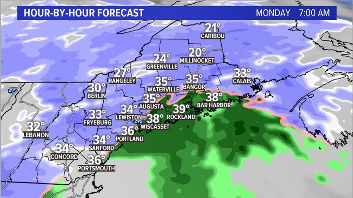
These showers will be snow at the onset, but do transition over to rain along the coast as warmer air builds in.
By noon, most will see rain with the snow falling only in the western mountains and into northern and north-central Maine.


Temperatures also jump up quite a bit later in the day...back to the 40s we go!
Quick side note: Bangor's low temperature Sunday morning was -8° F. With a forecast high of 40° F, that's almost a 50 degree jump in 36 hours.


SNOW CHANCE #2:
The next wave of energy rolls through Tuesday evening and lingers on into Wednesday morning.
At the onset, rain looks likely along the coastline with some mixing through central Maine. Western Maine mountains will see some snow flakes.
As colder air gets pulled in, we all transition to snow. Totals do not look too impressive out of this one; maybe another 1-2" in the mountains. The cold air and energy don't work well together to bring snow to Maine.


Snow showers wrap up Downeast through the late morning as high temperatures across Maine make it back into the upper 30s and low 40s.
SNOW CHANCE #3:
This is the chance that bears watching. Another storm forms through the south-central United States late Wednesday and moves toward Maine early Thursday morning.
There are a few things we need to watch still, but early track forecasts indicate that we're on the cold side of this storm as it starts up. This will favor snow showers through Maine, and could make the morning commute a bit messy.
Forecasts diverge a bit for the afternoon. Right now, it looks like we can expect some mixing at the coast, while inland ends up with a bit more snow.


Depending on where snow bands set up, central Maine could actually get some solid accumulation out of this. A widespread 3-5" through central Maine looks possible with this current forecast, but is absolutely subject to change as we get closer.
Behind this, Arctic air is back! Saturday morning will likely feature widespread temperatures below zero.
Don't look now, but another storm could be lurking for Monday...