
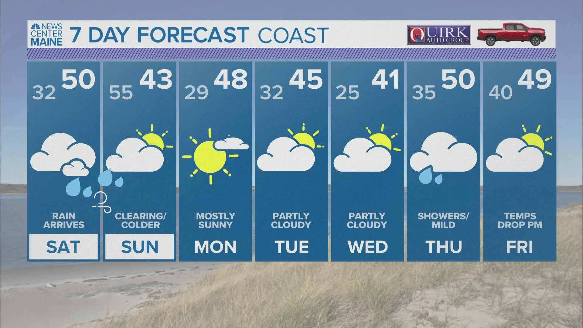
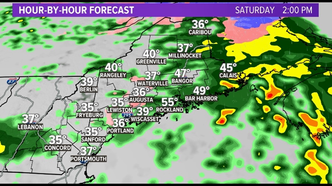
MAINE, Maine — Temperatures for Friday night are in the low-to-mid 20s. As precipitation moves in Saturday, the cold air will likely get stuck in place. This is what is known as cold air damming.
Since the cold air will be stuck in place at the surface, and the warmer air is moving in aloft, precipitation may fall as rain, then freeze on contact. That is freezing rain.

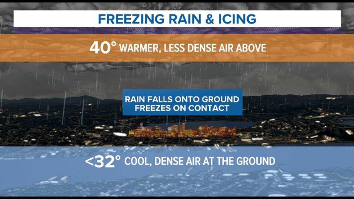
If the cold air pool is slightly higher off the ground, precipitation will fall as sleet, those little balls of ice that ping against your window.
Either way, roads will likely start getting very slick on Saturday morning and stay that way through the afternoon.

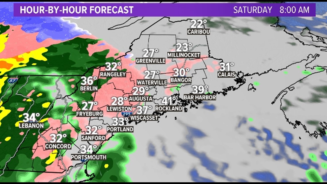
Freezing rain and sleet are possible all the way to the coast.

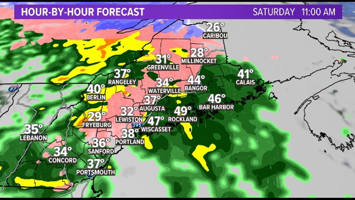
Warm air will be able to move in along the coast first, and then it should be able to erode the cold pool of air inland by Saturday afternoon/evening.

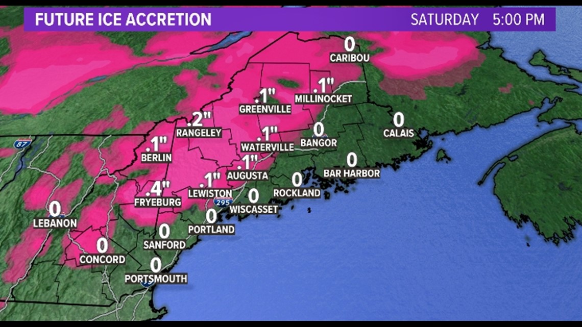
Freezing rain totals will be something like this, although we think Fryeburg is too high. I think at the coast we will see under .1" as well.

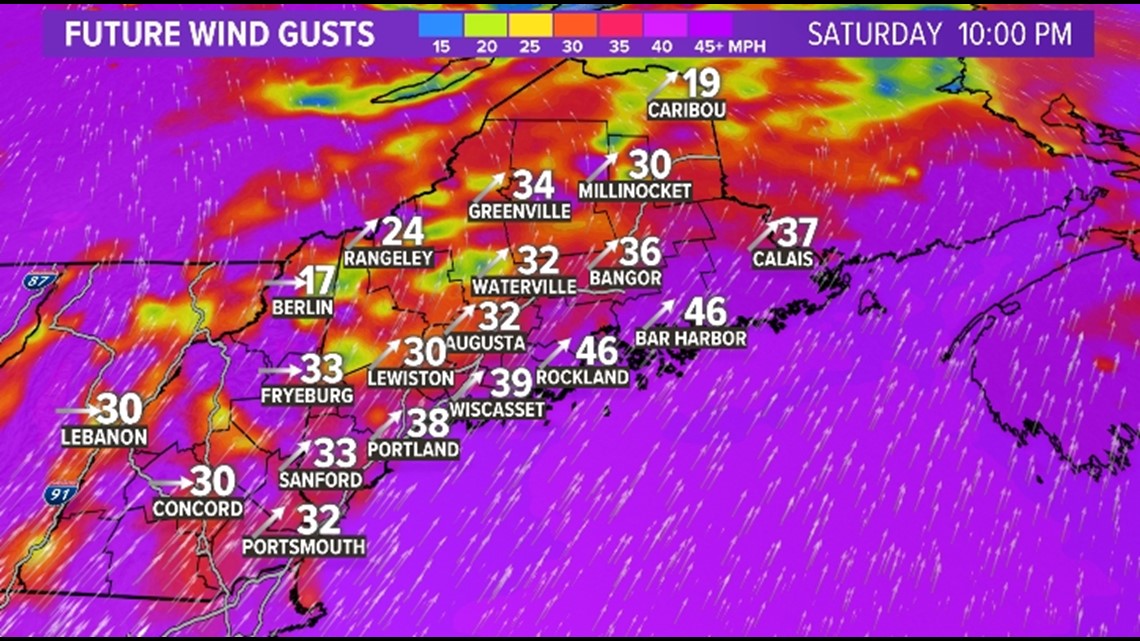
And once all that wraps up, the wind starts. It'll be windy with gusts of 35 to 45 mph Saturday night through Sunday morning. Winds will be highest at the coast and in the mountains. We will likely not see a lot of power outages, but some are possible.

We'll clear out on Sunday, and although it'll be a bit breezy, we'll get some sun too.
Any questions, let us know.
Stay safe.
Meteorologist Jessica Conley