
MAINE, USA — There's a lot going on weather-wise in the next several days.
The weather pattern is becoming pretty active with multiple rounds of winter weather possible.
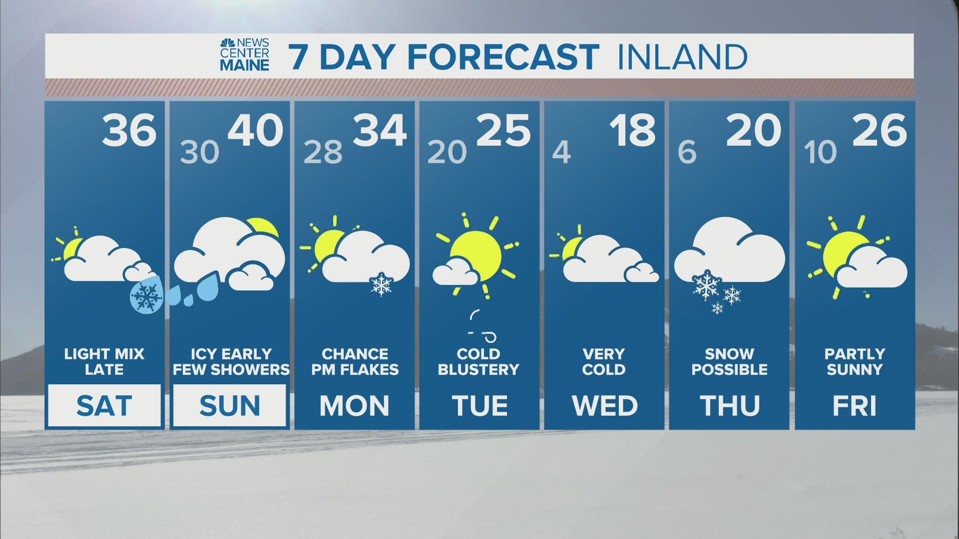
THIS WEEKEND
Rain showers continue at the coastline overnight, but inland areas will be dealing with wintry weather.
Sleet and freezing rain are expected through the foothills, mountains, central highlands, and lakes region tonight. While the storm itself is not all that impressive, icy spots are likely on any elevated surfaces and on untreated roadways. Take it slow out there Sunday morning.

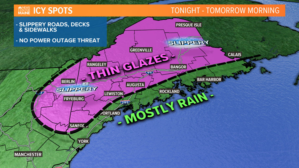
Icy spots can linger into Sunday morning in the colder valleys and up north.
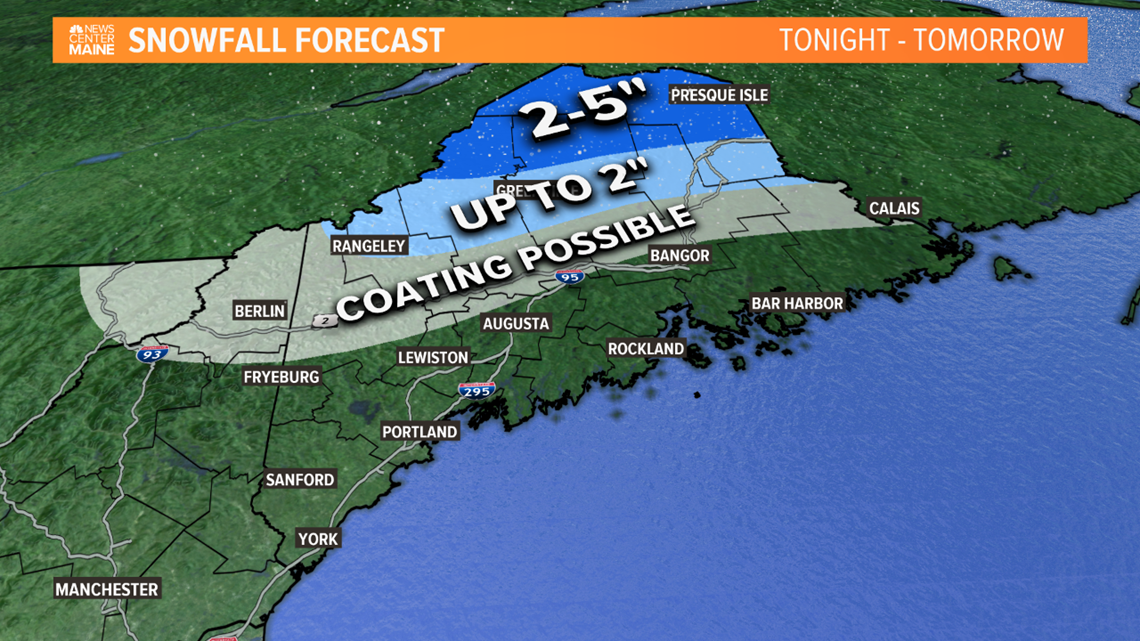
Sunday will be a mostly cloudy day with a few lingering showers and highs in the low to mid 40s. The exception will be in northern Maine, where a light mix with snow, sleet and freezing rain will continue. Several inches of snow are possible in northern Aroostook county.

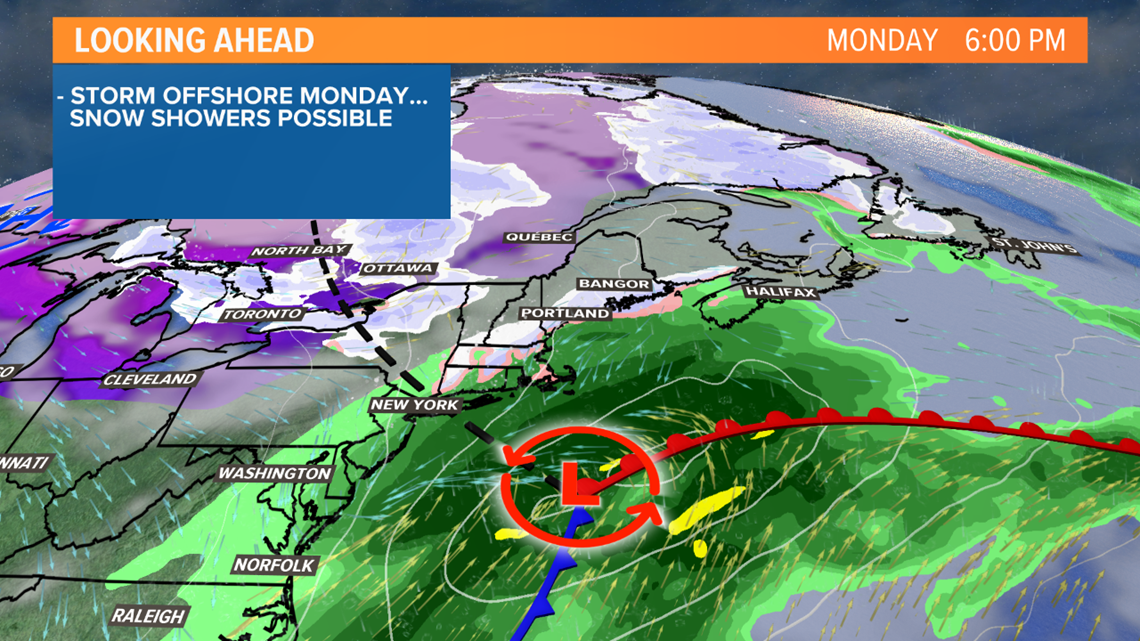
MONDAY
On Monday, a storm will be passing pretty far to our south, but a disturbance will also be approaching from the west. This could pull some snow back into southern and coastal Maine Monday afternoon and evening. Accumulations would be light as we're on the edge of the storm, and the snow could miss completely. Farther north, a few flurries or snow showers are possible.

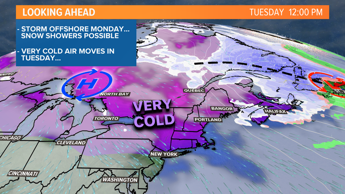
TUESDAY
The coldest airmass of this young winter season builds in on Tuesday. Temperatures will likely be dropping during the day, with early morning highs near 30 to the south and in the 20s elsewhere.

THURSDAY
That cold air will be in place as the next storm approaches. It looks like a large coastal storm will form to our south on Wednesday, affecting a large part of the mid-Atlantic and northeast.
The question for us is how close does it come.

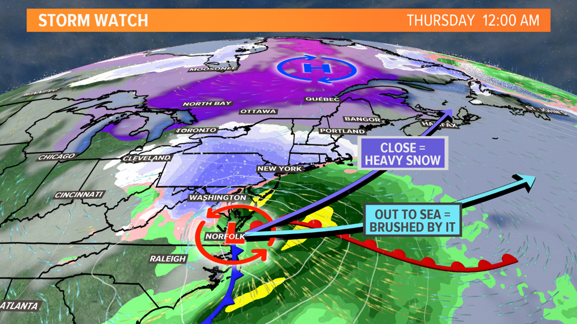
If it tracks close to Maine, with plenty of cold air in place, it could be a big snowstorm.
However, if is track is flatter and farther south, we would just see a glancing blow or end up on the edge of the storm, with light snow and minor accumulations.
We will be watching this closely over the next couple of days.
Ryan - follow me on Instagram @ryanbretonwx