

PORTLAND, Maine — Sometimes the broad strokes of a storm are well handled way in advance, but the details are harder to come by. That's the case with a potent wind/rain storm on the way for Sunday night and into Monday morning.
We flagged this system as early as last weekend (how dare we not call it a First Warning Weather Hide Your Kids 5000 Alert). It just had that gnarly, amped-up, southeast wind look to it. But are we talking 40 MPH winds or 70 MPH winds? Kind of a big difference.
Now that we are 3 days out we can refine the details a bit more and give you an idea of what to expect.
The big picture here is basically a juiced-up cold front with a wrapped-up low pressure embedded in it. The isobars (lines of equal pressure) are super packed which indicates an area of gusty winds.

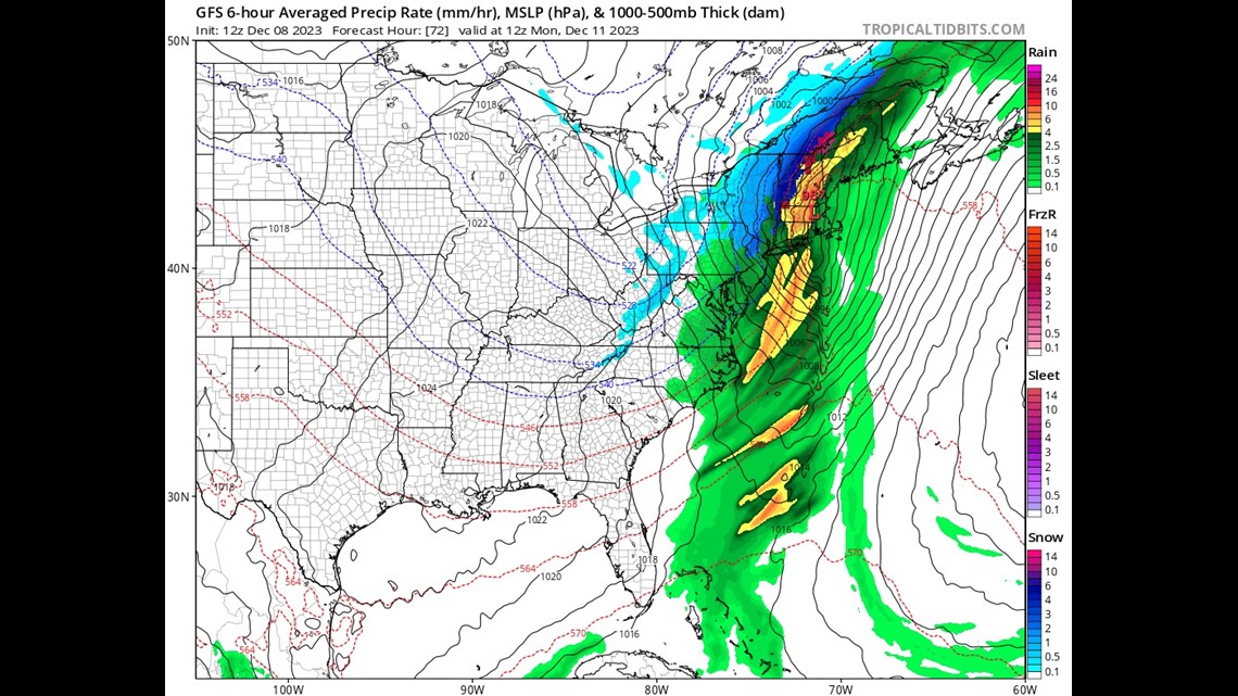
The challenge with this setup, and most wind events in Maine honestly, is figuring out how much of the strong wind action actually gets to the surface. Just a few thousand feet aloft I know for sure it's gonna be rocking ... but do those winds "mix down," as the nerds say?
Things are all quiet until Sunday afternoon. That's when the first showers move into western Maine.

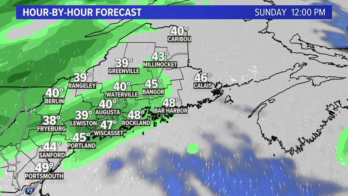
Things are pretty light during the afternoon and most of the evening. It's not until late Sunday into Monday morning that both the rain and the wind pick up some steam. Snow stays safely to our north though, it's much too warm.

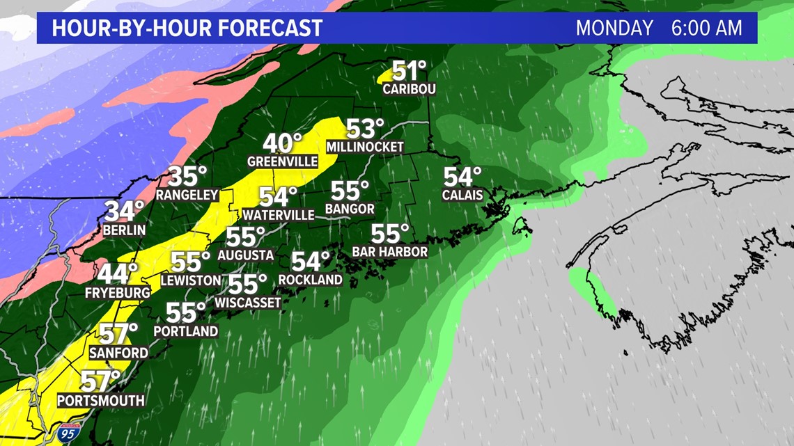
Rain gets heavy at the same time the winds are heaviest. That's a common theme around here and the heavier downpours act to mix down the winds.

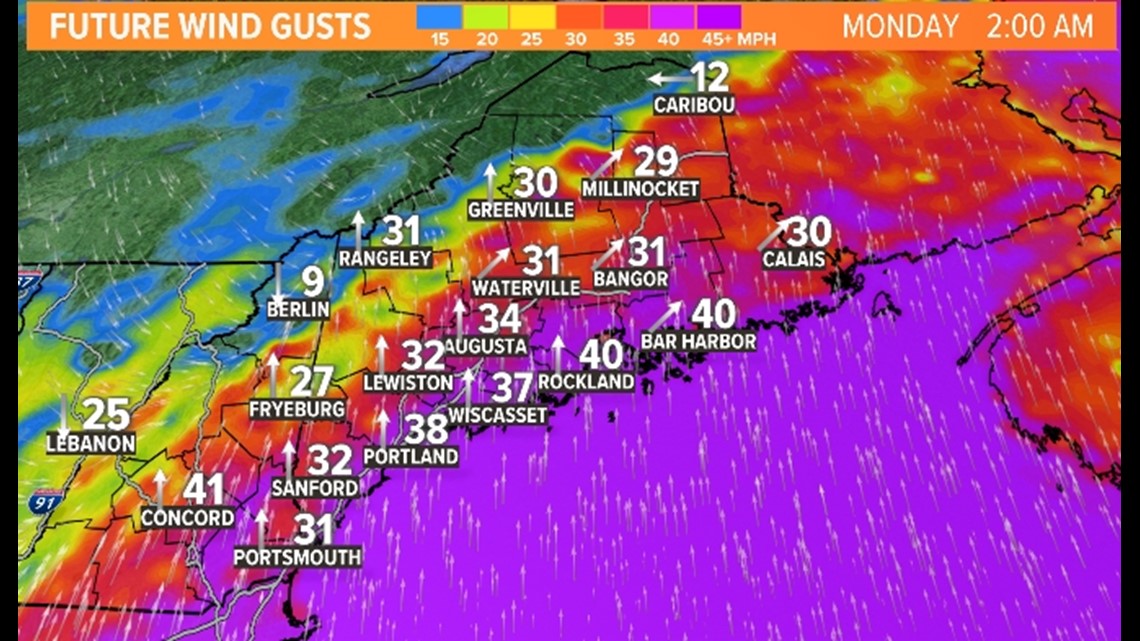
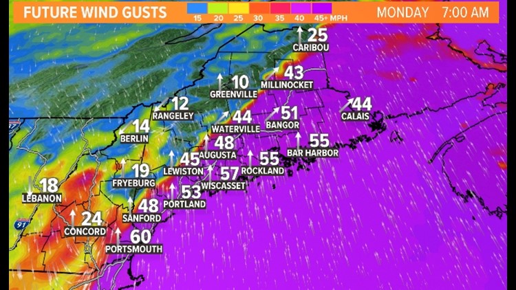
The peak intensity of the winds is likely to be between 5 a.m. and 11 a.m. for most of Maine.
A word of caution here: This model is showing a gust into the 70 MPH range in Rockland and while that's possible, I don't think it's likely. I think the southern coast of Maine will gust between 45-55 MPH and the midcoast into Down East Maine will gust 50-60 MPH. This isn't as much of an event for inland sections of Maine, although up to about Bangor could do pretty well being closer to the Down East winds.


By Monday afternoon, things will have settled down substantially. Windier inland at this point, but less windy as a whole.


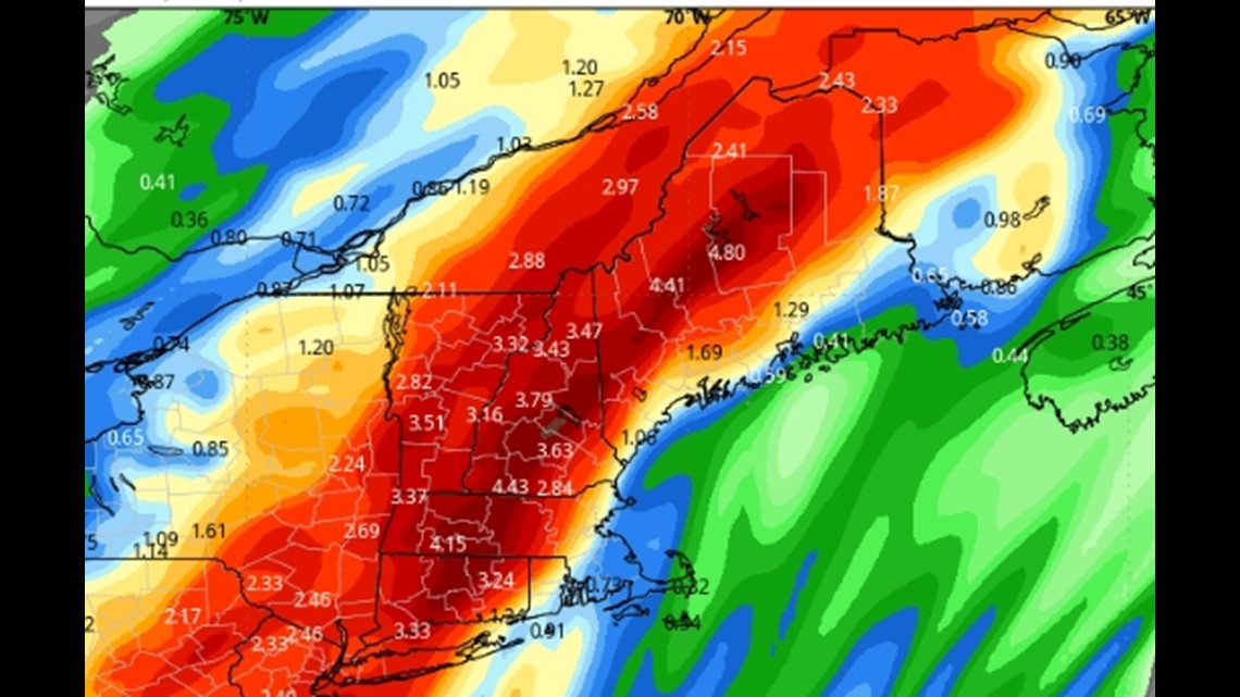
Rainfall amounts will total around 2" for most of Maine but there will be isolated pockets up to 4" possible. That on top of a melting snowpack after a weekend of temps above freezing during the day. If those heavier areas correspond with the foothills and their deeper snowpack, we could have some localized flooding.

Of course, the biggest possible impact here is power outages and that's always a slippery little fish around here. The winds are borderline—I like to think of 55 MPH+ being serious outage territory. Plus as you can tell by the dead landscape around you, there are no leaves on the trees which greatly reduces drag from the gusts.


All things considered, and recognizing we have two more days of data to wait for, I see this as a moderate power outage event. I like to live dangerously, so I'll venture a guess at peak power outage numbers for the state: 75,000-125,000.
Stay with us throughout the weekend for continued weather updates.
Follow me on Instagram here. You won't get a ton of weather, but boy do I post a mean shirtless pic.
