
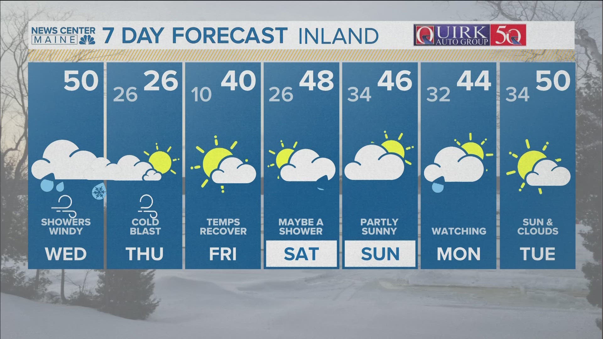
PORTLAND, Maine — Grab the popcorn and buckle up, the weather will be a little wild over the next 24 hours. A strong, spring-like storm system will sweep through the Northeast with periods of rain, gusty winds, and big temperature swings.
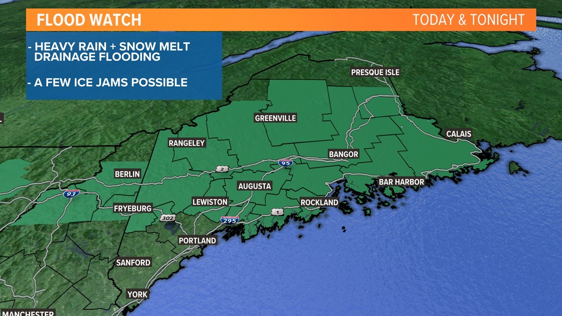
A warm front came through Tuesday night and our temps rose. We are now around 50 degrees, and it will stay balmy all day, melting more snow. Periods of rain are expected, too, and a few downpours will lead to some drainage issues. River ice is beginning to free up, so we'll need to keep an eye on them for any ice jams.

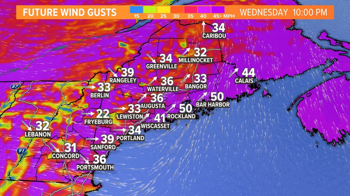
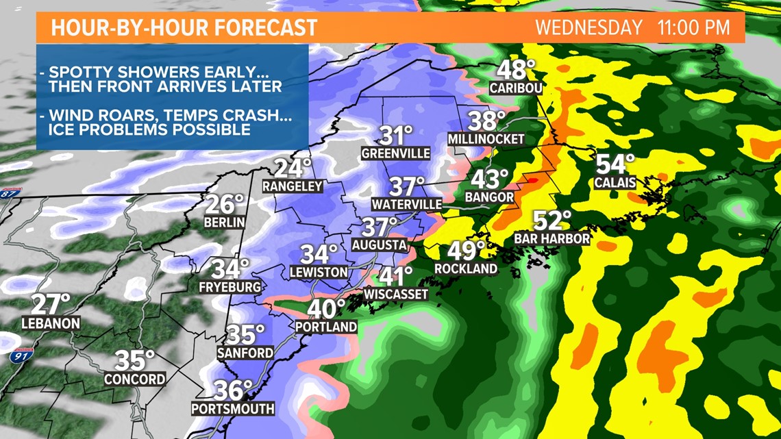
The main event may be the cold frontal passage between 10 p.m. and midnight. A squall line of heavy downpours, with an outside chance of some lightning too. Winds will swing to the west and roar, providing a better opportunity to mix stronger gusts down to the surface and create some power outages.

Temps will come crashing down almost instantly after the front passes. We'll likely see a 25-degree drop in just a few hours, leading to some flash freezing and ice for commuters tomorrow morning.

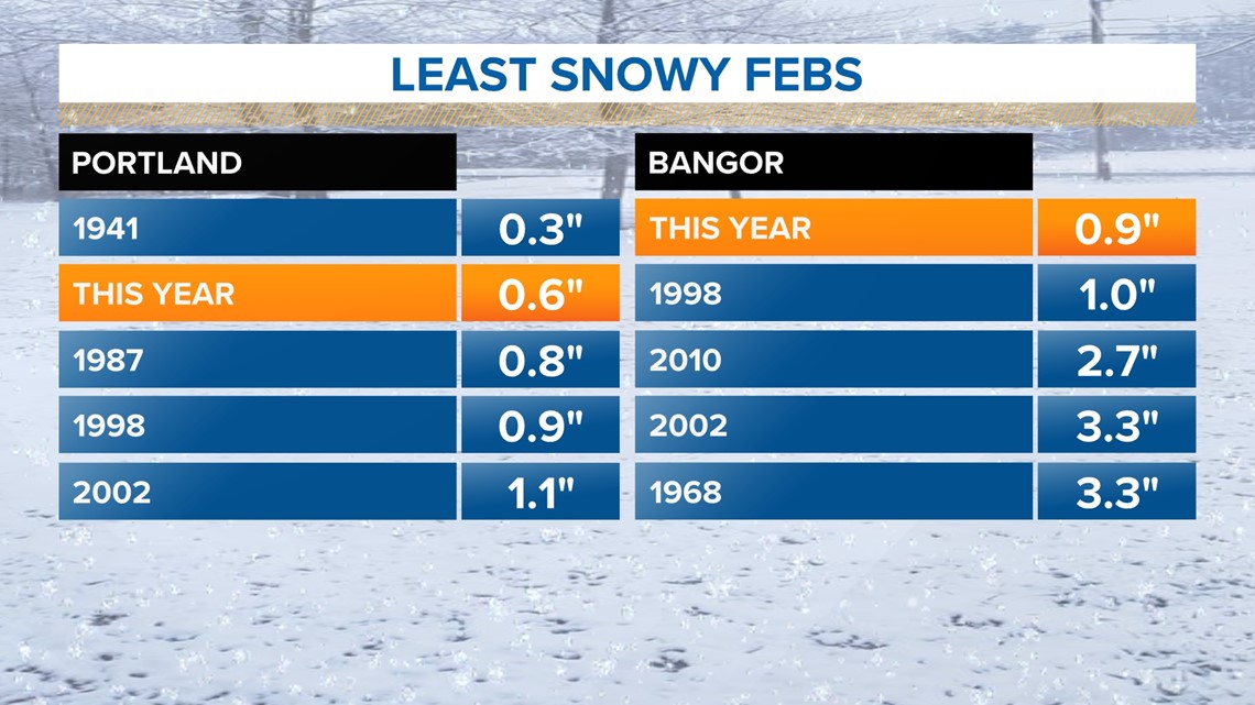
Currently we are in record territory for the least snowy February ever, sitting in the number 1 spot in Bangor and 2 spot in Portland. It's going to come down to the wire, as rain will be flipping to snow as the precipitation winds down overnight. With the anomalous Arctic blast, I'm thinking we'll see a quick coating in Bangor, perhaps knocking us off the record. It's going to be real close!

Todd - Follow my Instagram page here.