PORTLAND, Maine — We are off and running! Snow is falling throughout all of southern Maine, working east and north into the rest of the state this morning. Some of the bands will drop snow at a rate of 1 inch per hour, which is a solid pace. Winds will be howling at times out of the north and with the light, powdery consistency, blowing and drifting will be an issue.
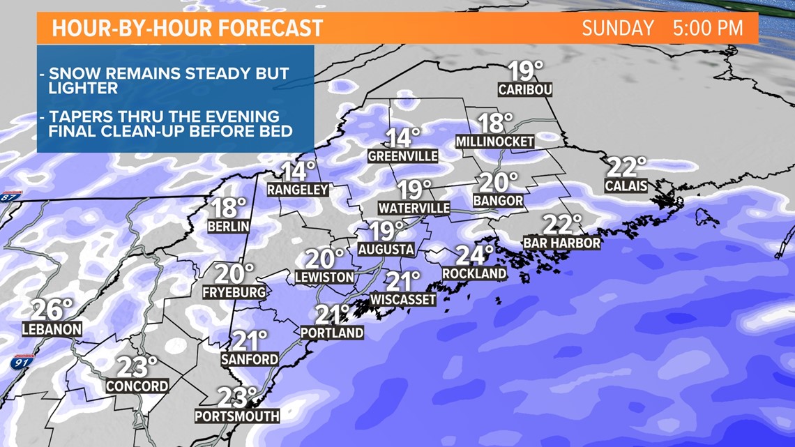
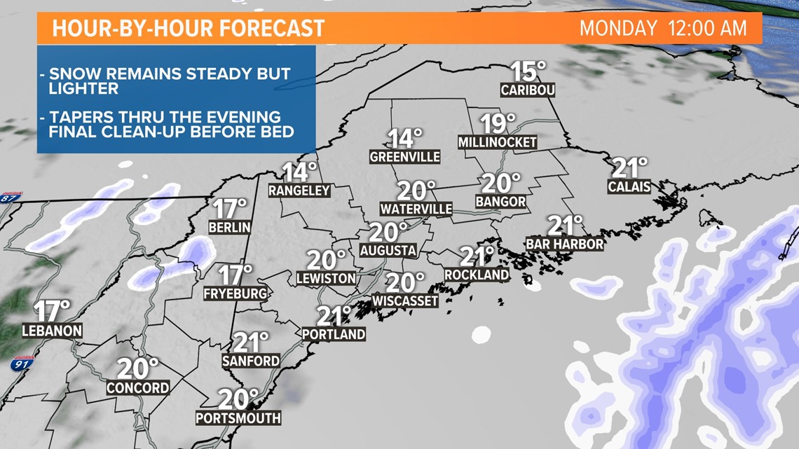
The low-pressure system is currently tracking north, approaching the southern New England coastline, where it will begin drifting east and then out to sea south of Nova Scotia. This is a flat track, one that deprives northern Maine from much, if any snow at all. The low will exit the area later this evening, snow will lighten up and taper off. Most will be able to do their final clean-up before bed, which should make the Monday morning commute much more manageable. I also don't anticipate too many school delays or cancellations either.
Pro-tip: Cover your face before you head out to shovel or use your snow blower. Winds are whipping and blowing snow around and those flakes will sting when they hit your face. Also, this is an exceptionally cold storm, "feels-like" temperatures will be near zero all day long.
AFTERNOON / EVENING:

TONIGHT:

Below is the current snow map. Highest totals will fall in southern Maine, especially from Portland south into York County, where double-digit amounts may be common. The cut-off is sharp as you go north, towns north of Bangor receive very little.

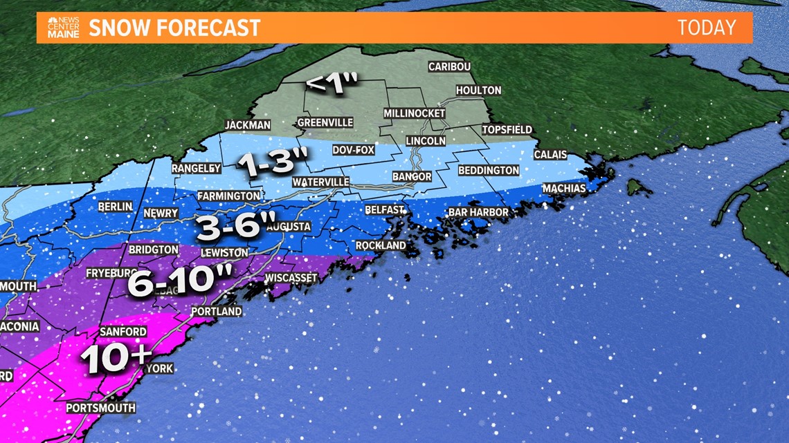
Here's a link for some of the snow totals so far - Click here.
The NEWS CENTER Maine weather team will be updating throughout the storm, keep checking back.
Todd - Check out Todd's Instagram