
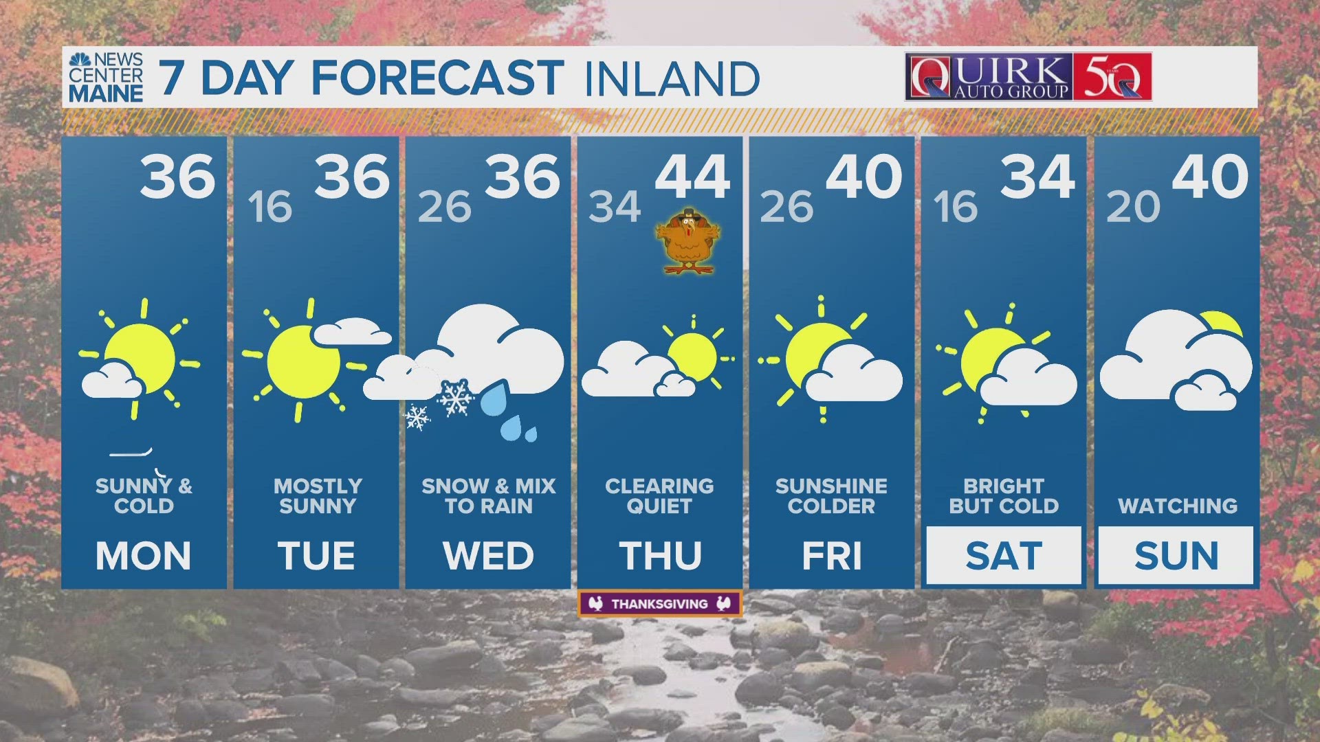
PORTLAND, Maine — We've got a storm brewing for Tuesday night into Wednesday. It's not a HUGE deal but it's relatively poorly timed for Thanksgiving travel.
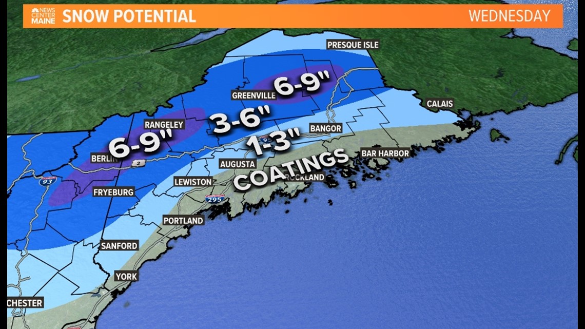
Low pressure will churn our way Tuesday night. When the leading edge of precipitation arrives, the atmosphere will be cold enough for snow in most places. There will be a quick burst of snow overnight into Wednesday morning. Along the immediate coastline it's pretty close- we may be just a BIT too warm for snow even from the beginning.


Eventually the rain/snow line will push inland through the morning on Wednesday. Likely reaching the Lewiston and Augusta area by 7-9 AM. The rain line should stall at the foothills keeping them and the higher terrain mostly, if not entirely, snow.


Rain will then continue to fall through the afternoon and evening before tapering off. A coating of snow is possible along the coast but will get washed away by the rain. The highest amounts will fall over the mountains and Central Highlands of Maine and could exceed 6 inches. Outside of the hills and mountains, there may be a couple of inches before the changeover occurs.

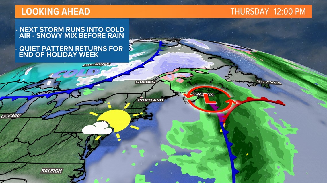
Thanksgiving and the end of the holiday week will be quiet and storm-free again.

I know Wednesday is a big travel day but unless you're hitting the road at 4 am; I don't see a huge issue here. Things will be much improved by the middle of the day into the afternoon.
Carson
Follow me on Instagram here.
RELATED: NEWS CENTER Maine Weather Forecast