
Sometimes the headline of a storm evolves as we get closer.
This storm goes like this:
- Potential 8 days from now
- Definitely a hit on Thursday
- Rain/Snow issues along the coast
- The mountains are gonna get smoked
- Wait, maybe it's really about the wind
My career headlines also evolved:
- Nerdy kid wearing glasses
- He's not such a bad forecaster
- Maybe he's a national network level talent
- No, he's definitely not
- Who's this annoying guy with the beard?
I bring this up because the hefty snowfall amounts likely in the mountains felt like the story of this storm until this afternoon, when the latest models came in with increased wind gusts. I'll get to that in a second...
Let's start with the setup. This storm is a double barreled low; it's occluded. Meaning, instead of it being an inland low or a coastal low...it's both. That means the inland low will be trying to pull in warm air while the coastal low tries to cool down the surface.

It all begins on Thursday morning as cold rain on the coast and snow away from the coast.

What will be apparent right off the bat is that the gradient between cold rain and absolutely nuking snow will be very tight. The best dynamics of this storm are right on the Northwest side of the rain/snow line.
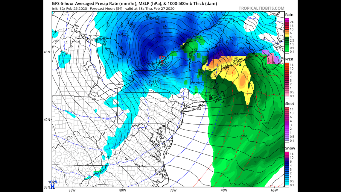
So much so that the American GFS model suggests there will be an under 20 mile distance between zero snow and almost a foot:
That gradient remains tight through the afternoon as snowfall rates exceed 1" an hour and cold rain gets heavier along the coast.

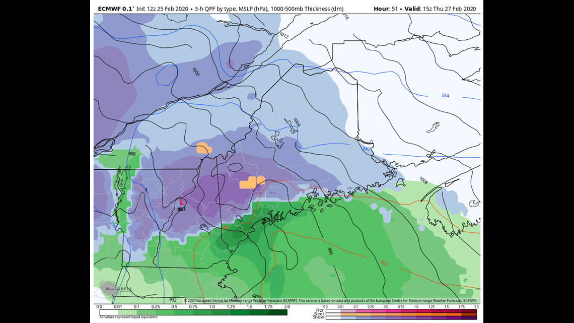
In the mountains the crush job is on, but along the coast the story is completely different.

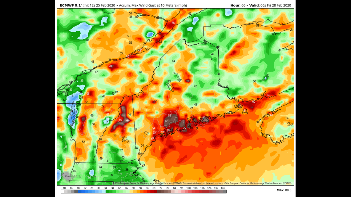
THAT is the latest EURO model wind gust output and...it's concerning.
Clearly if it were to verify we would have widespread power outages, especially along the coast. But even if it's overdoing it by 10 mph; it's still going to be an issue. That's especially true because the winds will be in a generally East to Southeast fetch, which has proven problematic for Maine and it's power grid made of Popsicle sticks and duct tape.
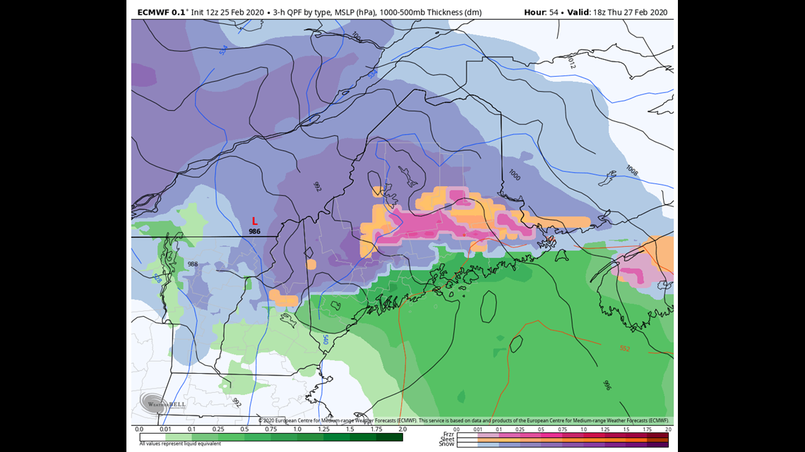
So I believe THAT will end up being the story of this storm when all is said and done. Winds will peak in the morning over southern Maine, middle of the day along the Midcoast and afternoon over Downeast.
Still, snowfall amounts are nothing to scoff at either:

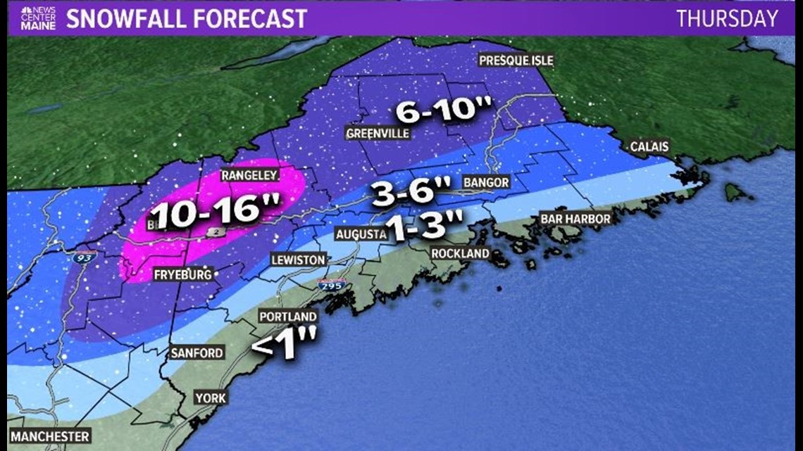
Full Disclosure: The part of this map I hate the most is Lewiston/ to Augusta. It's just such a razor thin margin between only an inch or so and 6-7." But I'm leaning warm for now and we have another day to get more precise if needed.
Shirtless pics, baby pics, and almost zero weather: https://www.instagram.com/keithcarsonweather/