PORTLAND, Maine — We are still several days away from any direct threat to Maine from Hurricane Lee. However, all scenarios are still on the table—let's talk about what I'm expecting.
I spent years on the Gulf Coast surviving many hurricanes, and I can tell you that a slight wobble or change to the storm track means a lot.
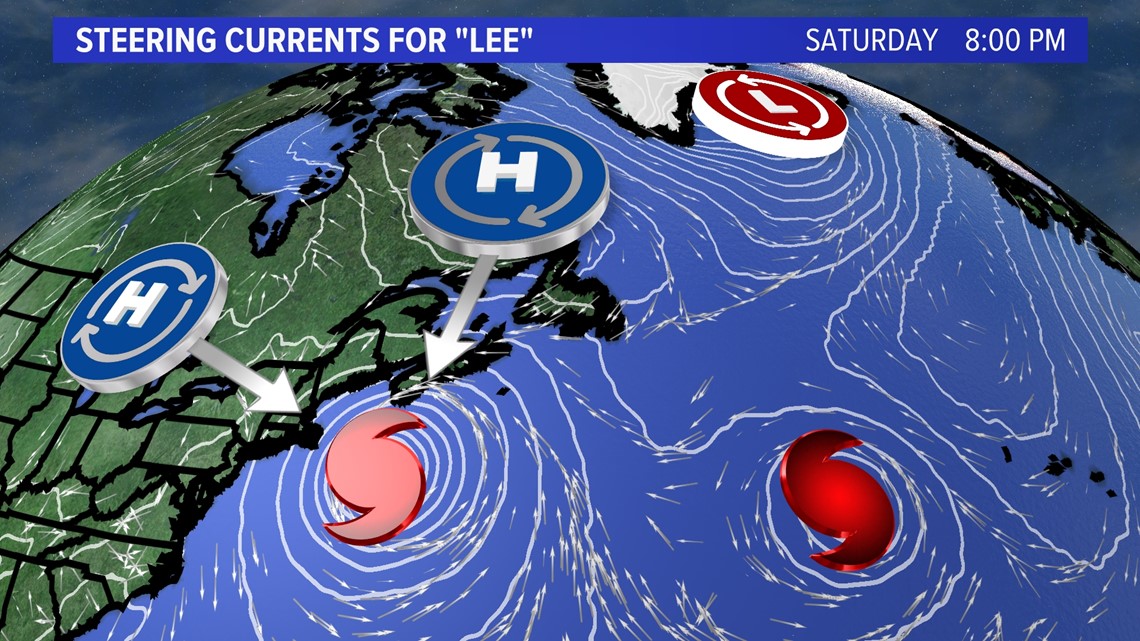
Right now, I’m looking at a trough digging to the west and whether it will pull Lee north or miss it altogether. A few miles slower with the storm track and we'll have a hurricane taking longer to get north and potentially missing the trough that scoops it up and kicks it west. High pressure is forecast to build in from the north after the departing trough, and could send Lee into the Gulf of Maine this weekend.
That’s one of many scenarios that could happen.

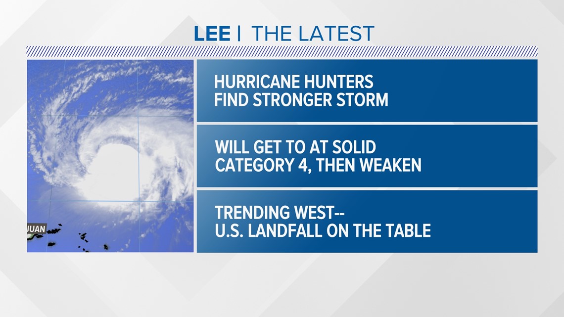
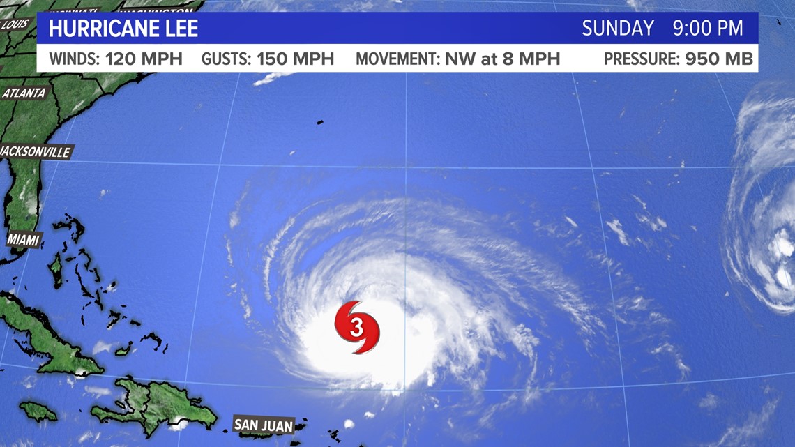
Lee has regained “major” status as was expected thanks to a more favorable environment in the Atlantic. The satellite picture is looking like a lot healthier storm than recently due to a lack of wind shear it was fighting.


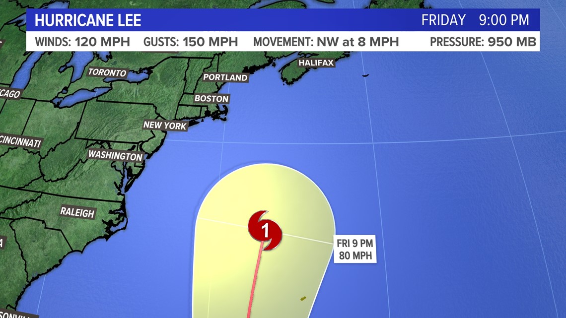
The latest official track from the National Hurricane Center shows Lee likely heading near or west of Bermuda. The storm is expected to reduce from a Category 4 to a 1 by that time.

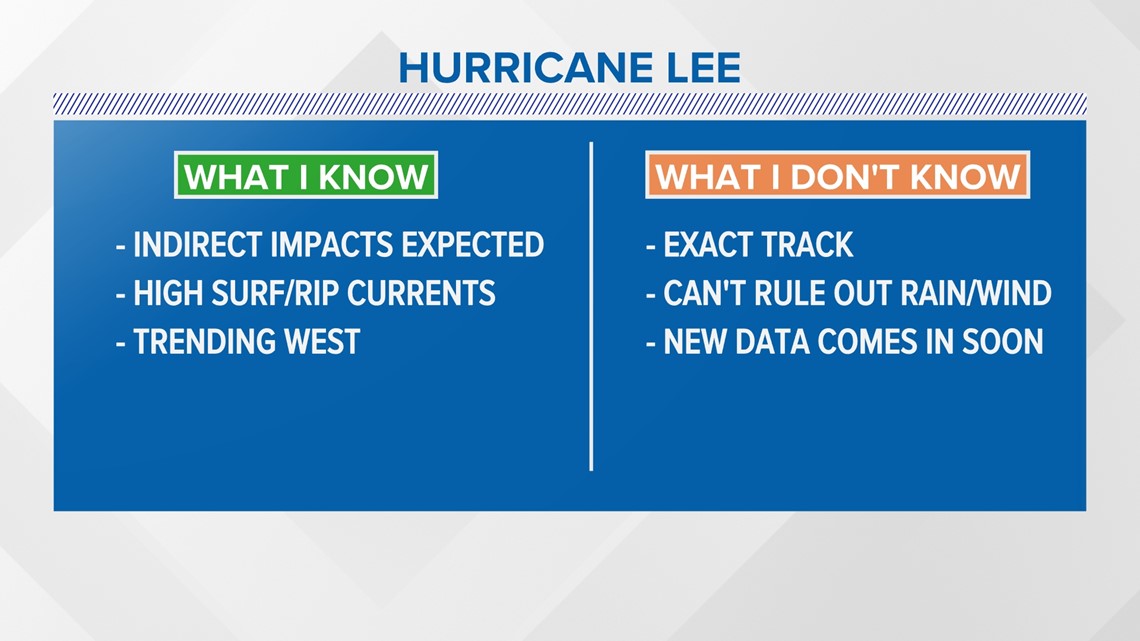
A storm of this size coming down from a high-end category will expand in size as well as wind field. At the very least, we are nearly guaranteed to have high surf, long-duration swells, and life-threatening rip currents later this week and weekend.
What I don’t know is how close or far Lee will get to us yet, and cannot rule out direct impacts from wind and rain.

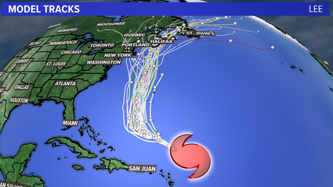

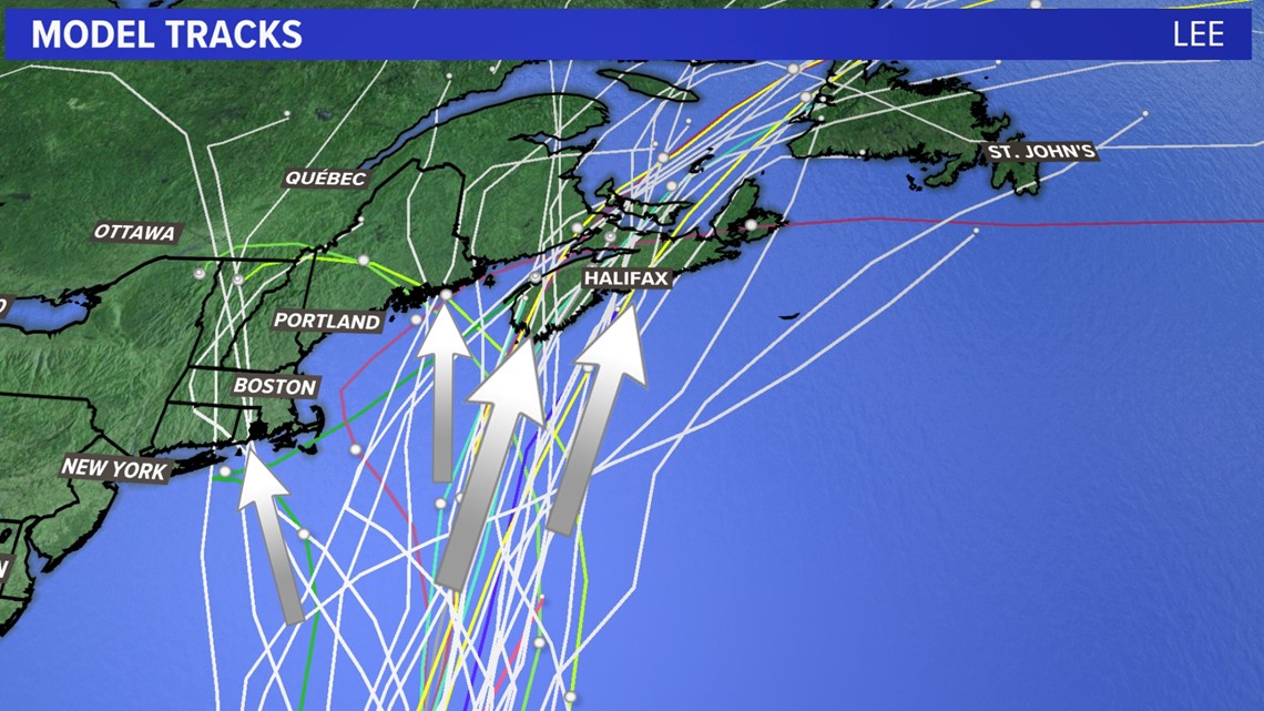
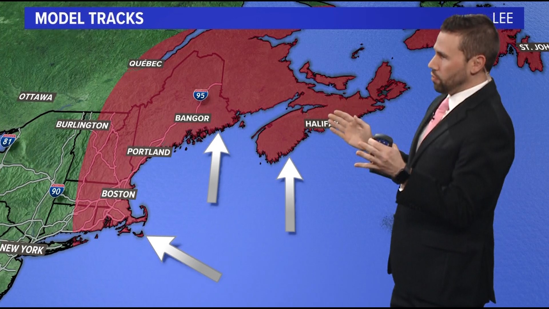
The latest scenarios (spaghetti model tracks) show a trend to the west with a slower storm. If this trend continues, a landfall on the East Coast becomes more likely. Right now I'm targeting 4 clusters of potential landfalls.
Lee will miss connecting with the trough to the west and north. The storm could get nudged west by a weak ridge to the east and slide in under the trough.

Regardless of the track, wave heights are almost certain to be a major factor for the coastline Friday into the weekend.


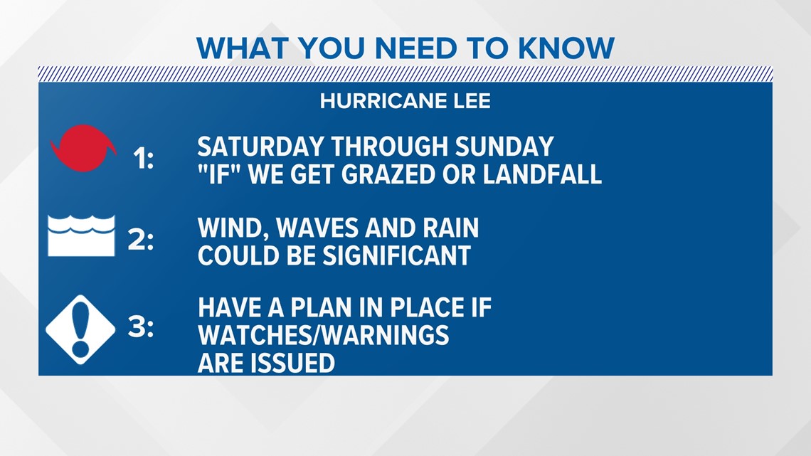
If we see a landfalling hurricane or tropical storm then the wind, waves and rain will be significant. It’s important to have a plan in place if watches or warnings are issued.

Be sure to check back frequently and follow my social media for the latest updates on Lee.