

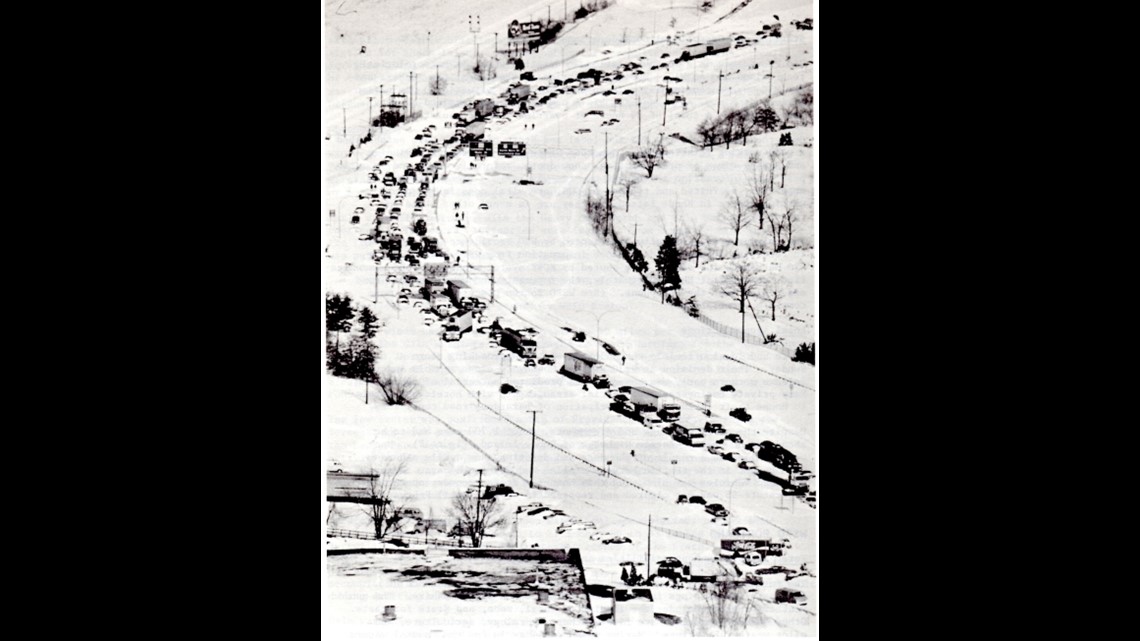
PORTLAND, Maine — It has been 46 years since the blizzard of 1978, where a record amount of snow fell in New England, New York, New Jersey, and Pennsylvania from Feb. 5-7. In addition to heavy snowfall, this storm held the record for the highest water levels in areas like Portland—until January.
In the days leading up to the blizzard, New England was experiencing fair weather because of a high-pressure system. The storm was weak as it moved through the Great Lakes, but rapidly intensified into a Bomb Cyclone, which is where a storm drops (at least) 24 millibars in 24 hours.
The storm was well-forecast, but strengthened very quickly, with hurricane-force winds and long-duration heavy snow as it traveled north along the New Jersey border. It brought historic snowfall and coastal flooding to New England, including Maine.


Today, the western half of our state (plus New Hampshire) is served by the National Weather Service's Gray office, which provides area forecasts, warnings, and other weather and hydrological products. In 1978, they were called WSFO Portland, but their mission was the same.
WSFO Portland issued snow and marine-related warnings ahead of the storm. On the morning of Feb. 7, they issued a coastal evacuation order due to the high water levels and subsequent flooding. They warned of a potential all-time high water level—a feat which was achieved at high tide later that day.

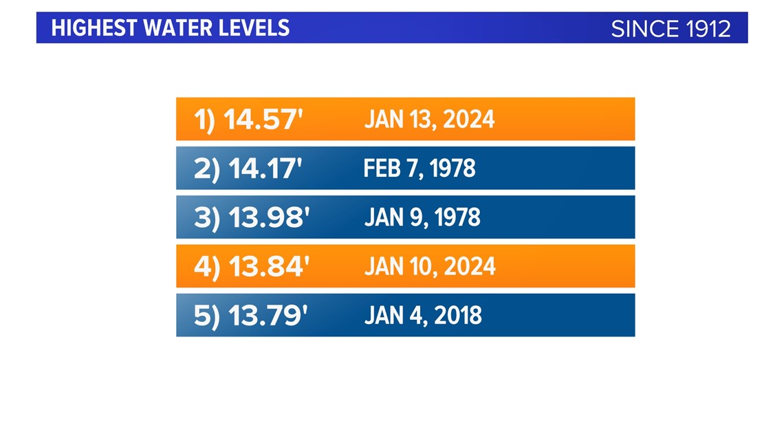
The blizzard of 1978 set a record high water level in Portland at 14.17 feet. This was recently broken this January, setting a new record-high water level of 14.57 feet.
This occurred due to multiple factors, including storm surge, the highest astronomical tide of the month (sometimes colloquially called the "king tide"), and high winds/waves. The flooding caused damage to beaches and waterfront property like docks, homes, roads, and businesses.

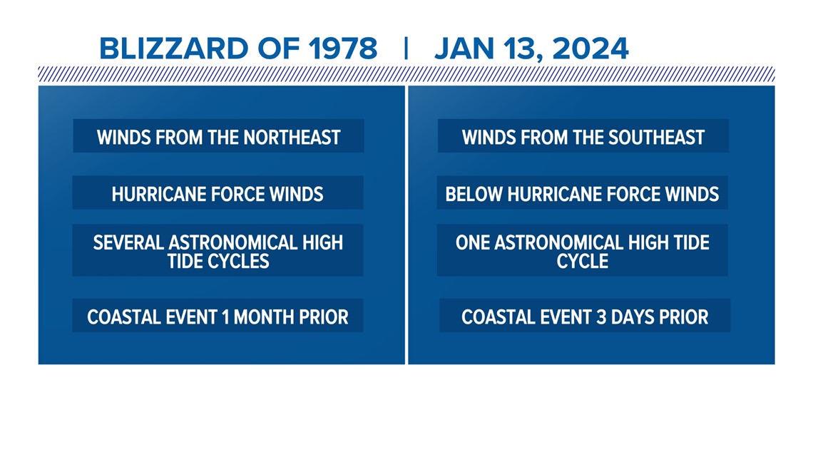
Despite these storms having similar outcomes in regard to coastal flooding, they had some key differences. The blizzard of 1978 was much colder and was an all-snow event that followed a nor'easter pattern, where the storm's center was offshore to our south. The January 2024 storm was an inland runner, where the center stayed to our west over land, putting us in more rain and mixed precipitation.

Two storms that appear very different can have similar impacts like coastal flooding because of a multitude of factors. The coastal damage from the storm on January 10 this year significantly weakened the coast and made it easier for more damage to occur only days later. Something similar happened in 1978 when a January storm weakened the coast and set the highest water level until the blizzard.
But at that time, there was a month in between to help strengthen the coastline again. This year, a three-day break between storms was not enough time to prepare for more record-setting flooding. Other differences include how slow-moving the blizzard was, versus the January storm being a fast-mover and the differences in the storms' precipitation type.
Both of these storms were incredibly impactful and caused considerable damage to the coastline 46 years apart. Climate change is causing strong storms to occur more frequently, so we can learn from these storms at how we can better adapt to a changing climate.
- Dana Osgood