

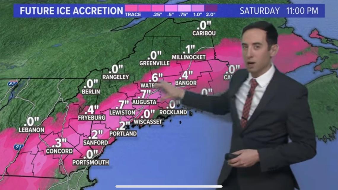
MAINE, USA — Although ice was in the forecast on Saturday night (see below), there's no doubt southern Maine got significantly more ice than expected.

So, what exactly happened? How did no meteorologist in the state see this coming?
To explain the science behind it, we need to start with a counterintuitive statement: ice storms really don't occur at 32F or 31F. You'd think all you need for big ice is to be below freezing. But it's more complicated than that.
When a substance changes phases—goes from liquid to solid, solid to liquid, or liquid to gas—heat is either released into or taken from the surrounding atmosphere. In the case of going from a liquid to a solid, e.g. ice forming from freezing rain, heat is released into the environment. This is called latent heat of fusion of ice.

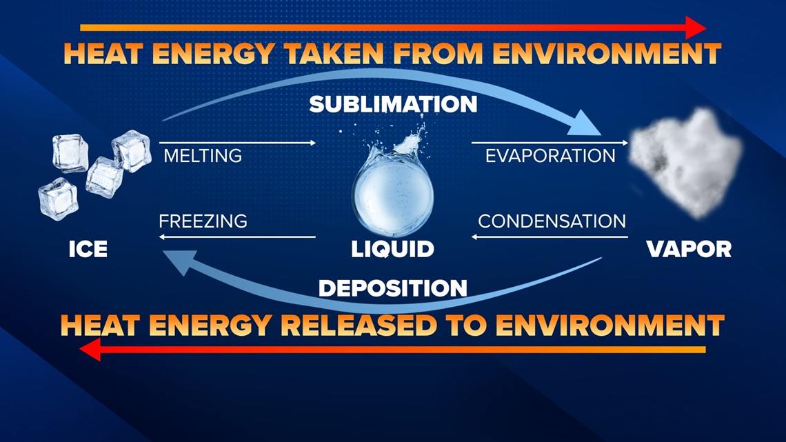
That latent heat release means that even if the surface is 31F or 32F initially, after the first layer of ice forms, the heat release brings the layer directly above the ice up to 33F or 34F, therefore preventing any further icing. That's why, in a nutshell, solid freezing rain events almost never happen at such borderline temperatures.
Almost never.
Which brings us to Saturday night. The temperature in Portland during the height of the icing was 31F, usually not enough for significant icing. But the wind turned to the north and starting blowing at 20 mph consistently.
This wind acted to quickly remove the latent heat above the ice layers, and allowed the surface just above the ice to be below freezing for hours on end. Think of it like how a fan cools your skin: it does so by removing the layer of heat that is normally radiating right above your body.
The direction of the wind was also helpful to icing, as a wind off the water likely would have quickly snapped temperatures above freezing.
That relatively subtle process was enough to give us 0.5-0.7" of ice when 0.2-0.3" was forecast. That 0.2" or so of ice makes all the difference when it comes to impacts, trees down and outages.
The last piece here is known computer model biases. I'd estimate that over the course of just this winter, the computer models have forecast 10-12 large icing events that never happened. It was our job each time to note the bias of the models to overproduce ice (usually be assuming the ice accretion will be too perfect) and correct it. So when the models produced large ice amounts along the coast, at a temperature that ice almost never accumulates, we all took the under.
As usual, mother nature has the final say.
Keith