

PORTLAND, Maine — If you ask most Mainers what a nor'easter is, they will say it’s a powerful storm that usually brings a lot of snow and wind.
That's true, but it can also rain. There are two types of nor'easters based on where they originate and how they impact Maine. Let’s look at what’s on the table for the upcoming storm.

For a nor'easter to become powerful, you need the pressure to fall rapidly as the wind increases. This is called "bombogenesis": when an area of low pressure drops 24 mb in 24 hours or less.
This typically happens in the Gulf of Maine or farther down the coast with an approaching low-pressure system that has nor'easter potential.

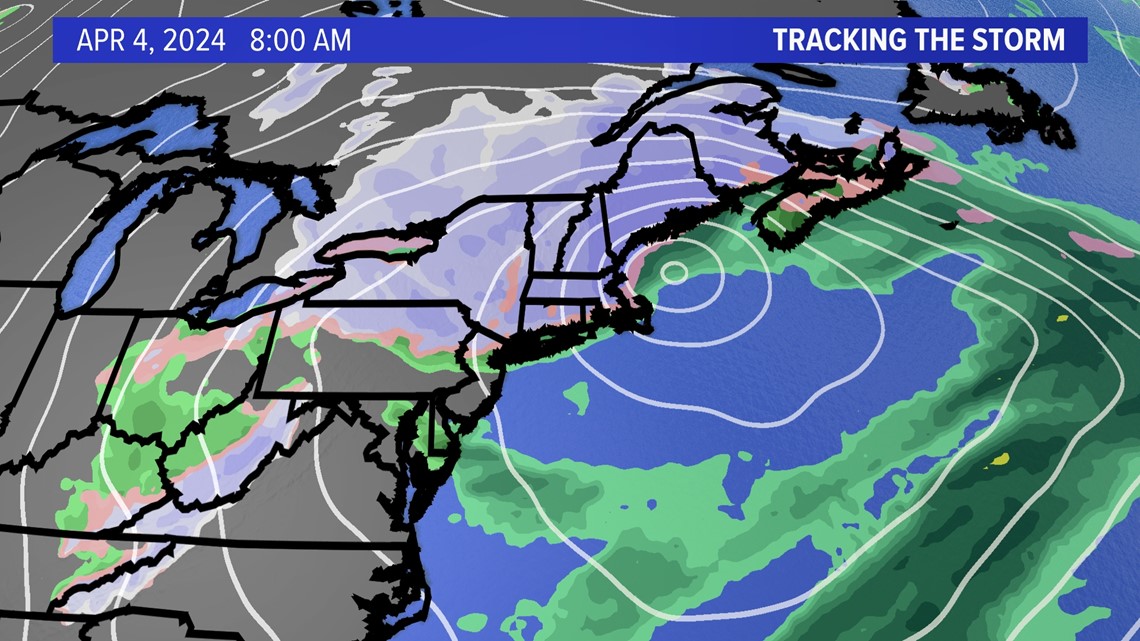
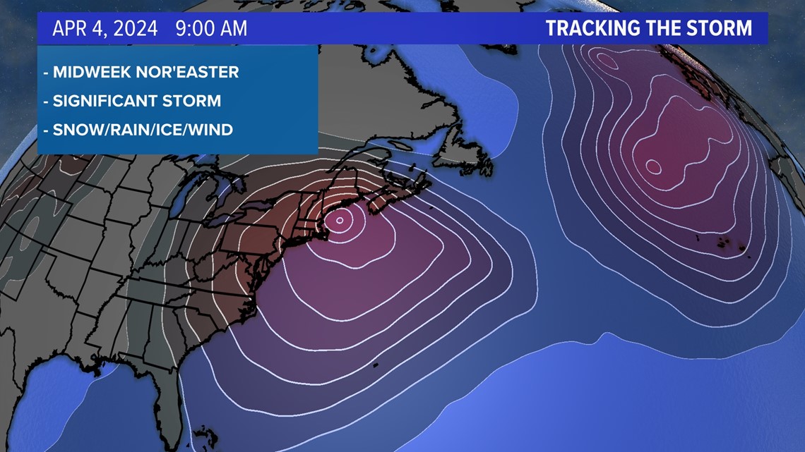
By the middle of next week, we will have a deepening area of low pressure in the Gulf of Maine with snow on the backside as the storm runs into colder air coming down from the north.
This storm will also get an injection of energy from the north and create its own cold air from top to bottom as the heavy snow brings cold air down to ground level.

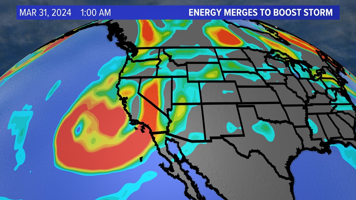
It all starts on the west coast at 500 mb where a large piece of energy will be slamming into southern California. That energy will travel over the Midwest and "phase" or merge with another piece of energy coming down from Canada.

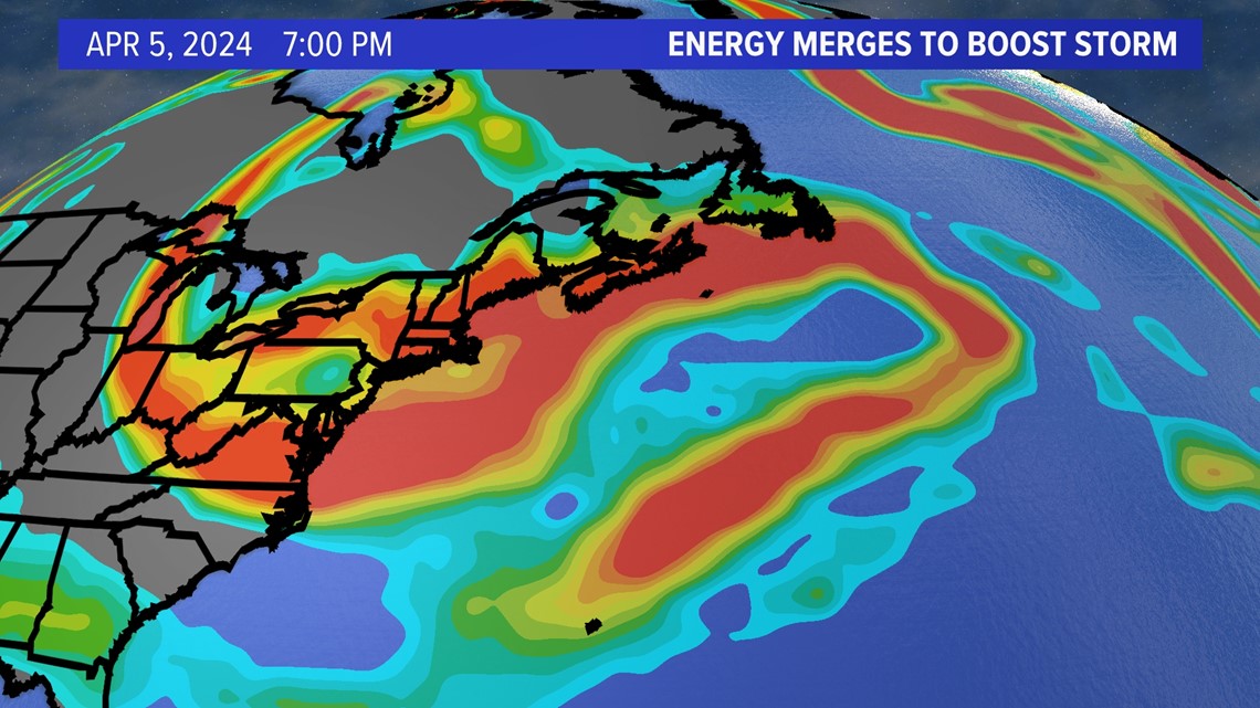
The juicy energy from the Pacific, combined with the cold energy from Canada, will merge in the Gulf of Maine to form our nor'easter.

But it's not quite that simple where the surface-level low-pressure system develops. When is the key to who gets snow and how much over Maine?

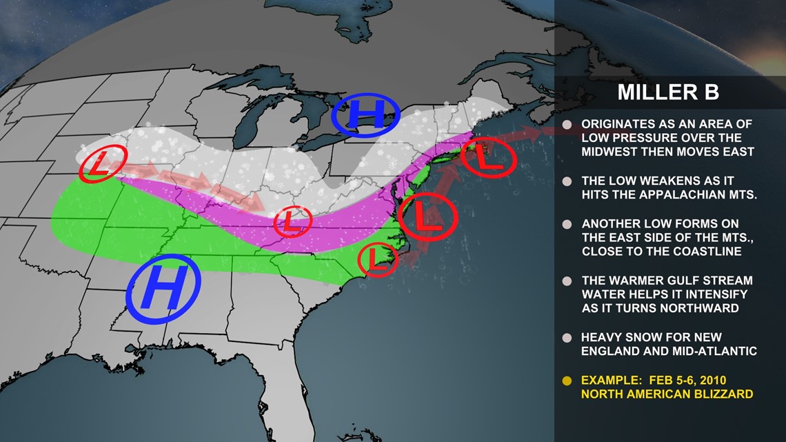
This is typically called a Miller "B" nor'easter track. The low pressure over the Midwest will transfer its energy to the developing coastal low and intensify as it turns northward.

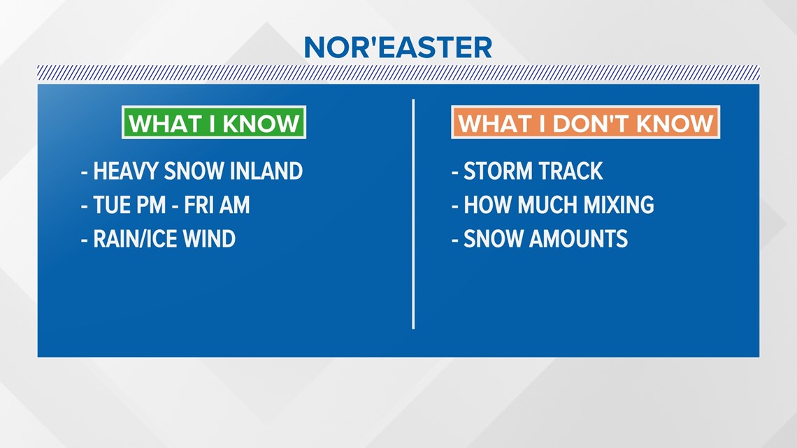
Here is what I know and don’t know about next week’s nor’easter: Heavy snow is most likely inland, especially if it's a coastal hugger track. I don’t know how much mixing will occur, and a lot relies on the position of the low and storm track.

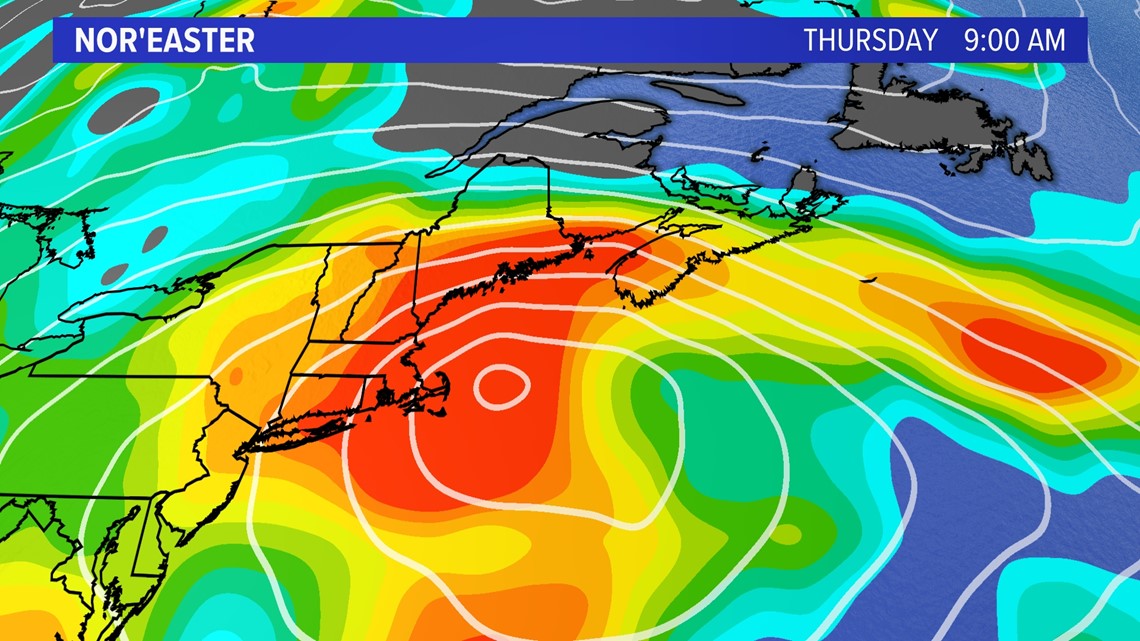
The radar could look like this on Thursday with an all-snow solution if the low tracks far enough off the coast near the 40N/70W benchmark.

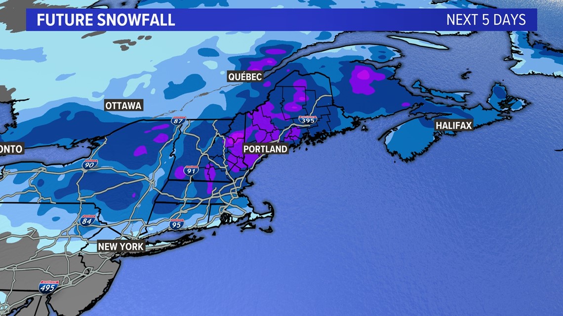
The amount of snow is still to be determined based on the factors I’ve mentioned above, but significant totals are likely with a juicy system and enough cold air.

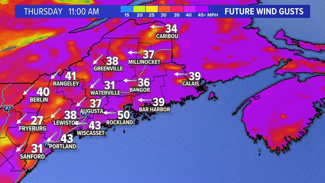
One thing to consider is power outages due to the weight of the snow.
In April, it's tough to get high snow ratios with the high sun angle and moisture content. Wind will not help that situation.

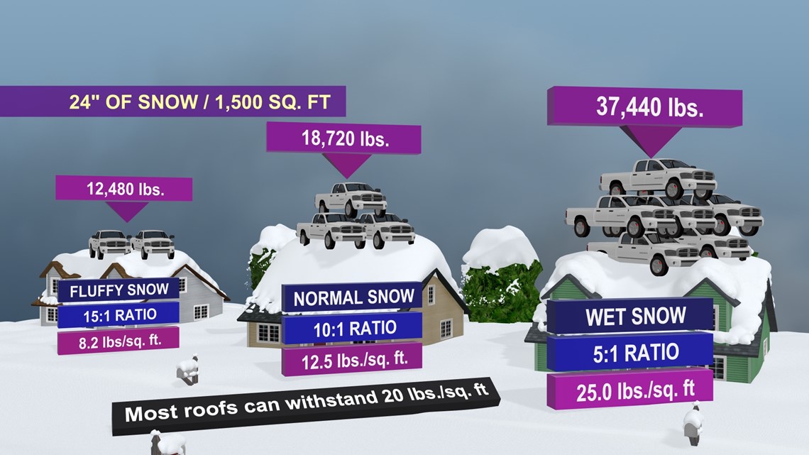
What's worse, is the snow ratios could be less than 10:1 and lead to extra weight on roofs. It won't take much more snow for some roofs to have problems holding the weight.

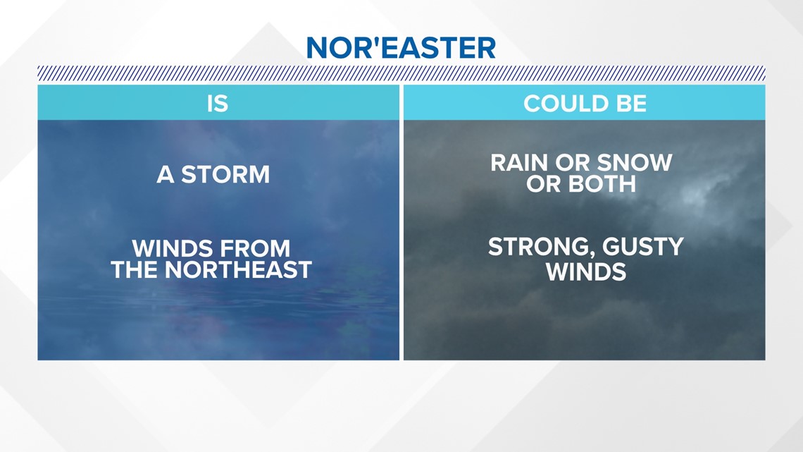
In conclusion, a nor'easter is a storm with wind from the northeast. A nor’easter could be rain or snow or both with strong, gusty wind.

Follow along for more weather blogs and pizza discussions.