

PORTLAND, Maine — This thaw has been impressive and devastating for winter lovers. The Nordic and sled trails are bare. The ponds still have open water. We need cold and snow and we need it stat!
Low pressure from the Midwest will slowly work through the Northeast over the next few days. This will not be a very organized or strong storm, but it will still throw some ice and snow at us, creating travel problems.
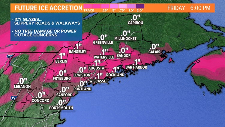
It all begins Wednesday night. Late Wednesday evening, the next wave of moisture will slide in. Cold air from southern Canada will bleed south, hugging the surface and creating a thin layer of sub-freezing air. Rain will begin to freeze on untreated surfaces creating icy glazes by Thursday morning.

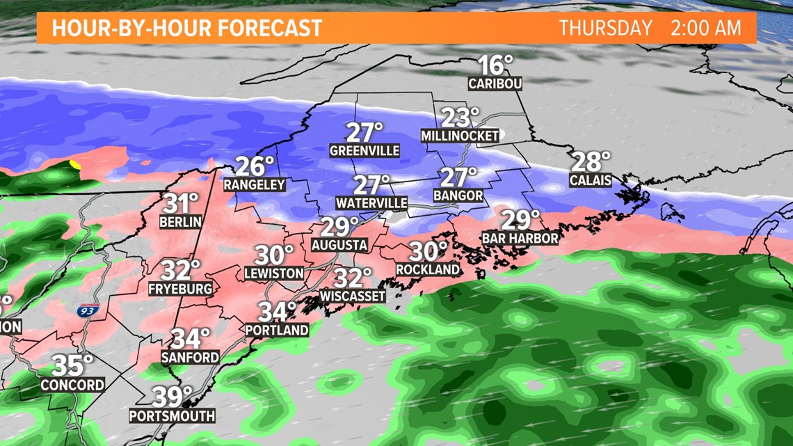
The precip will taper off and become very light and misty through the day on Thursday, but the atmospheric temp profile will continue to chill. Light sleet pellets will mix in with the freezing mist.
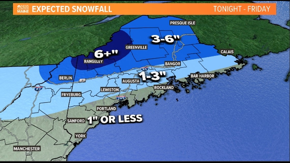
Finally, late Thursday night, the entire column from the cloud to the ground will be sub-freezing. Any lingering precip will fall as snow. There won't be a whole lot of leftover moisture, but minor snow accumulations will be possible on Friday.

Nobody likes ice, and we're going to get some. It will only be a thin glaze, not enough to crack tree limbs or produce power outages, but travel problems are expected.


Salt from prior road treatments has been washed away by recent rain. Crews will need to head out and treat many roads and walkways. School delays and cancellations will be possible Thursday too.
Todd - Check out my Instagram
