

The next winter storm is on deck for late Tuesday into Wednesday.
Before then, we have a couple of bright, cold days ahead, both Sunday and Monday.
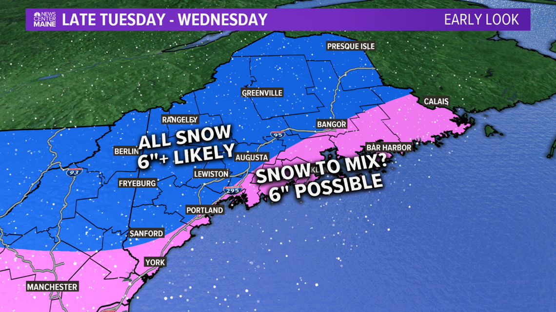
It looks like all of us will see accumulating snow.
As we've seen in so many storms this winter, the track will determine whether southern and eastern areas see a change to sleet or rain.
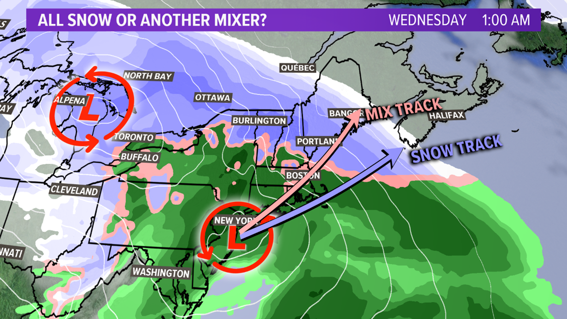
Farther inland, it looks like this will be mostly or all snow, and it'll be fluffy.
Most of the daylight hours Tuesday will be okay, with increasing clouds.
Right now, it looks like the snow will start in western Maine around 4 p.m. The timing of this will be very important for the evening commute in York, Oxford, Androscoggin and Cumberland counties.
It will be cold enough for the snow to accumulate from the start, and it may ramp up quickly.

Farther north and east, especially east of Augusta, the evening commute should be fine. Snow will start in central Maine during the evening, and may not make it to eastern and northern Maine until 10 p.m.
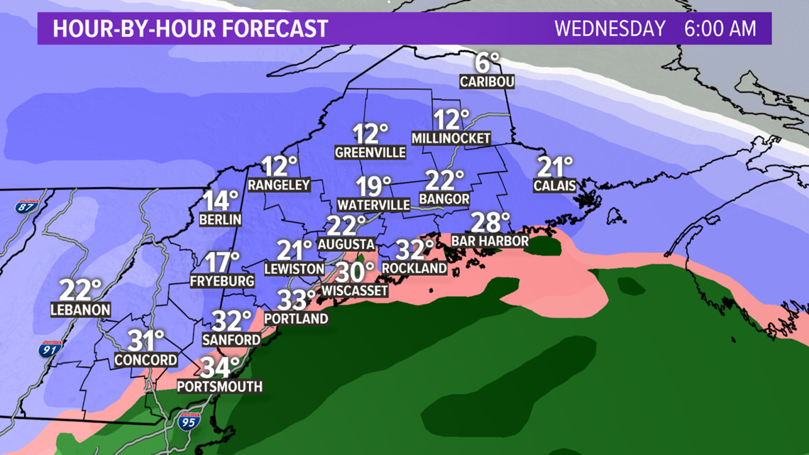
The heaviest snow will come overnight into Wednesday morning. The morning commute will be a mess.
Even if a change to sleet or rain does happen in southern and eastern Maine, several inches of snow are likely to fall before it does.
The precipitation will end late morning in western Maine, and take until later in the day in eastern and northern Maine.
At this point, it's too soon for specific snow totals. We should be able to do that later Sunday for you.
An early estimate is for 6 inches or more of snow inland, with some spots seeing double digits, where it stays all snow.
Near the coast and in eastern Maine, it will depend on how much mixing occurs, but even there, 6 inches is possible before any changeover happens.

Stay with Cory and me for updates throughout the weekend.
Ryan
