
As I write this, which is before the sun has even risen, temperatures across all of Maine and New Hampshire are well above freezing.
Rain has started to move in, too, with fog being reported across most of the coastline.
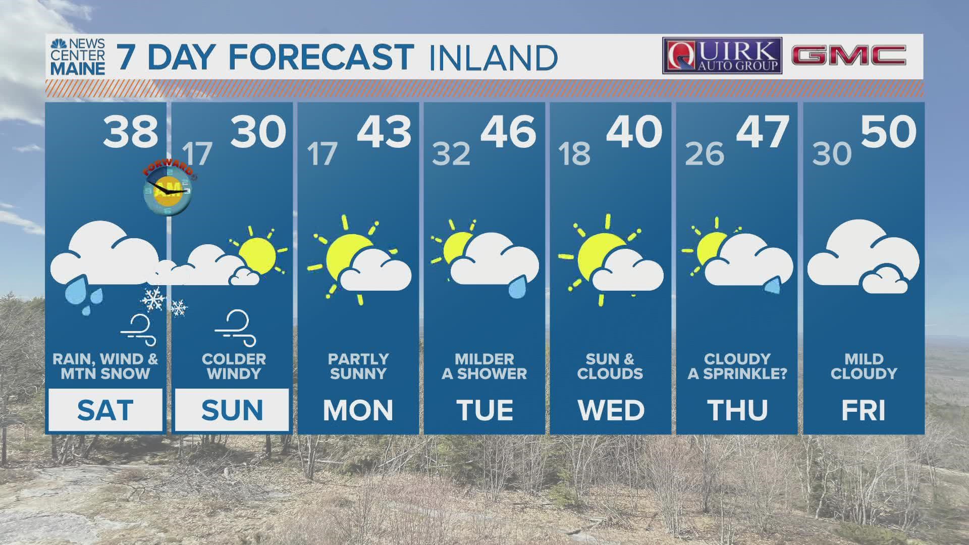
Temperatures stay mild enough to support only rain for part of the day. Expect colder air to move in with a temperature crash this afternoon.
The rain/snow line will crash south bringing flakes to the coast by the middle of the afternoon.
Beyond this, milder weather returns through most of next week.

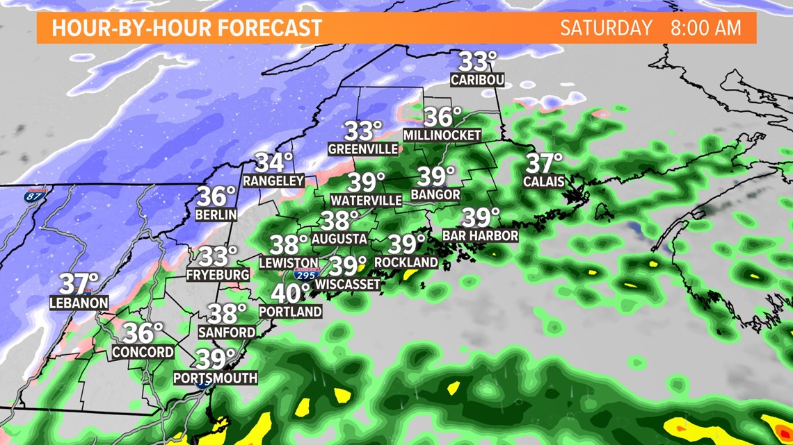
Showers began overnight as warm, moist air moved in on top of colder air locked in at the surface.
Most south of Route 2 will see just rain. North of Route 2, especially across the higher peaks, is where I expect some snow through the early morning.

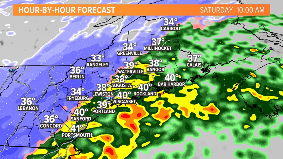
Colder air gets wrapped into the storm with a sharp transition between rain and snow.
At this point, the higher elevations of western Maine into the Allagash will be full-on snow.
The low-lying areas across western Maine will still be dealing with a bit of mix.
This all happens by 10 a.m. Saturday.

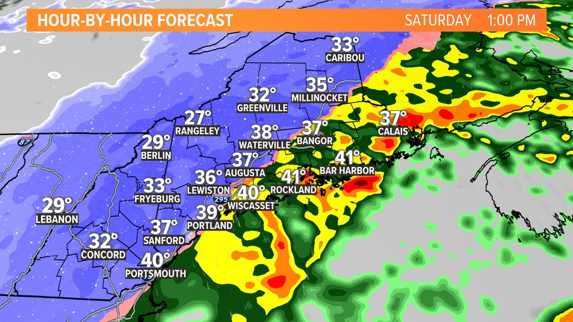
As the low tracks through the Gulf of Maine, colder air keeps pouring in behind this storm.
The rain/snow line crashes south toward the coastline.
By 1 p.m., snow will be falling for most west of the Penobscot River.
While it may look dramatic outside, impacts will still vary. Southern areas will still be a little too warm for snow to stick to roads, but it will likely be sticking easily in the mountains.

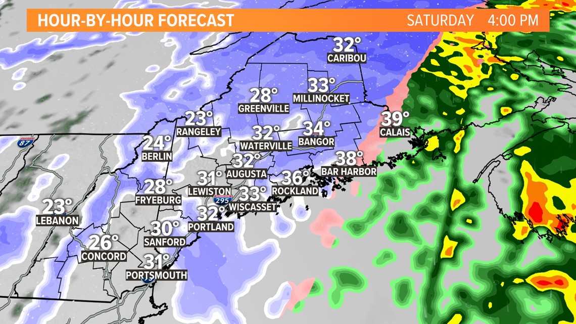
By 4 p.m., the rain-snow line will be racing Downeast.
Temperatures will finally have dropped enough across western Maine to support more accumulation. Slushy roads are expected as far east as Bangor through the late afternoon Saturday.
With colder air coming in, a flash freeze is possible for some roads. The slickest roads statewide will be in the evening.

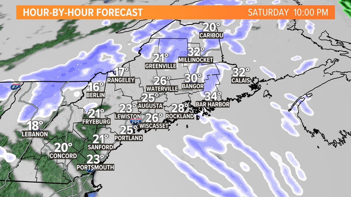
As colder and drier air wraps around the departing storm, snow showers end too.
Sunday stays cold and well below average before milder air slides back in starting Monday.

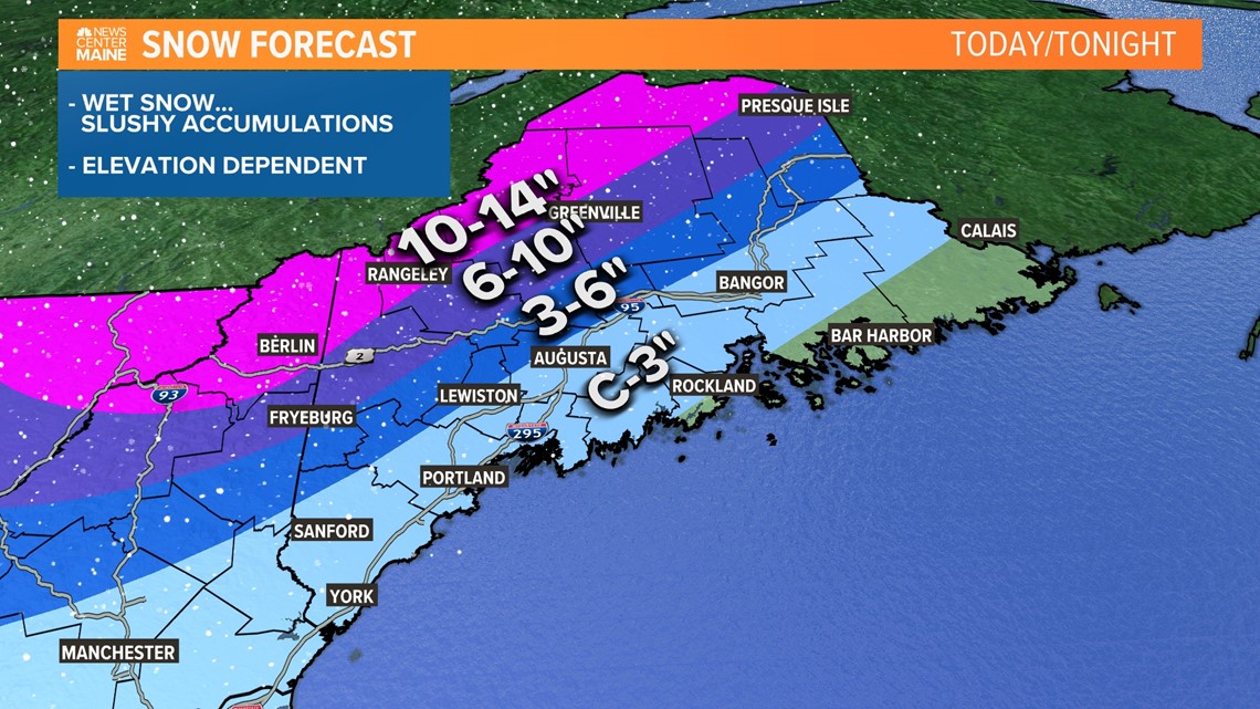
There are no big changes to the snow map right now. Unfortunately, I think a lot of this snow will be wet and heavy. That means shoveling will be a tough task.
On the bright side, accumulation on roads will not be as significant as grass.
The highest elevations will see the most snow out of this storm. Skiers, rejoice!
At the coast, especially Downeast, the late transition to snow and lack of moisture will mean just a slushy coating or so.
Slick spots are possible heading into Sunday morning, but sunshine in the afternoon should clear roads right up.

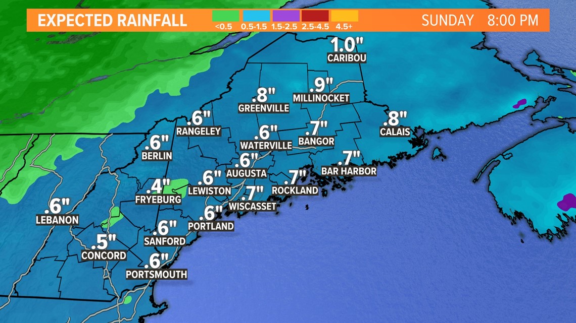
Total rainfall from the storm still comes in right around an inch, give or take a little.
This could be enough for some localized high water issues. That's especially true in areas that end up with storm drains blocked by snow.
The frozen ground will lead to some excess runoff, too.
The overall risk of river flooding and/or ice jams still remains quite low.

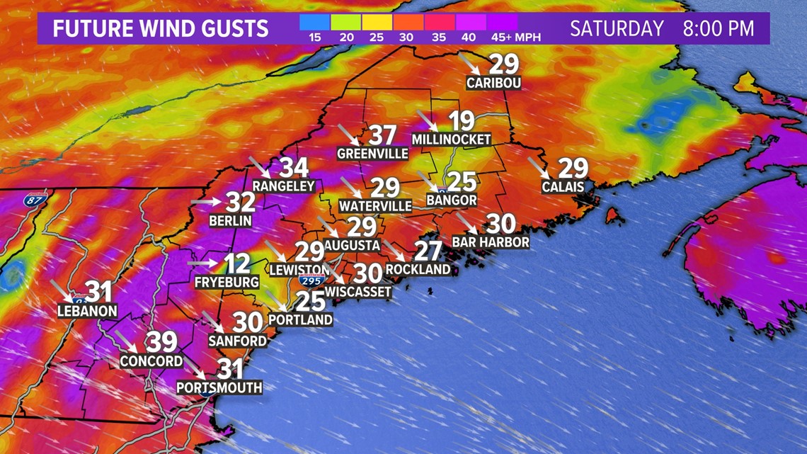
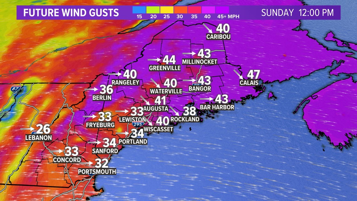
The wind aspect of this storm comes at two separate points in time.
As the surface low strengthens a bit, stronger wind gusts are expected on the backside of the storm.
Gusts will approach 30-40 mph Saturday evening and last for a few hours. The strongest gusts will be in and just downwind of the mountains.
A few outages are possible and wind stays gusty right into Sunday morning.

The wind aspect of this storm comes at two separate points in time.
As the surface low strengthens a bit, stronger wind gusts are expected on the backside of the storm.
Gusts will approach 30-40 mph Saturday evening and last for a few hours. The strongest gusts will be in and just downwind of the mountains.
A few outages are possible before wind gusts relax overnight into Sunday morning.
Monday looks much, much nicer. Most of next week will be near or slightly above normal with a lot more sunshine mixed in.
If you see damage or want to send in snow totals, you can do that through our app's "Near ME" section. Just make sure you do it safely, please!
I will be here all day Saturday to track the storm with you. Follow me on Twitter: @MikeSliferWX.
- Mike Slifer
RELATED: NEWS CENTER Maine Weather Forecast