
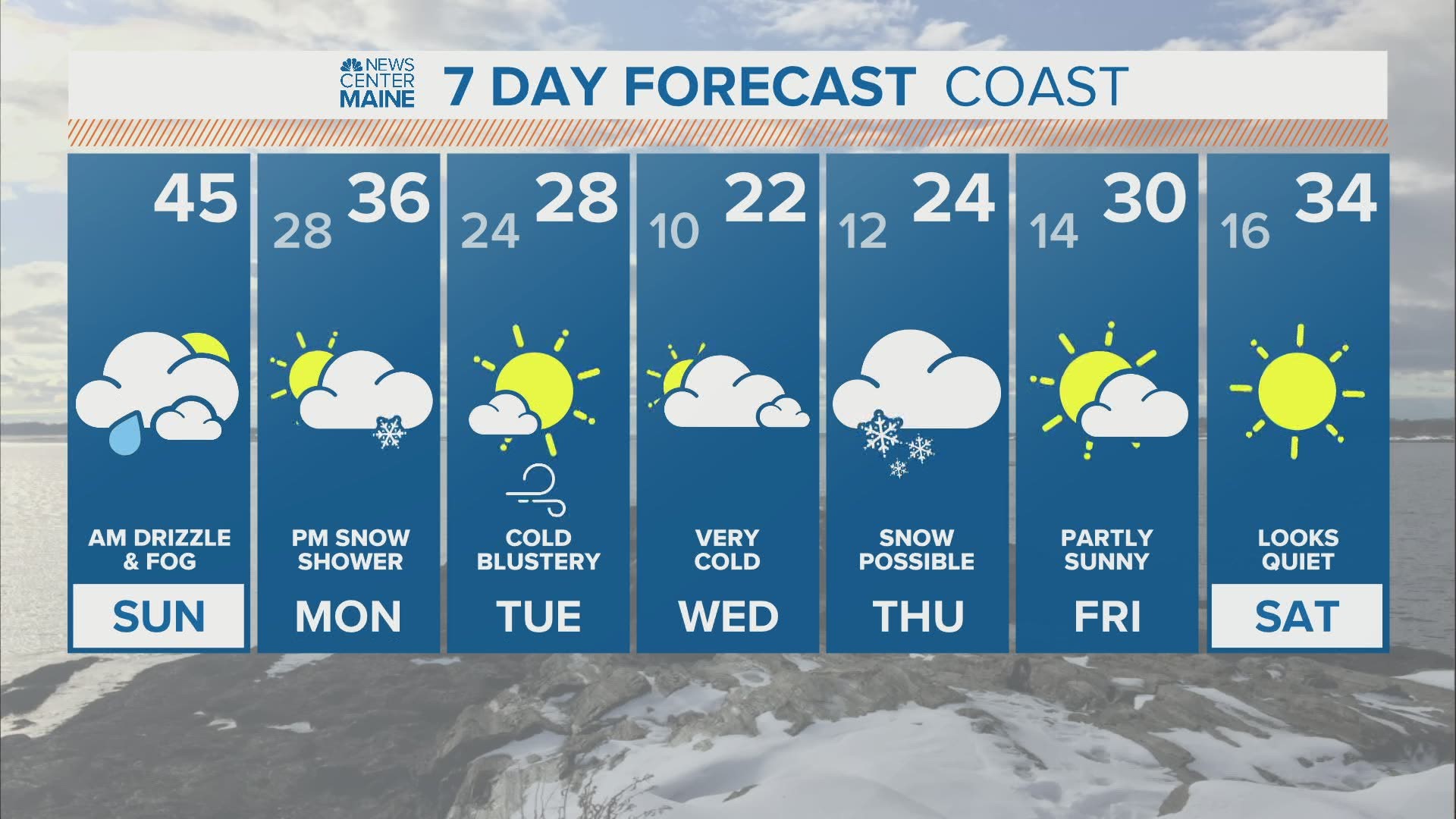
MAINE, USA — It's going to be a wintry week in northern New England.
While it's not a guarantee we'll be hit by a big storm that will form on the East Coast, the coldest air we've seen so far this young season is a guarantee.
One storm will pass to our south on Monday. But an upper-level disturbance hanging back behind it will trigger flurries and snow showers in the afternoon and night.

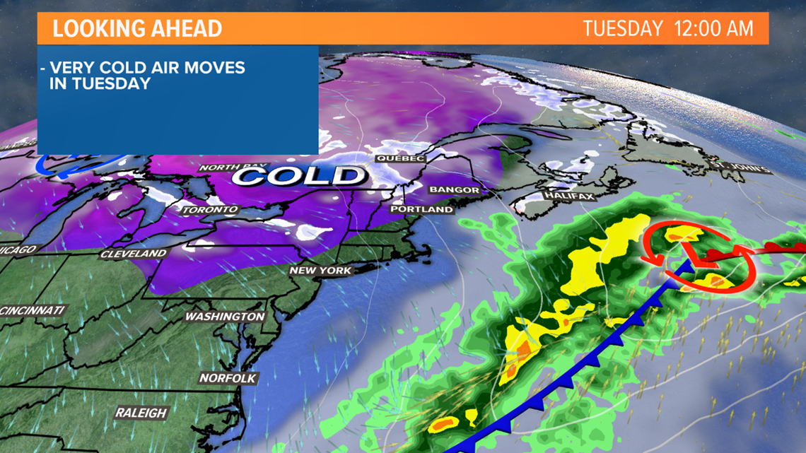
Behind this, an arctic air mass will build south on Tuesday. Temperatures won't rise much during the day, and with northwest wind gusts of 25-30 mph, the wind chill will become a factor too.

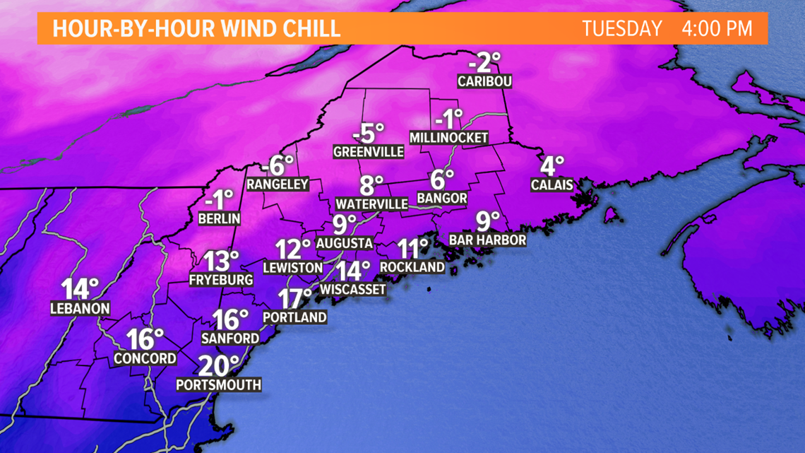
Actual air temperatures likely drop into the single digits Wednesday morning away from the coastline.
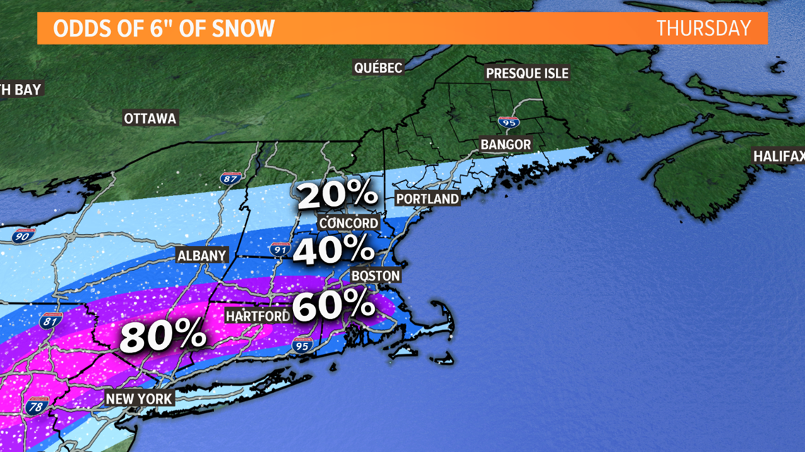
This cold air will be in place ahead of a big storm that forms on the East Coast later Wednesday into Thursday. Right now, odds favor the bulk of the storm staying to our south.
A wide area of 6-12" of snow is likely from Pennsylvania into southern New England. Some places will get more than a foot, considering how cold the air mass will be.

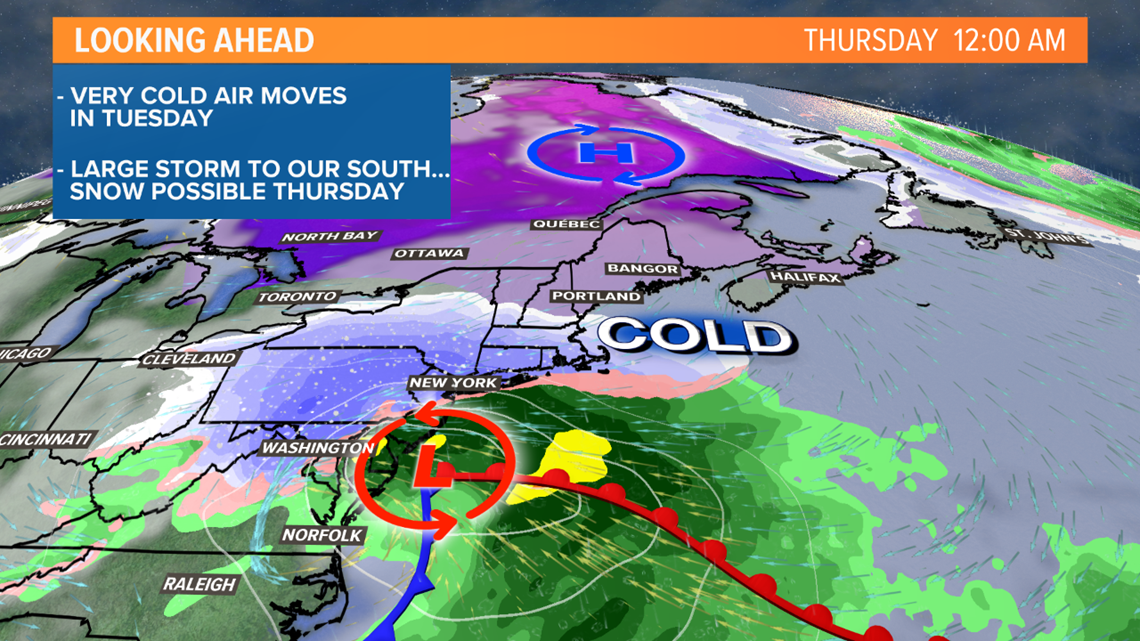
While the odds favor the heaviest staying south of us, we are still a few days out, and it's possible the track of the storm could shift north a little bit.
So, I am saying snow is possible on Thursday, especially in southern Maine.
With this uncertainty, it's too soon for specific snow totals. But I'd put the odds at 6" around 20% in Portland and around 40% in southern York County. Those odds will decrease if the storm's forecast track stays to our south. It would take a major shift north to bring the mountains into play for significant snow.

Stay with us for updates this week.
Ryan - follow me on Instagram @ryanbretonwx