MAINE, USA — Some spots woke up to a fresh coating to an inch or two of snow in central and eastern Maine this morning.
Believe it or not, those snow showers were a sign of much milder air moving in, relative to the arctic air mass we dealt with to start the weekend.
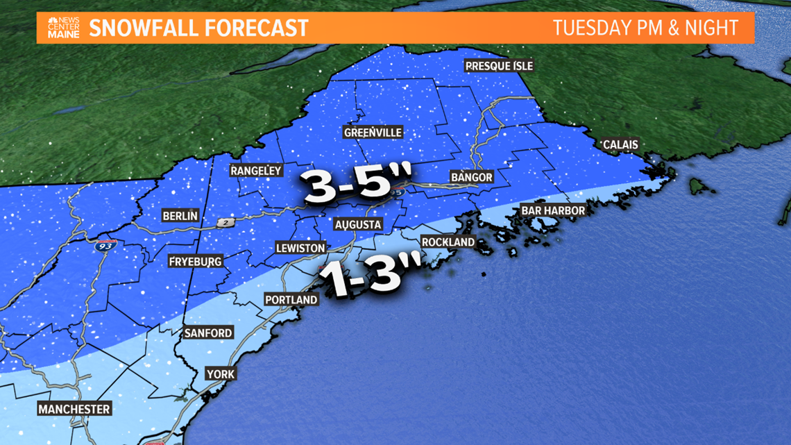
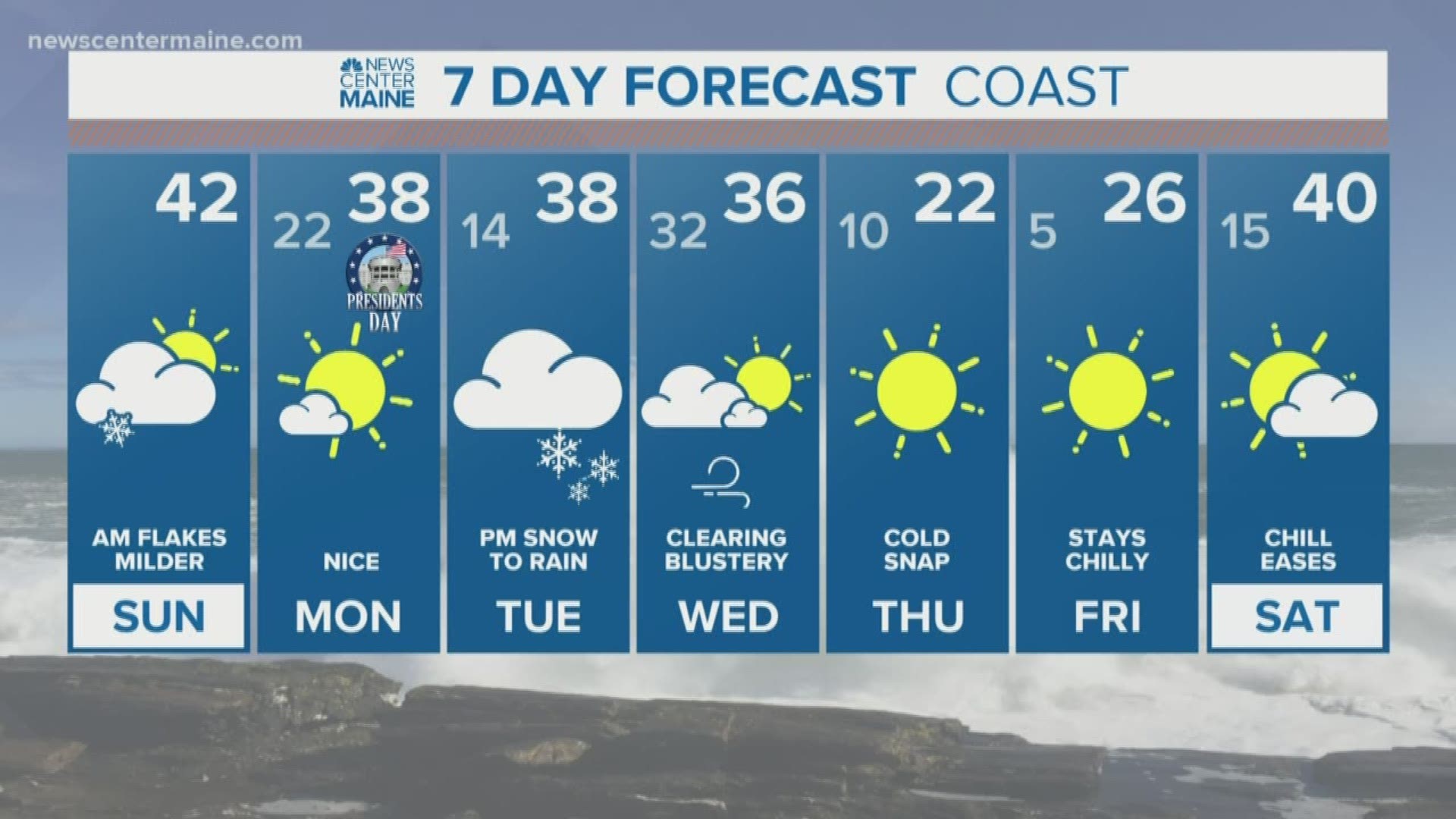
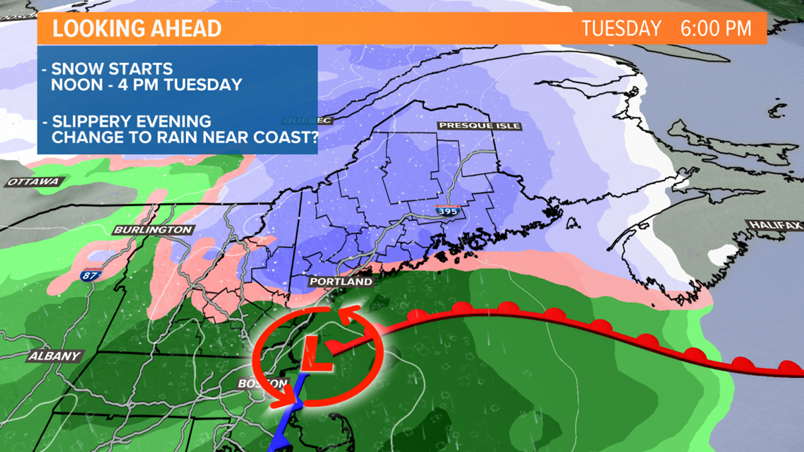
The next round of widespread snow is coming Tuesday. It's not a big storm and given it's school vacation week, the impact should be fairly low. But it will be enough for most to have to plow.
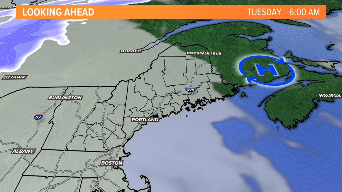
Tuesday morning starts off dry with thickening clouds. A few flurries or snow showers are possible later in the morning, but steady snow should hold off until afternoon.

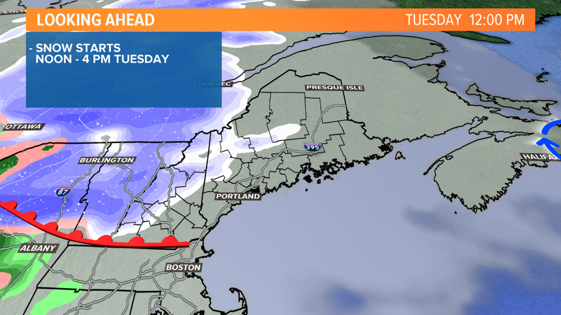
Snow moves in between noon and 4 p.m. from west to east. It may take until after 4 p.m. to reach far eastern Maine.

It'll be a wet snow near the coast, and it may warm enough for a change to rain in the Portland area and in southern Maine. That'll limit snow totals to 1 to 3 inches.

Mostly or all snow is expected in the foothills, mountains and north. That's where a widespread 3 to 5 inches are expected; a few spots could see a bit higher.