
MAINE, USA — January is ending on a cold note, and February will begin on a stormy one, as a nor'easter moves up the coast to start the month.
Here are some of the latest forecast headlines:
- The timing has sped up. The heaviest snow in southern and central Maine will be Monday night into Tuesday morning.
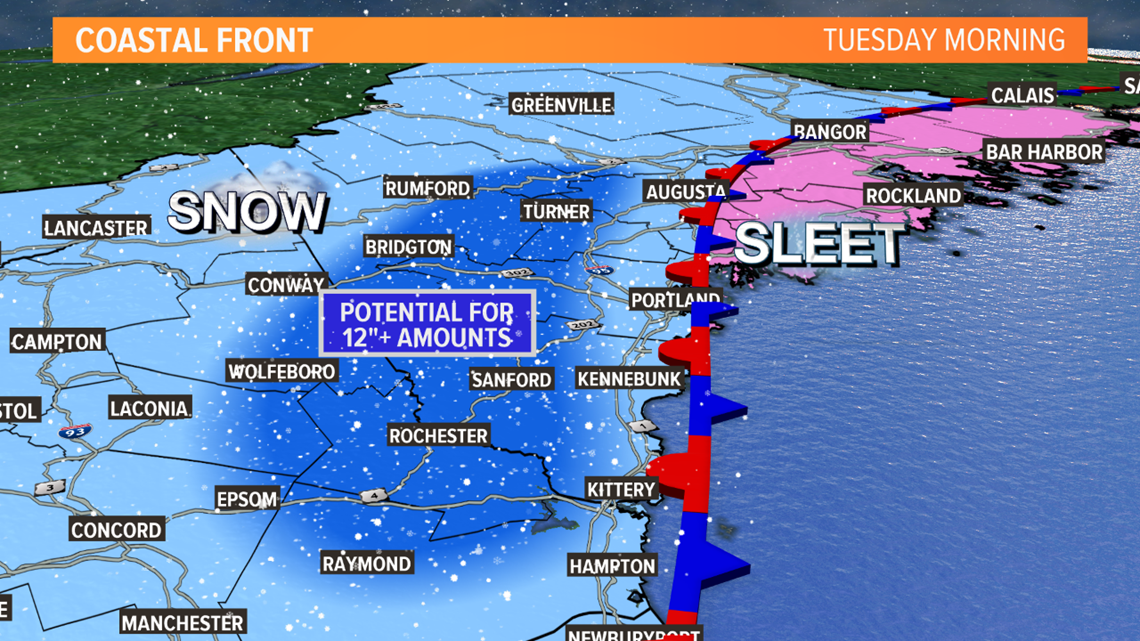
- It's a little stronger and tracking closer to the coast. This will mean coastal areas and eastern Maine switch to lighter sleet and rain later Tuesday morning and Tuesday afternoon. The mountains and far north will keep snowing into Tuesday night.
- Wind and tides will be an issue. Northeast gusts to 40 MPH are possible Tuesday morning. That will blow and drift the snow. Tuesday's 2 a.m. and 2 p.m. tides are of concern for minor flooding and splashover.
Now for the details...
Clouds will increase on Monday. Well ahead of the storm, there may be some flurries or snow showers in southern Maine, but the bulk of the snow moves in Monday evening and night.
Steady snow will start in Kittery around 4 p.m. Monday. In York County especially, roads are likely to become snow-covered during Monday evening's commute.
In the rest of southern and western Maine, steady snow will start between 4 p.m. and 8 p.m.

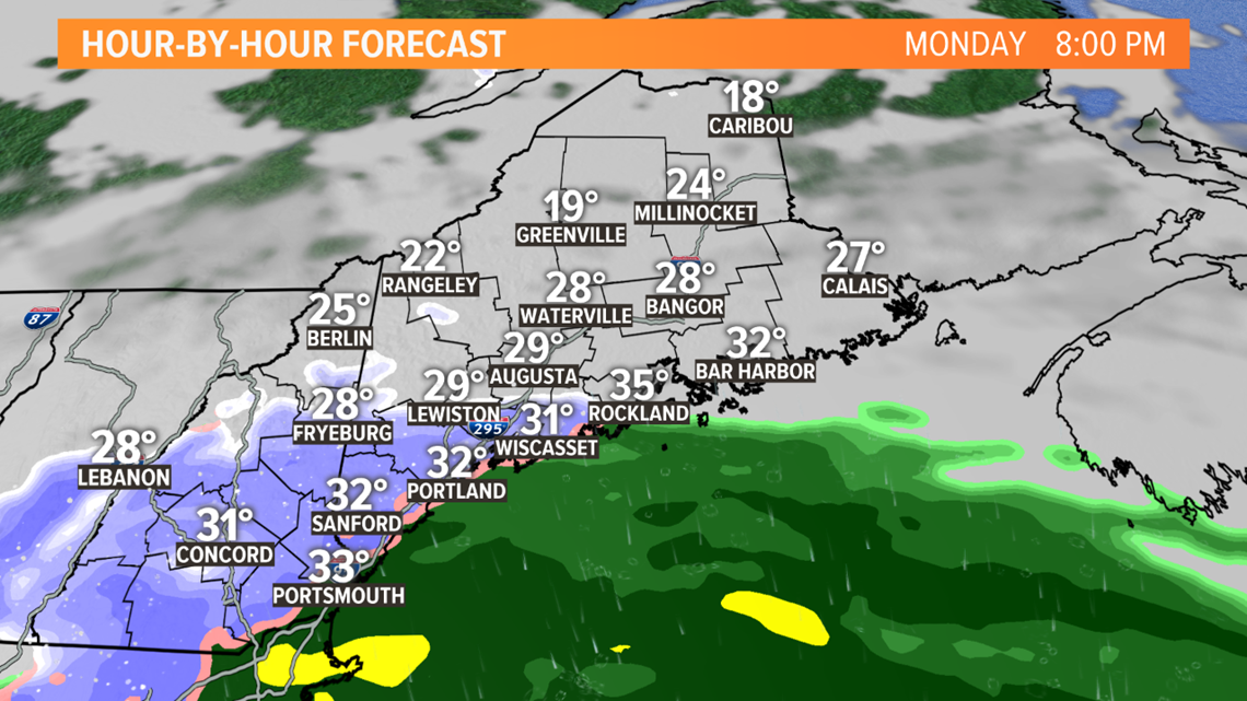
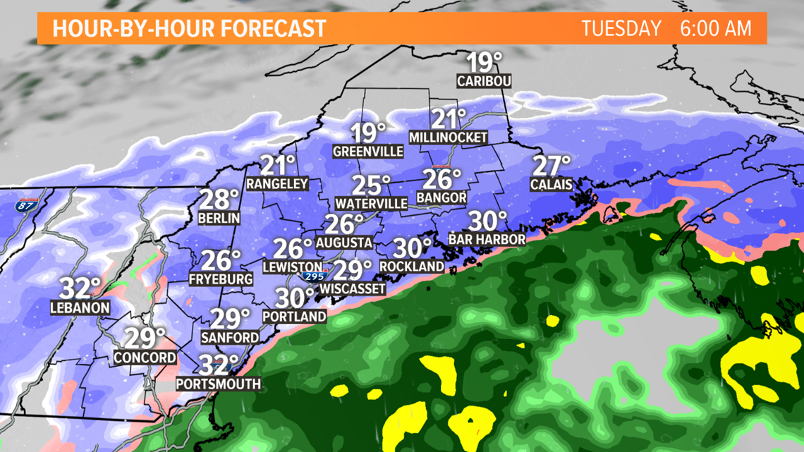
In central and eastern Maine, it will start between 8 p.m. and midnight. By midnight, several inches will be on the ground from Lewiston south.

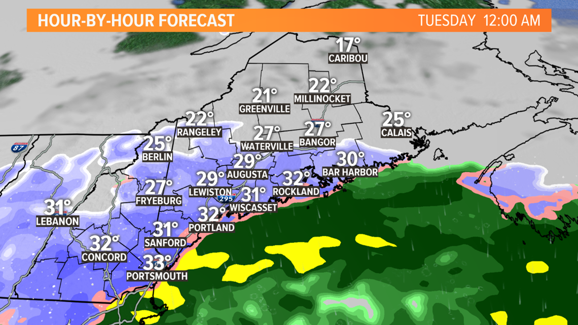
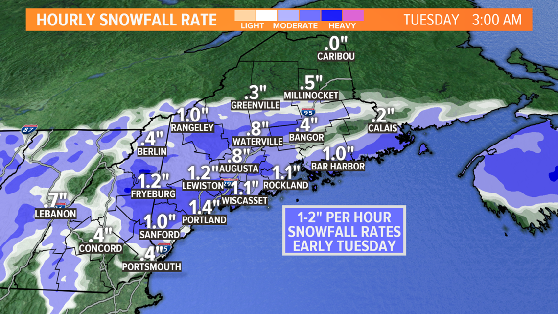
The snow will be intense overnight, at times falling at the rate of 1-2" per hour early Tuesday morning. Travel overnight and early Tuesday will be quite difficult. This is the height of the storm for southern and central Maine.
Whiteout conditions are likely as the northeast wind gusts to 40 MPH at times.

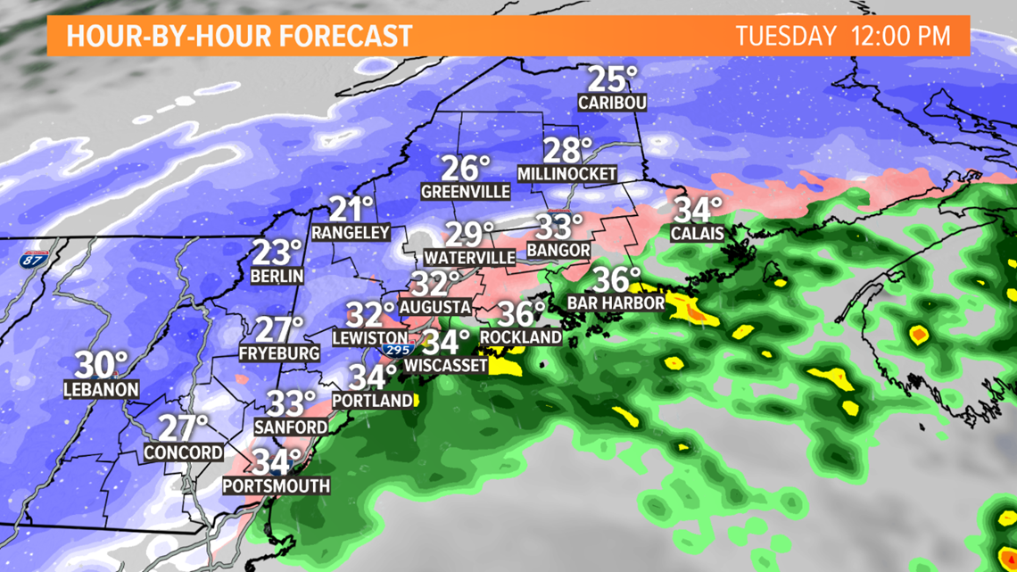
After sunrise Tuesday, the heavier snow will move into the mountains and northern Maine.

Lighter snow will begin to change to sleet as warmer air moves in aloft. This change is likely to happen near the coast and in eastern Maine, but during the day Tuesday even farther inland some sleet may mix in.
At the same time, it will keep snowing in the mountains and up north.

Periods of snow and mix will continue into Tuesday night, and even in southern and coastal Maine a flip back to snow is possible at the end of the storm.
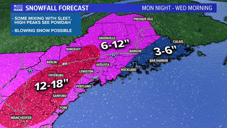
In total, a widespread 6-12" is expected, with amounts topping a foot in western Maine. Somewhat less is anticipated in eastern Maine (3-6"), but depending on the timing of the changeover to sleet Tuesday morning this could be adjusted.


Follow our updates this weekend. Mike is back tonight and Todd and I will both be in Monday morning.
Ryan - follow me on Instagram @ryanbretonwx
