
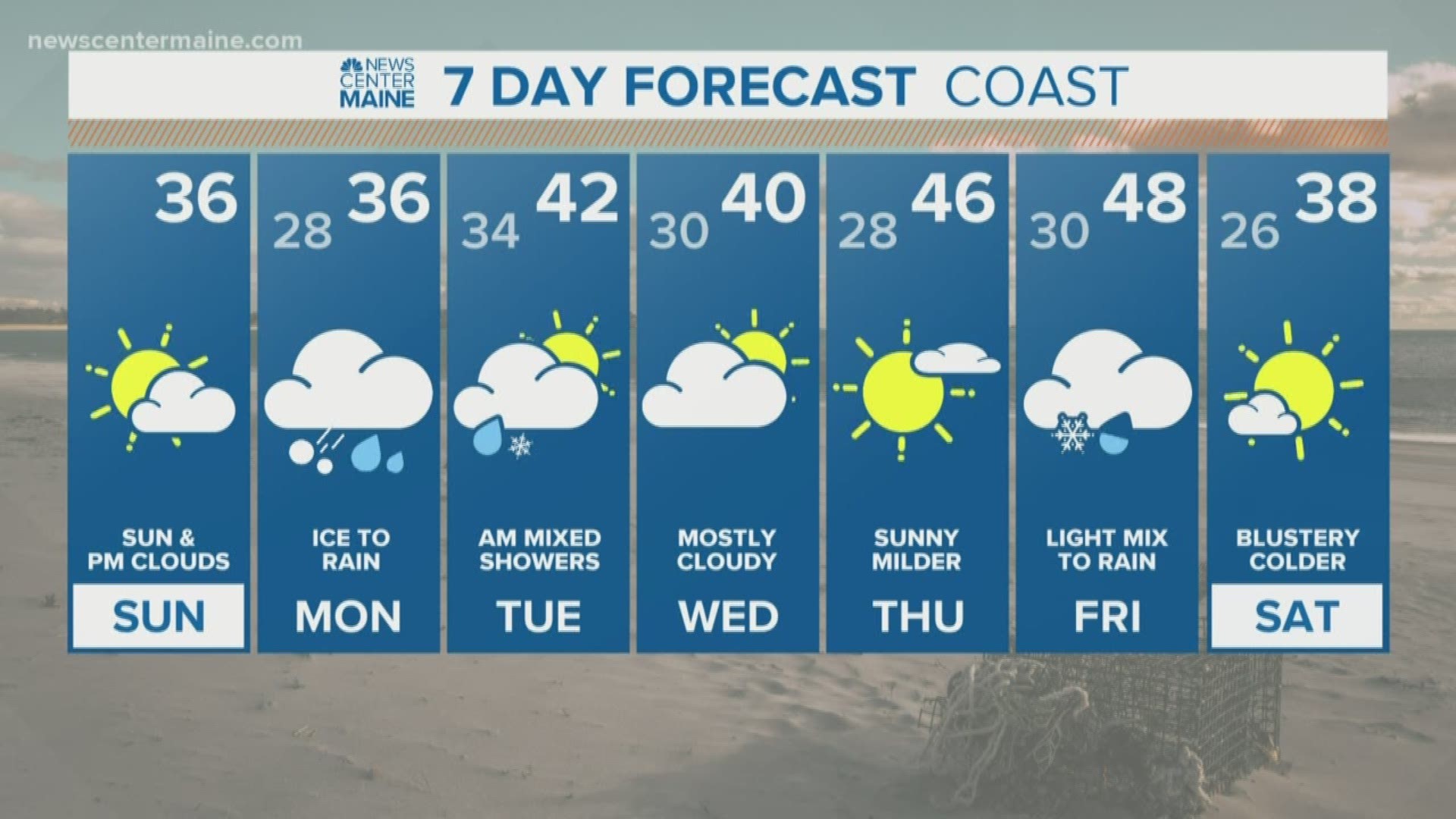
MAINE, USA — After record cold this weekend, a storm moves in Monday with largely rain.
But as it begins, the temperatures at the ground will be very close to freezing. This makes freezing rain (rain that falls, then freezes once it hits the ground) a concern.
When the precipitation starts will be important for Monday morning's commute. I'm cautiously optimistic it'll hold off and we'll avoid big issues, but just a couple hours can make a difference.
Here's the map for 5 a.m. Monday. Rain is mostly offshore.


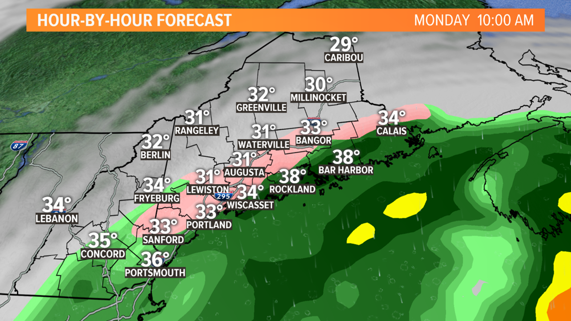
This rain will move into southern and central Maine between 6 a.m. and 10 a.m. Temperatures will be near 32 degrees, so any untreated spots may ice up, especially away from the immediate coast.

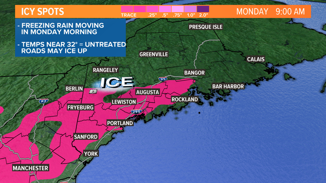
Here's the map at 10 a.m. Ice possible inland, especially in central and western Maine. Still dry in the mountains and northern Maine.

During the day, temperatures will slowly rise a few degrees above freezing. It'll be a chilly rain during the afternoon with ice issues confined to the mountain valleys. It takes until late day for the precipitation to make it to northern Maine.

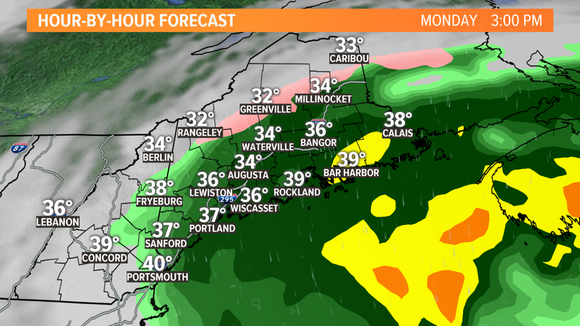
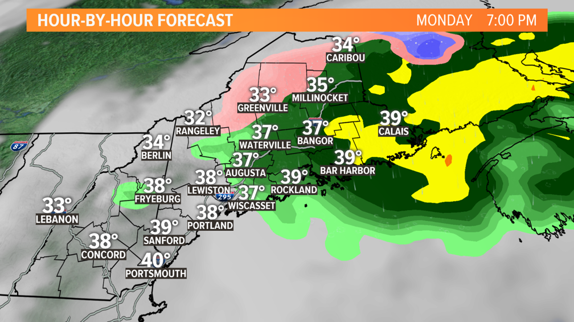
By evening, the steady rain will move into eastern and northern Maine. It'll be chilly with drizzle and a few showers elsewhere.

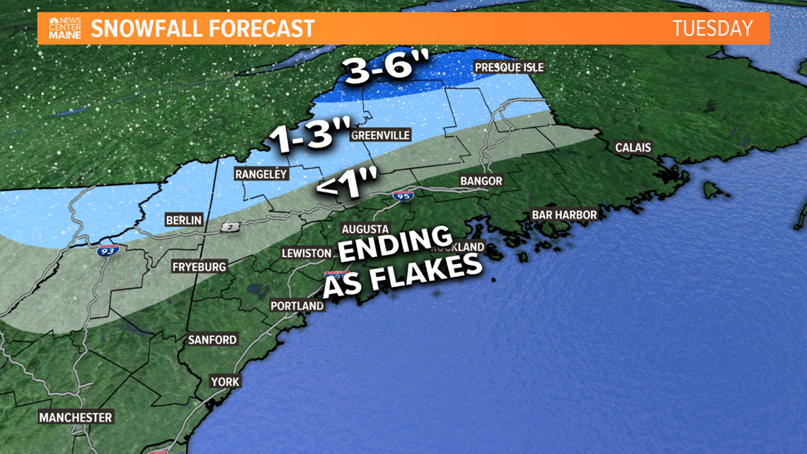
Late Monday night into Tuesday, colder air will move back in, and a change to snow is possible in the mountains and far north. No accumulation is expected in the cities or farther south. Rain may end as some wet snowflakes there.

A side note: Tides are a bit higher than normal. Add the storm offshore, some minor flooding and beach erosion is possible during Monday afternoon's high tide, between 1 p.m. and 4 p.m.
Stay with us for updates tonight and tomorrow.
RELATED: Snow making begins at Lost Valley