
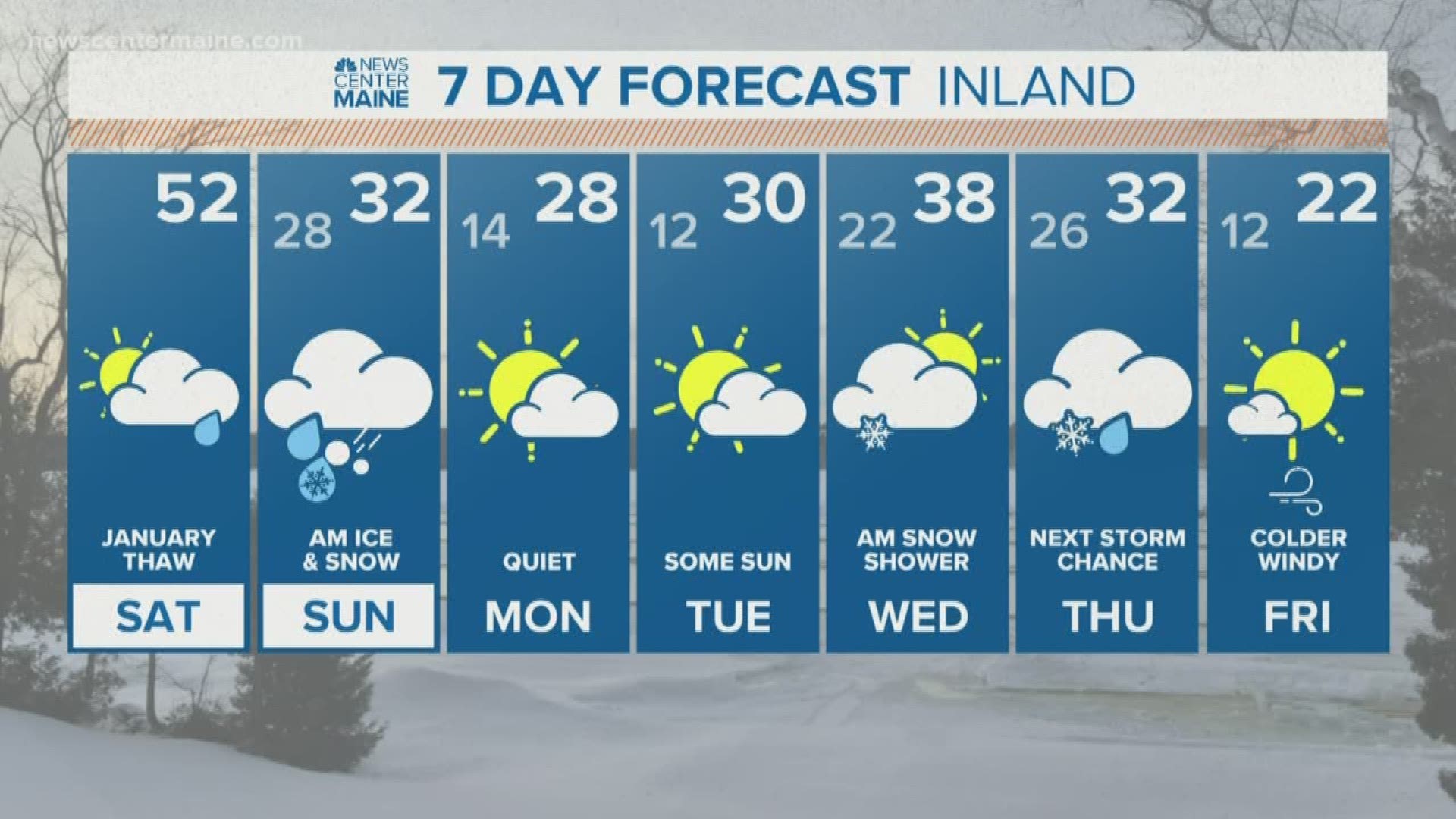
MAINE, USA — Record high temperatures are in jeopardy today, but the cold returns in a big way tomorrow.
Most of today will actually be dry in central and southern Maine. Breaks of sun will boost temperatures into the 50s. The records are 54 degrees in Portland and 52 degrees in Bangor.
A sharp cold front sinks south tonight. This front divides the spring warmth from below freezing air. The cold air will move in at the surface first, while it remains above freezing aloft. This creates a set-up for freezing rain (rain that falls and freezes on contact).
Between midnight and 4 a.m., this cold front will drop through central Maine, with temperatures falling below freezing in places in like Bangor, Waterville and the Route 2 corridor. It will remain very warm overnight across the south, with temperatures still in the 50s at midnight in spots!

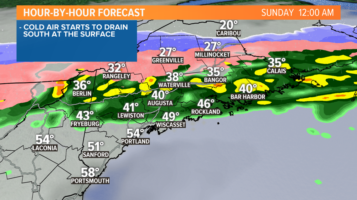
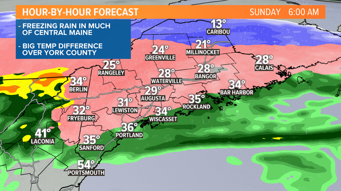
By sunrise, this front will be located over southern Maine. There will be a WILD temperature difference. It may be in the 50s in York County, but below near or below freezing in Lewiston.

Even where it is very warm Sunday morning, there's still a chance temperatures drop if the wind comes around to the north.
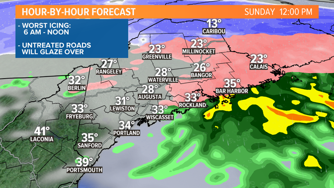
I’m concerned about roads glazing over Sunday morning as the temperatures drop. Driving will be impacted. Untreated roads, sidewalks, driveways will become icy. Remember, bridges freeze first as cold air sinks below them.
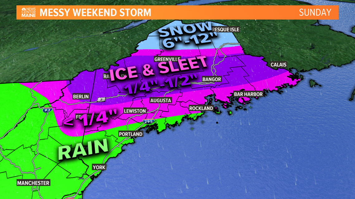
Meanwhile, freezing rain will continue in a lot of central Maine, with sleet and snow in northern Maine. The worst of the icing will be from about 6 a.m. to noon.

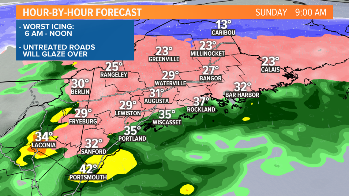
The good news is this is a quick-moving system. By noon it's over in western Maine, and it will be ending during the afternoon in central and eastern Maine.

Since it’s a quick-mover I think we’ll avoid big power outage issues. That’s why this should not be like the "ice storm" of 1998 or 2008.
That said, plan for some outages in central and eastern Maine. 1/4" to 1/2" of ice accretion is expected. Ice clinging to tree limbs will weigh them down, with scattered outages likely.

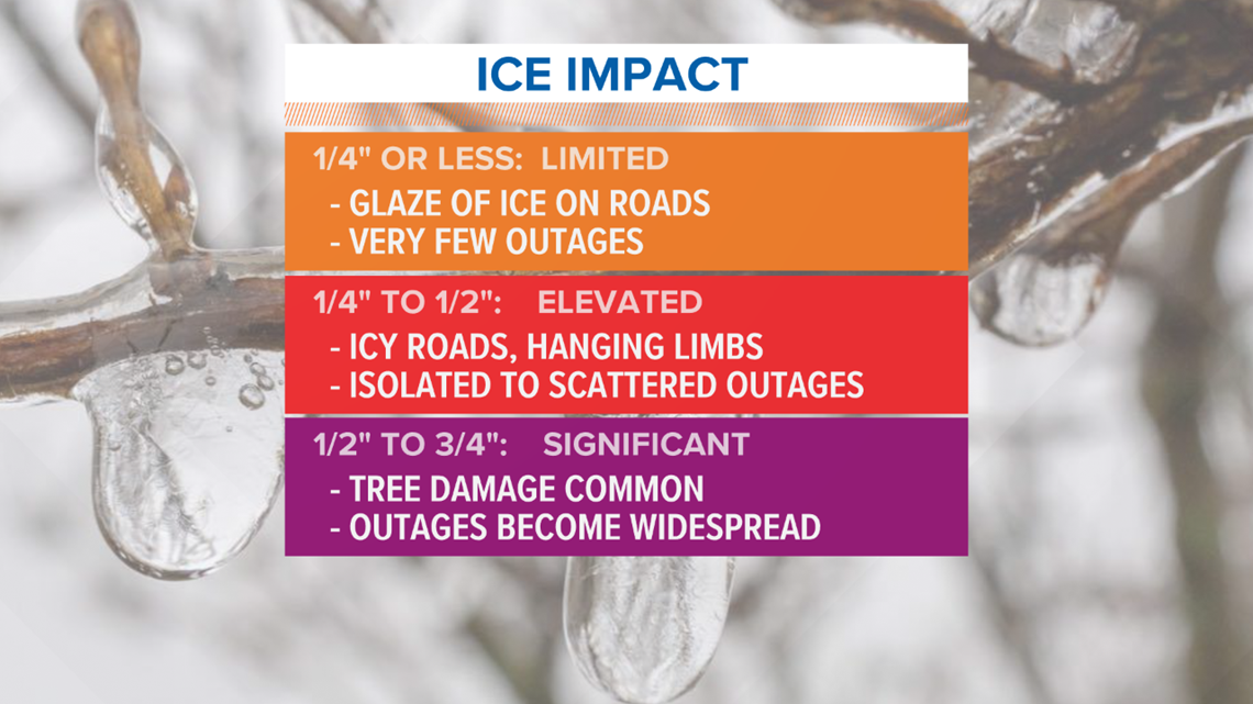
If we get ice accretion above 1/2", outages become more widespread. I rate that a low chance just given how quickly the storm is moving, but it's something we'll be watching for.
Here's the summary of expected impact, which we really haven't changed since Wednesday.

We'll have full storm coverage Sunday, stay with us on-air and online.
RELATED: Dangerous ice expected Sunday