
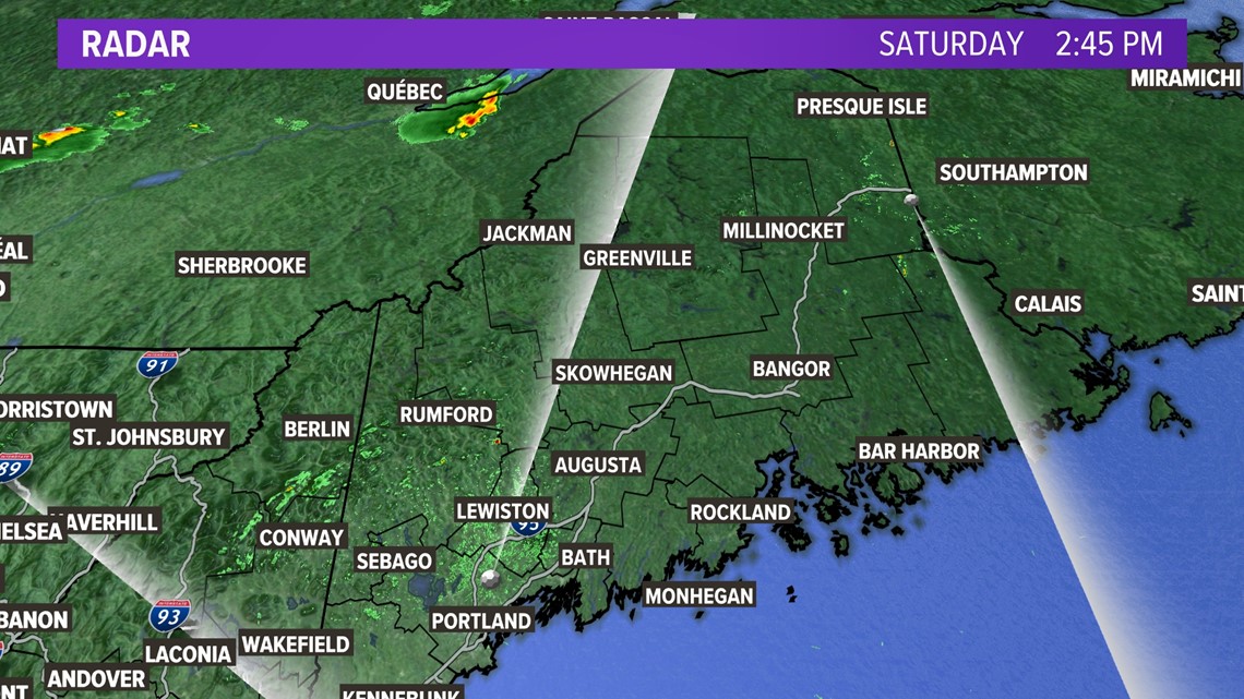
Saturday afternoon update to the weekend severe thunderstorm risk in Maine is showing the western and northern mountains have the best shot at severe weather.

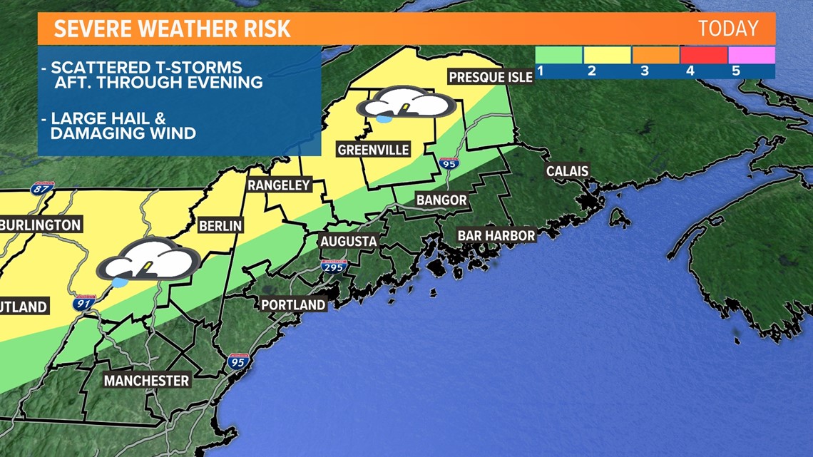
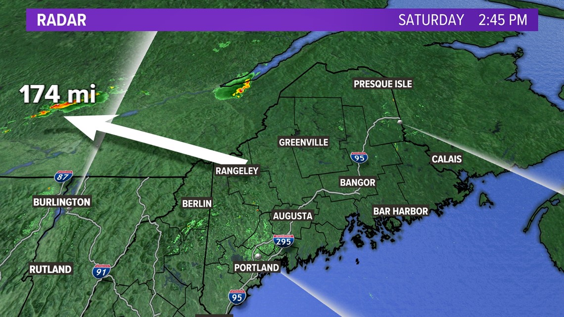
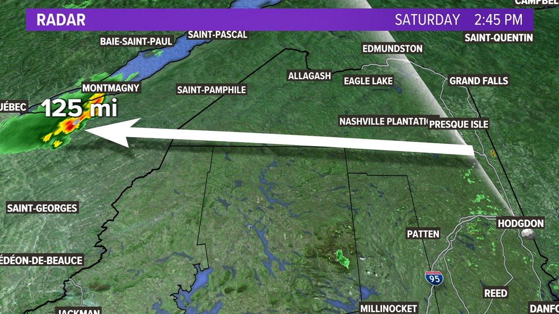
Scattered thunderstorms are moving into the Aroostook Hills right now and they can have damaging wind and large hail. There's another line of thunderstorms advancing the boundary plateau and western mountains later this afternoon and early evening.


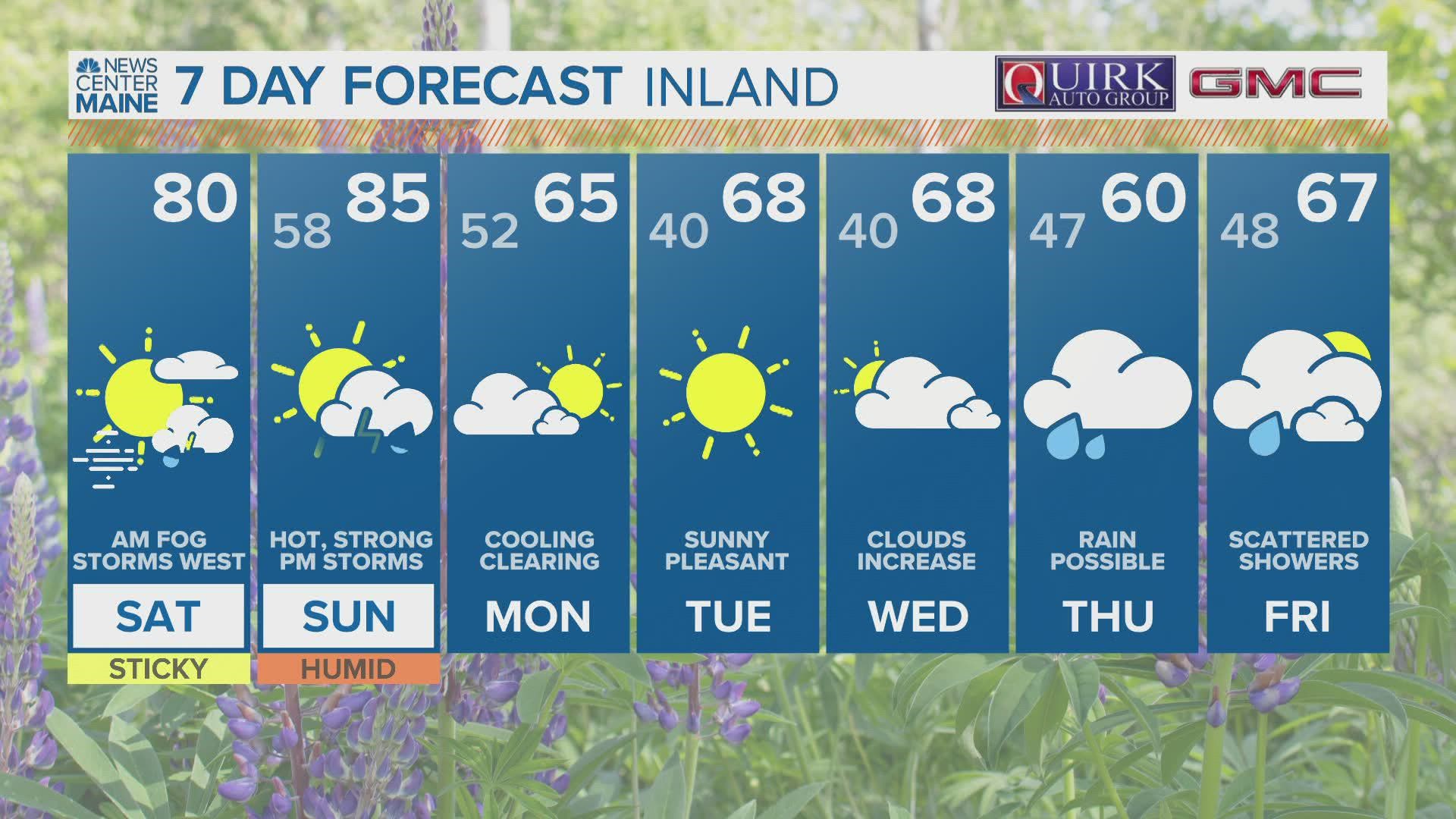
The coast won't see much from the severe threat today, but the national weather service has expanded the threat zone south and east tomorrow.

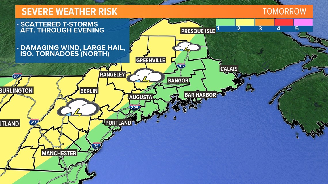
It's a level 1 out of 5 (1 being the lowest, 5 being the highest) from Calais to Bangor, Bar Harbor, Augusta, Portland, and the southern coast.
Watch for level 2 for the foothills, central mountains, and western mountains to points north.
The timeline for Sunday's severe weather potential is afternoon through evening with damaging wind, large hail, and even isolated, brief tornadoes (north).
Keep checking back with NEWSCENTER Maine and Meteorologist Jason Nappi's Facebook page (https://www.facebook.com/jasonnappiwx/) or updates.