
PORTLAND, Maine — SEVERE THUNDERSTORM WARNINGS are in effect for parts of Maine and New Hampshire... 60 mph wind gusts and penny size hail are possible within these storms.
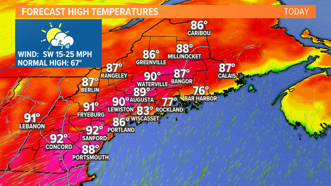
A taste of summer will be out there Wednesday as an abnormally hot airmass works into the northeast. Temps will spike through the 80s and may even hit 90 degrees for the first time this year, easily making it the hottest day to date for the State. The record high for Portland is 91 and the record high for Bangor is 88, probably coming up just a little bit short. Along with the heat, there will be high levels of humidity as dew points climb into the 60s. The air will be thick so take it slow.

The air will be buoyant and with a cold front sweeping in from the west during the afternoon providing the trigger, thunderstorms will likely ignite.

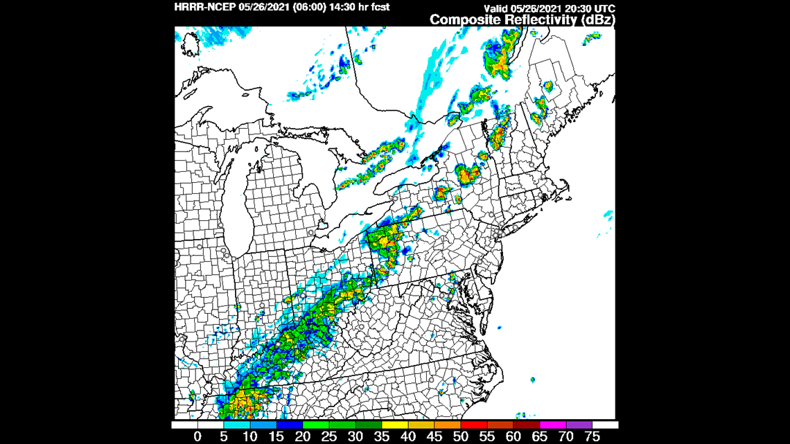
By mid-afternoon, the air may destabilize and a few convective cells may pop. If they form, they would pulse to severe limits quickly with damaging wind and hail. They may rotate into super-cells too, so they'd need to be watched very closely.

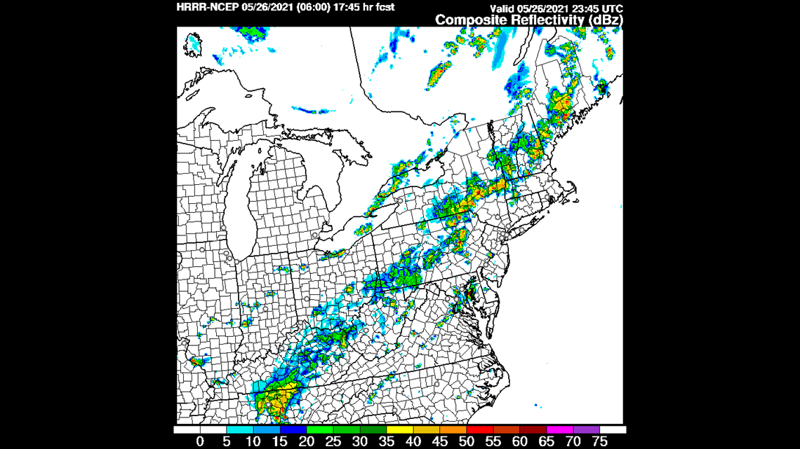
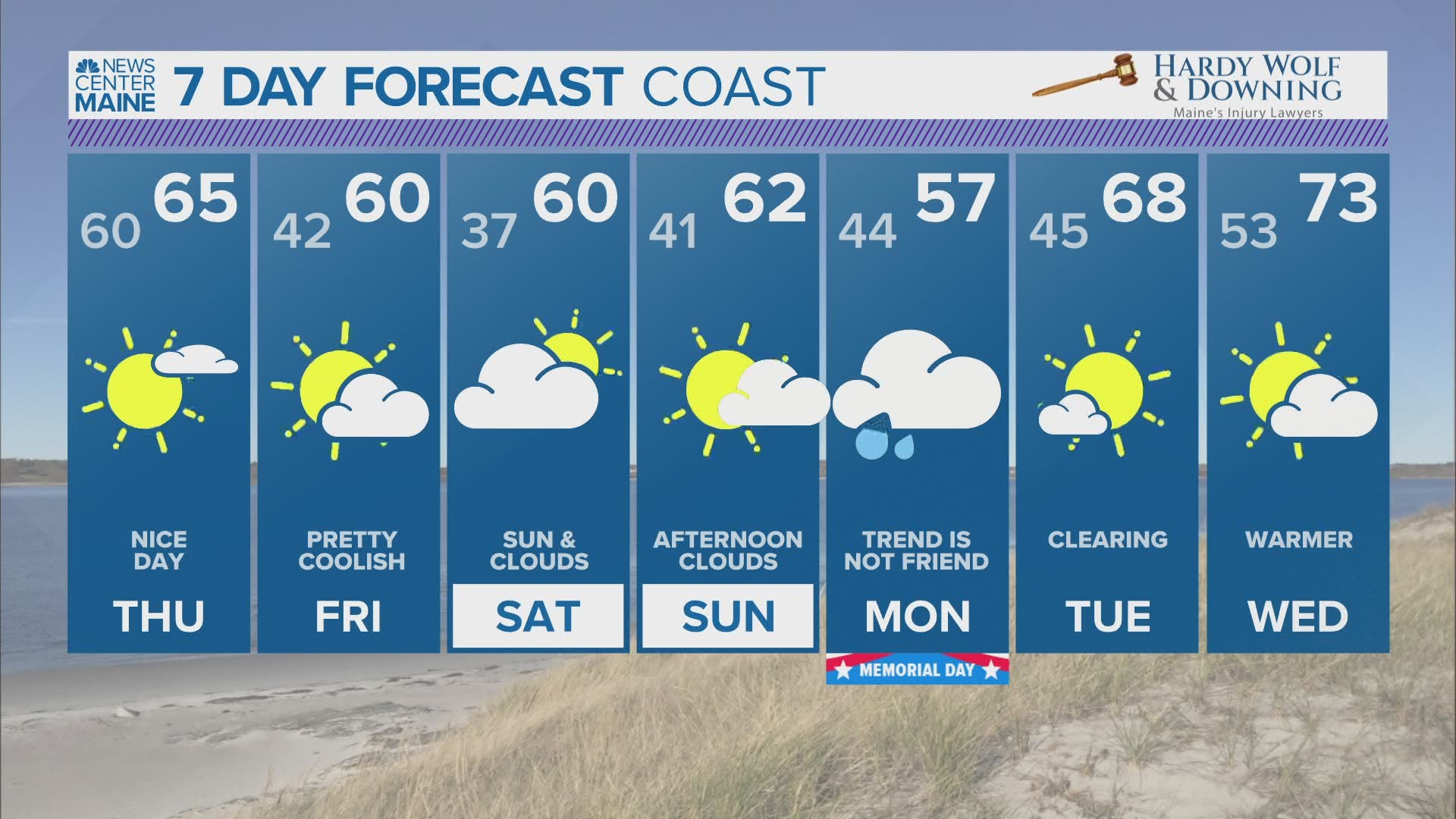
A more solid line will roll in later in the evening, probably 7-9 PM. This line will have some very heavy rain within it along with the potential for some damaging, straight-line wind gusts. The showers and storms will exit by midnight with cooler and more comfortable air returning by Thursday morning.
RELATED: Daily Maine Local Weather Forecast