

MAINE, USA — The first of our three storms has passed. Nothing too notable about that first one, but it was also the weakest of the three.
Forecast snow totals have increased slightly for Saturday's storm. Monday's storm shows a new potential, too...the potential to move out to sea.
Let's start with Saturday first and then get into the details on what we know for Monday's storm potential.
Snowy Saturday
The storm on Saturday is not all that impressive, but it will bring some decent accumulation. This is especially true away from the coastline since mixing will not be as much of an issue.

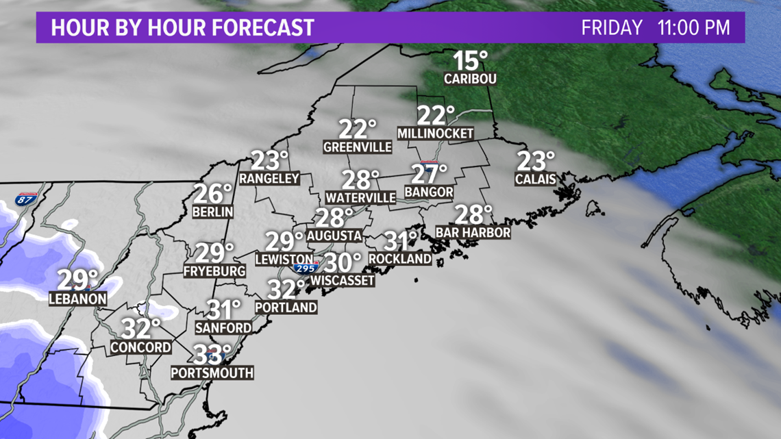
Friday actually looks pretty good! Clouds roll in quickly after sunset and shortly thereafter snow showers begin.
The first spot to see snow is northern New Hampshire and western Maine. The showers will spread east overnight.

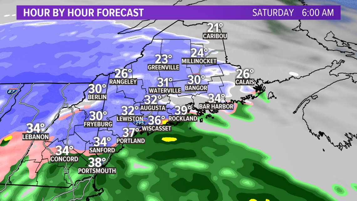
Most wake up to snow falling on Saturday morning. The only places that still might be dry are Eastport and Caribou, as well as the US 1 corridor.

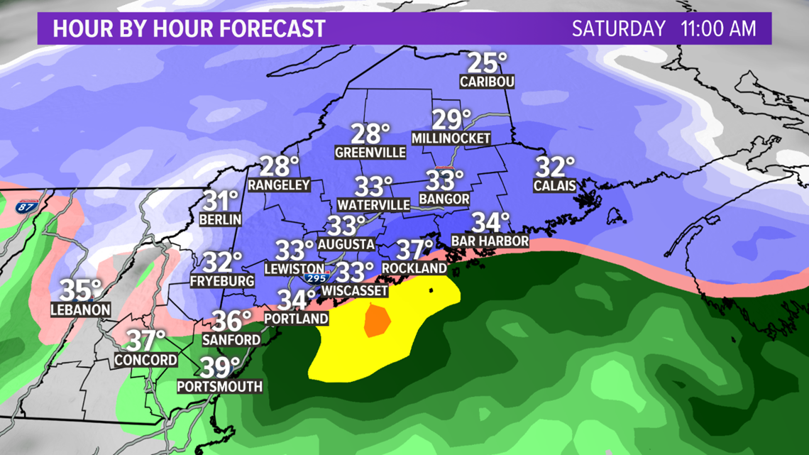
As the storm moves south of Maine, warmer air starts to mix in through the coastline. Coastal areas west of the Penobscot Bay will switch to just plain old rain before noon.

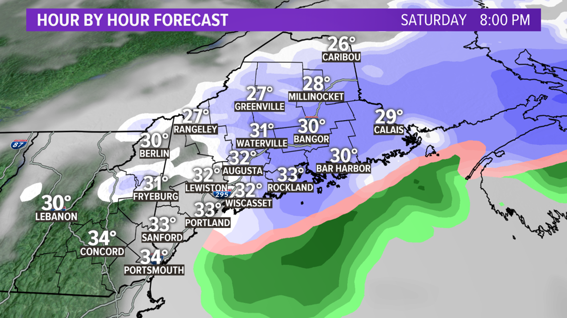
The storm pivots through the afternoon with one last band of snow showers passing by the late evening. These snow showers will likely be a bit weaker than the ones in the morning. Some of these flakes may make it far enough south to bring one last coating of snow to the coast.

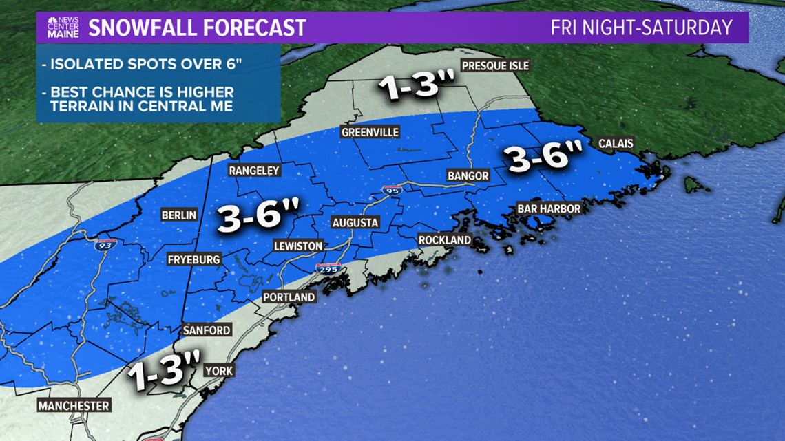
Here it is! The snow map for Saturday's storm. Let's zoom in and talk about what has changed.

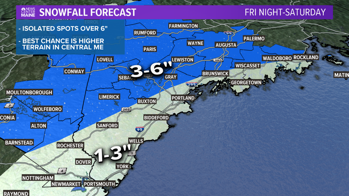
Given the trend with temperatures, I brought the 3-6" line closer to the coast through parts of York and Cumberland counties. Still, southern sections are looking at 1-3" and some mixing. The higher elevations in York county could end up slightly higher than 3" if snow rates hold up.

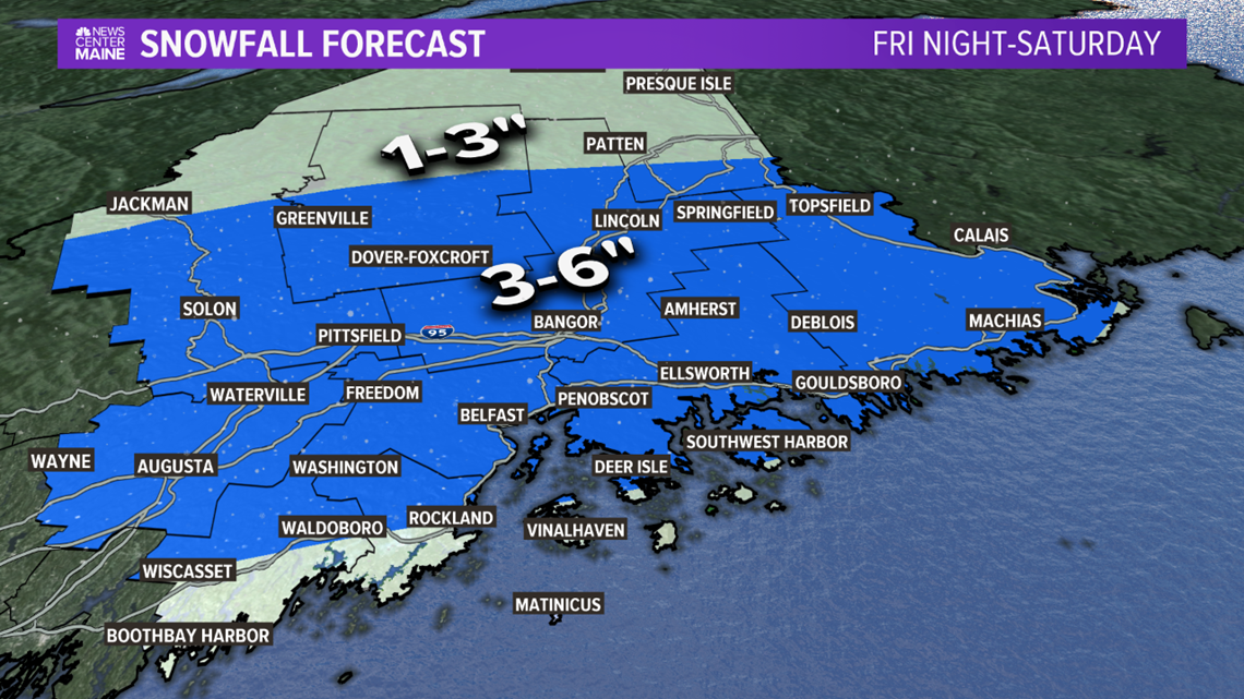
Eastern Maine is roughly the same. I'm expecting 3-6" Downeast all the way to the coast since the track of this storm should favor keeping some of the colder air around.
With the second band of snow pivoting through, northern Maine ends up with some snow after all. It looks like a solid 1-3" across Aroostook county, but I wouldn't be too surprised to see a few spots make it to 4".
Snow clears quickly Saturday evening with some brighter, quieter conditions on the way Sunday.
Monday's Storm Potential
The trends for Monday's storm are...interesting. The American model, the GFS, continues to show the storm slowly moving northwest. On top of that, it's slowing down.

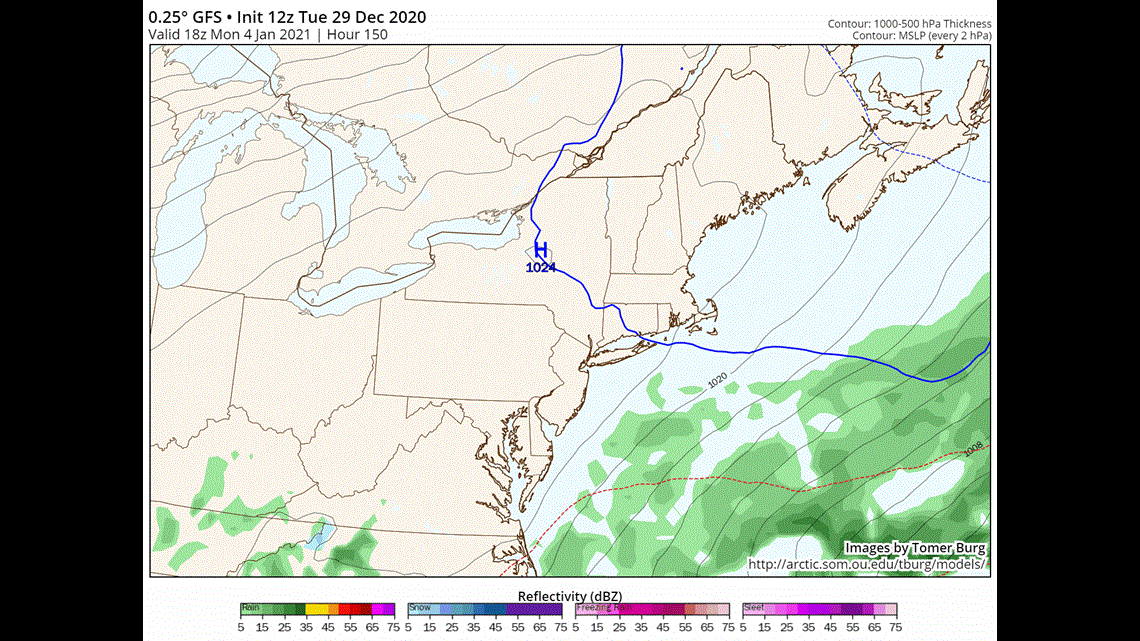
The first frame is an old model run, and the last frame is the most recent model run. The storm is clearly trending northwest and slower.
If something like this actually verifies, it could be a more significant snowstorm.
So, why the hesitation to lock it in? Let's take a look at the European model...

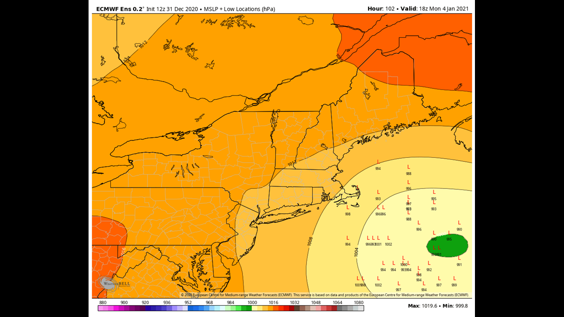
The big trend for the European shows a big jog south in the track. Each "L" on the image above shows a possible location for the storm itself.
Should something like this verify, it means we stay cloudy but miss out on the snow.
Not to mention, there are a plethora of other models showing solutions in between these two. There will be a bit more consensus moving forward, especially once the late Saturday and early Sunday run come into play.
Personally, I think there will be a shift northwest on the European. Maybe it's wishful thinking, but I'm not ready to throw this storm chance away from one model run...
Check back with us tomorrow and I'll have more updates. Until then, you can get more forecast information on my Twitter account, @MikeSliferWX.
