We've seen worse this winter, but the timing of this next storm will present a challenge.
The heaviest precipitation will fall early Wednesday morning, impacting the commute, then the storm will make a quick exit, and temperatures will plunge behind it.
We'll have some sun Tuesday morning. Clouds increase during the day. There could be some "ocean-effect" very light snow that develops near the coast early to mid afternoon.

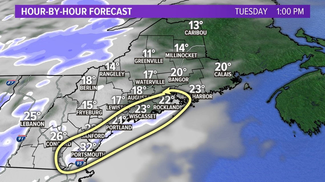
Otherwise, any steady snow holds off in western Maine until after sunset. Temperatures on Tuesday will slowly rise into the 20s.
Heavier precipitation moves in overnight Tuesday night, after midnight. The heaviest comes from about 4 a.m. to 9 a.m. Wednesday in southern/western Maine, 6 a.m. to 11 a.m. in eastern/northern Maine.

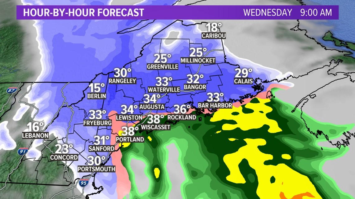
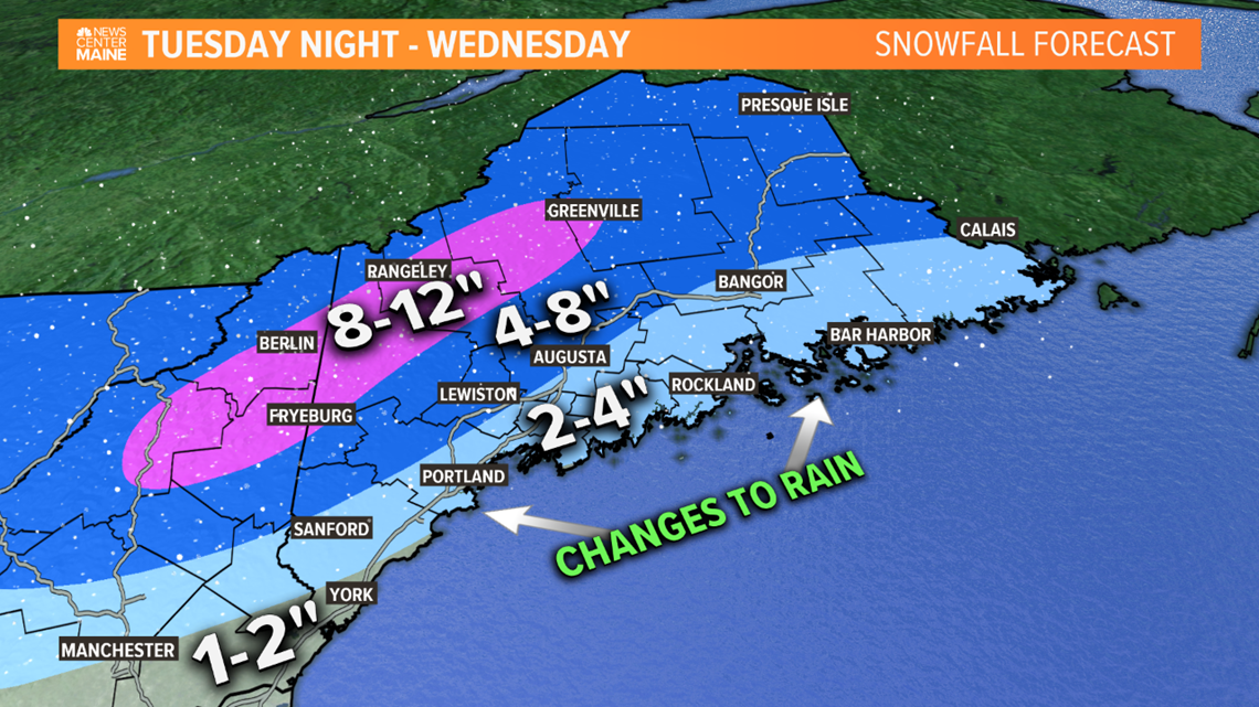
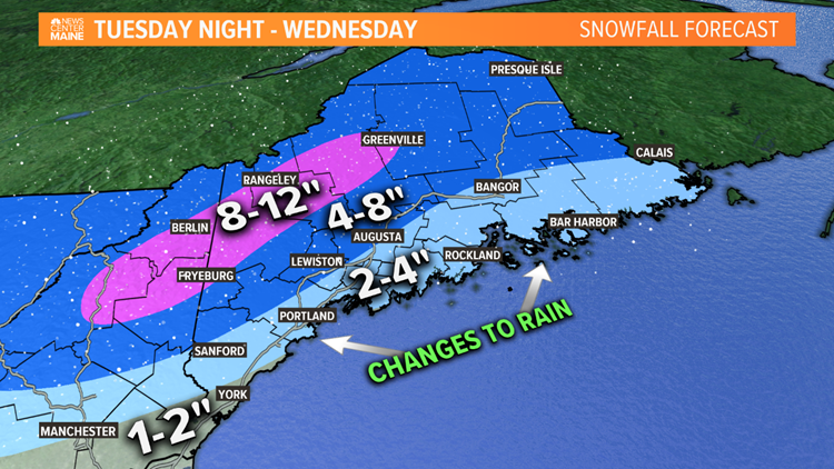
We'll have heavy snow inland, snow changing to rain in southern and eastern Maine. 2-4" look likely for the coast due to mixing, but inland amounts should range from 4-8". Some of the mountains may pick up a little more than 8".

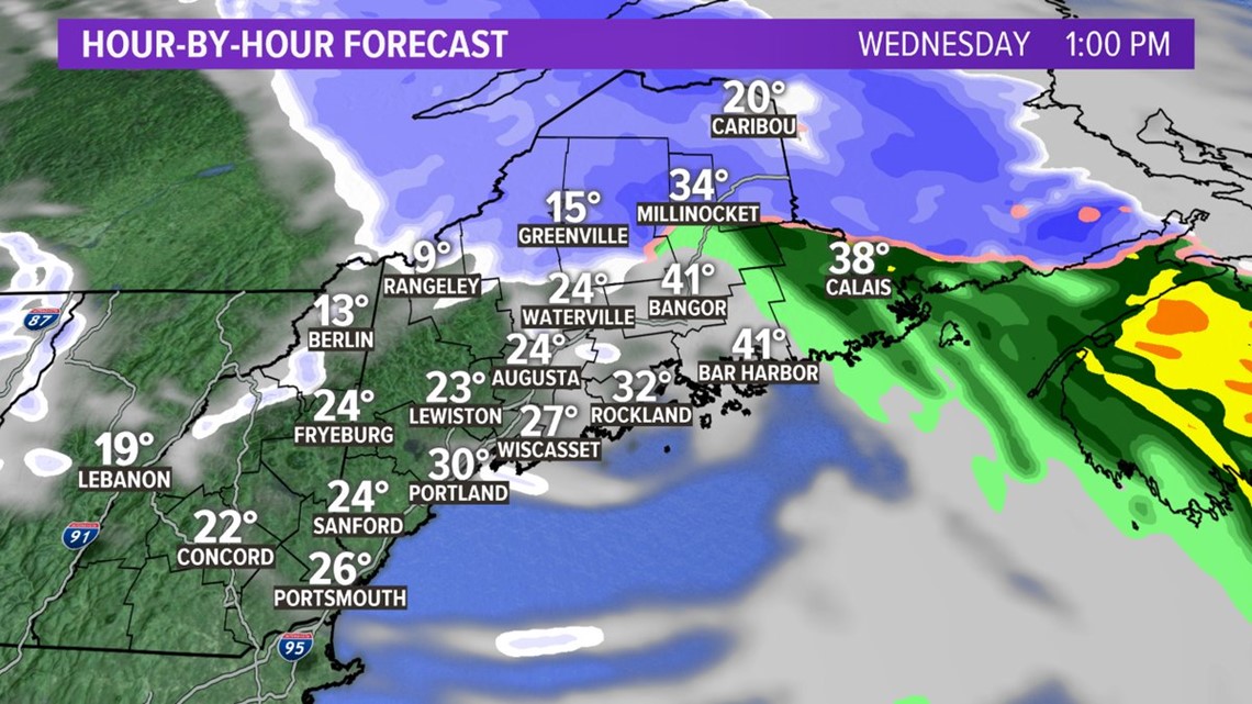
Temperatures will drop as the storm departs Wednesday afternoon. Some icy spots may redevelop after the precipitation ends. There could even be a snow squall late in the day, as frigid air moves in for Wednesday night and Thursday.