

MAINE, USA — If you see me with gray hair this weekend, just know that it's almost exclusively from this forecast. Well, that, and trying to convince my corgi that -6°F is not the optimal temperature for a long game of Frisbee.
There are a lot of pieces to this forecast, and it's becoming clearer as we get closer. As it stands, significant snow is on the table for most of Maine. This is especially true for Penobscot Bay, Bangor, and areas Downeast.
However, a word of caution: find someone you trust (even if it's not me) to give you forecast info. There's a lot of bad information going around social media right now, including some completely unrealistic snow maps.

Let's jump right into the "what we know, and what's to be determined" section of the blog.
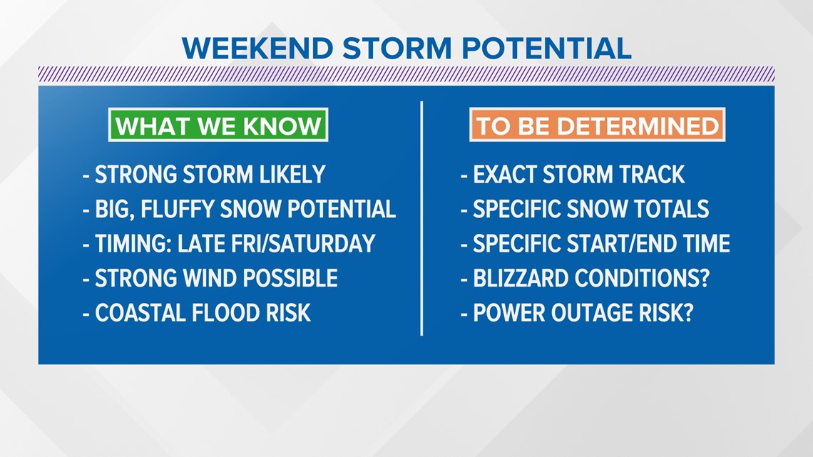
What we know
There is a large, strong storm system that will form off of the Carolina coastline on Friday.
It will move north, impacting New England either late Friday or early Saturday. Should it hit New England, it may not wrap up until Sunday morning.
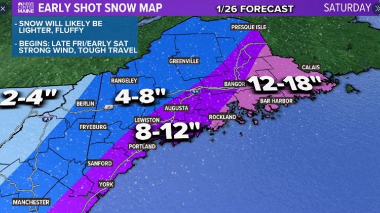
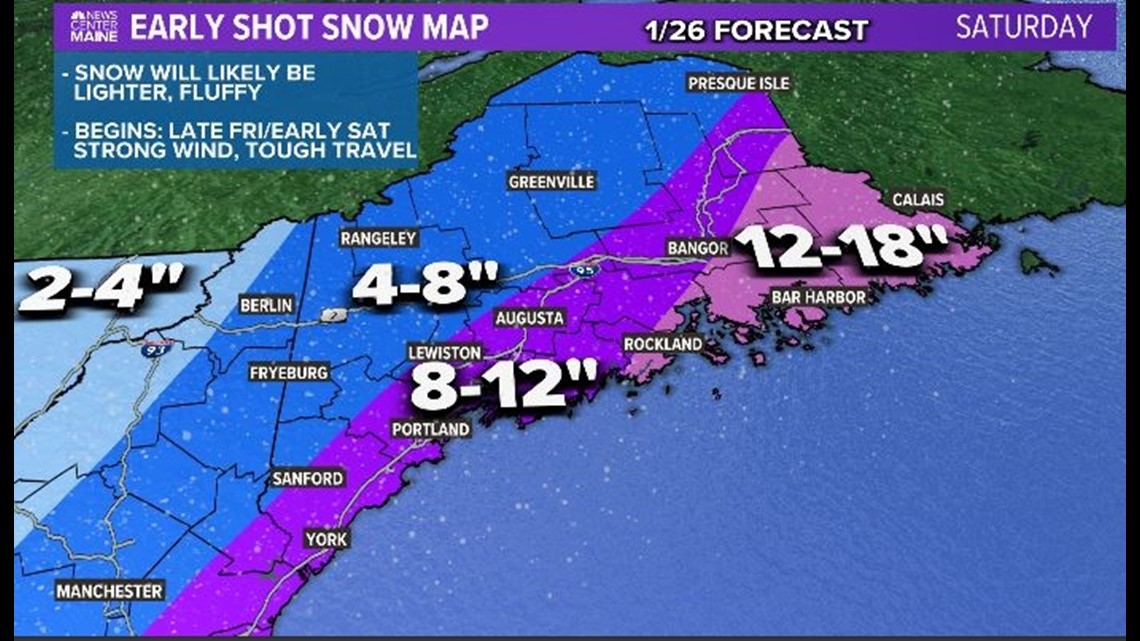
The cold air that this storm has to work with will favor light, fluffy snow. Some signals point to a widespread area of at least a foot of fluff in Maine.
Wind gusts will be strong, coming out of the northeast. That could cause a bit of coastal flooding during high tide, similar to the storm a couple of weeks ago.
What we don't know
The exact track of this storm is still far from set in stone. Any shifts in track will also shift where the heaviest snowfalls.*
*Note: the likelihood of big snow totals (over 10") is most significant for Bangor and Downeast. It would take a big shift in storm track to change this part of the forecast
That's why the specific snow totals and start/end times are in the "to be determined" category.
Blizzard conditions are independent of snowfall totals, but fluffy snow and strong wind gusts could certainly lead to blowing snow. For now, to be determined ... but odds are increasing that at least some areas in Maine could see blizzard conditions.
There's also an outage risk, depending on how strong the wind gusts get. With a frozen ground, that helps to mitigate issues, but it will not help enough if the gusts are strong enough.

As it stands, most of this falls on Saturday, even if the start and end time get shifted a bit. Travel looks pretty tough through the day.
I think the best chance at over a foot is along the Penobscot and east. No matter how you slice it, this looks like the biggest storm of the season for at least part of Maine.
Check back again tomorrow. I expect to have a more comprehensive idea of what's going to happen since we will have had almost 24 hours of new data to sift through.
Make sure you follow our whole team (Todd, Keith, and Jess) on social media for updates before then.
RELATED: NEWS CENTER Maine Weather Forecast
RELATED: Saturday storm has big potential
