Much like forecasting snow in the winter; the broad strokes don't get you much credit: You gotta nail the details.
That's the case with upcoming Nor'easter. We KNOW:
- It's gonna be rainy
- It's going to start Wednesday night
- It's going to simmer down Thursday night
- It's going to be windy
But that last one, well that's the key. (Drops in Keith Morrison voice: How windy? Well...that's the question that would churn about this quiet state for days to come. The answer...as it turns out...will tear apart friendships, marriages and...branches?)
So let's get right to the wind headline. What's interesting about this wind forecast is that I truly believe 10 mph makes all the difference when it comes to impact. Not all 10 mph increments are created equal; the difference between 20 and 30 is usually irrelevant for example. But 50 mph vs 60 mph is pretty big.
That's because 55 mph is the threshold for more widespread power outages in Maine. That's what most wind algorithms will tell you, and I'd agree from experience. My experience also tells me that when you get to 65 mph the outage numbers go up exponentially...it's not linear.
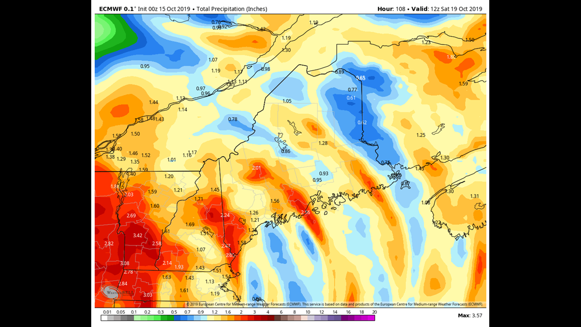
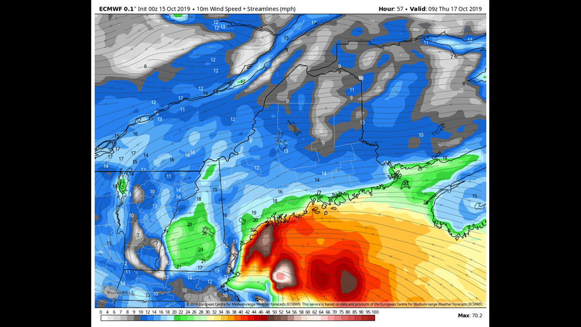
Now back to our Wednesday night/Thursday storm. Look at the EURO model output for max wind GUST (not sustained, this is key):
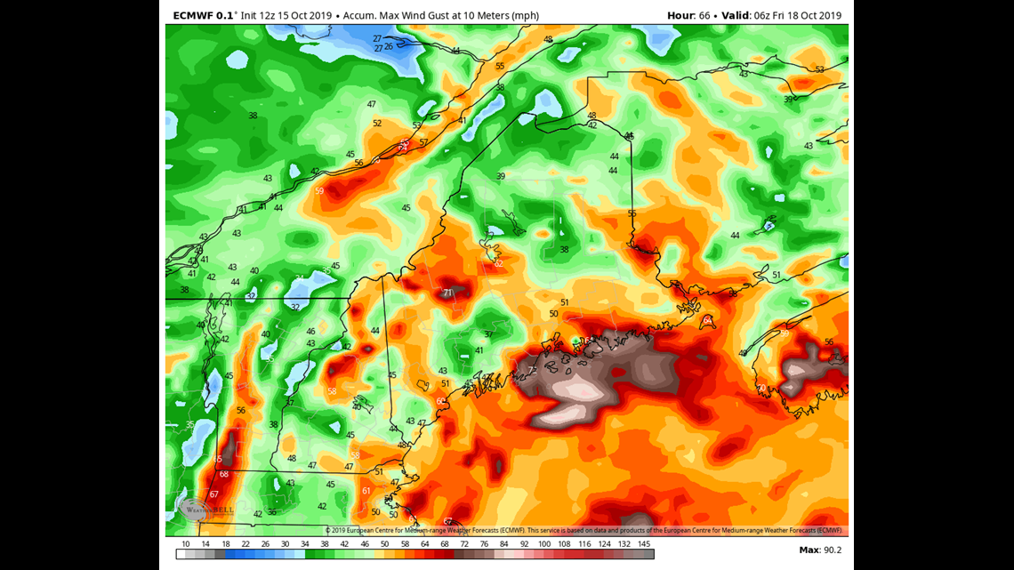
You'll see some 40s, 50s, 60s and even a few 70s....
Now it's important to note that this is 10 meter wind, so it's measuring the wind up about 30 feet up in the atmosphere. Enough to catch quiet a few trees, sure, but unlikely to get to most people on the surface.
So what do we make of this? The EURO sometimes gets excited when it comes to the wind gust layer, overplaying it. But I'd say if we can get the rain to hit at the right time, mixing the winds down from aloft, coastal Maine has a chance to gust to 60 MPH with gusts over 65 MPH possible over the islands of the Midcoast into Downeast.
If that verifies we'd be looking at at least a moderate amount of power outages, with the biggest threat along the coastline.
Rain is the other biggie here of course. Rain will begin late on Wednesday night in most spots but the worst of it will be early Thursday morning. That's the case with the whole event really, it peaks on Thursday morning and winds down on Thursday night.
Amounts will broadly average 1-1.5" total, but there will be some spots with over 2.5" possible. Now, our ground isn't overly saturated so that shouldn't bring widespread flooding concerns, but urban flooding and "this spot always floods" flooding is likely.
Euro rainfall projection below:
Wind direction is the least piece of this puzzle. You'll recall (or I do because I'm a weenie), that the big October 2017 windstorm had the strongest winds out of the South. That was unusual.
This is a Nor'easter so the winds will be out of the Northeast.
This is more of a theory than anything but I think that helps us. It's what I call a "tested wind direction." Most of our strongest storm have Northeast winds, so that's a direction that has been battered over and over again. The South like 2017? Not so much. Think of it this way- When you try to get a nail out of a stud you can bend it all the way in on direction and not much will happen. Sure it'll be pointing in that direction but you wont get it out. Now if you bend it the other way a few times and then snap it to the side: Voila the nail is out. That's what happened in 2017. Our nails are accustomed to being bent in this direction. So that'll help us.

All in all, this is a moderate event. I do expect power outages, maybe even quite a few along the coastline. So prepare for that however you see fit.
Carson Out.
STORIES NEWS CENTER Maine VIEWERS ARE READING