
MAINE, USA — This is my favorite kind of weather update. The kind where I can tell you the forecast still looks good and I don't see any reason to change the snowfall map.
Previously:
Oh boo hoo, it's mid-February and we have to deal with some snow.
In a winter that is running #1 warmest on record in both Portland and Bangor, the middle/end of this week might be quite a shock to many Mainers.
(We have a little bit of snow coming Tuesday night, too, but it's 1 to 2" and I cannot be bothered with such trivial matters.)
This is kind of a weird event because it's technically TWO waves of low pressure along a stalled out front. But because of how quickly they will follow each other, I'm going to treat this like one long storm, because that's how it'll feel.
Snow starts late Wednesday night into Thursday morning (think midnight to 2 a.m.).

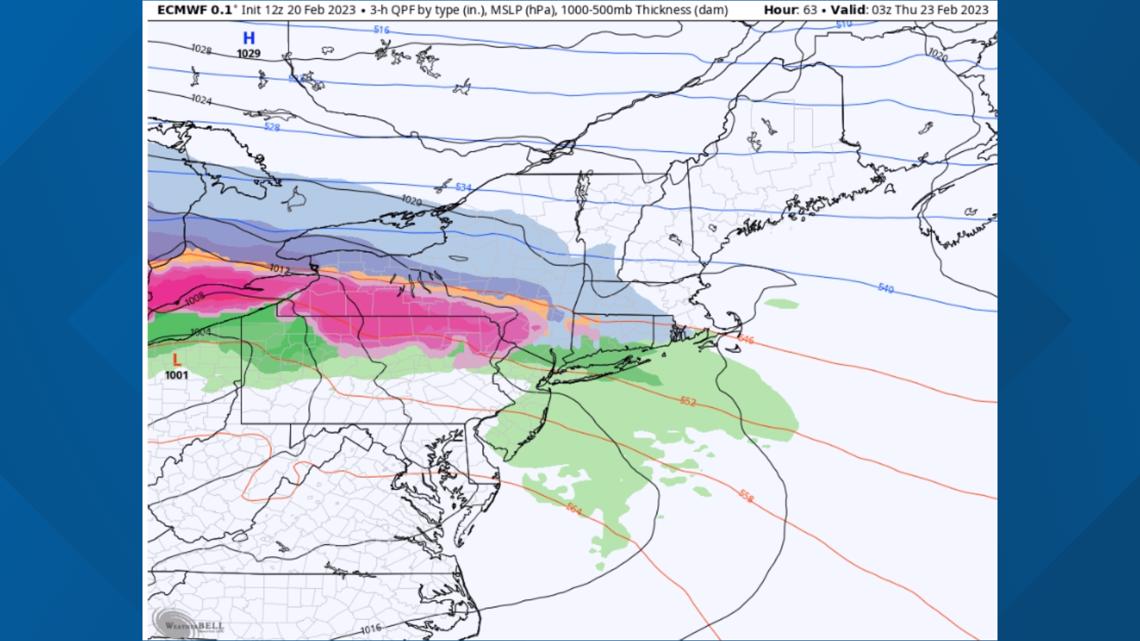
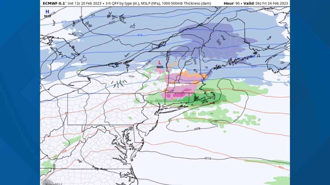
As more moisture pours over the top of the front, the snowfall rates will increase. The below depiction is 4 a.m. Thursday morning and it's really thumping over southern Maine.

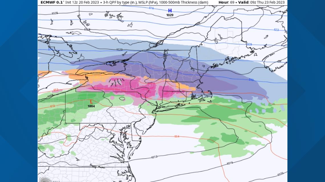
Those strong dynamics last through the morning but eventually the wave of low-pressure slides to the east and the snowfall rates decrease through the middle of the day into the afternoon.

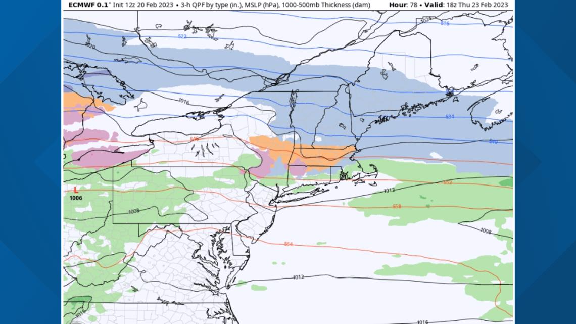
It's a bit hard to tell how this will look exactly on the ground, but it'll likely be some periods of light snow still continuing on Thursday afternoon, but it might feel like the back end of the storm ... like things are winding down.
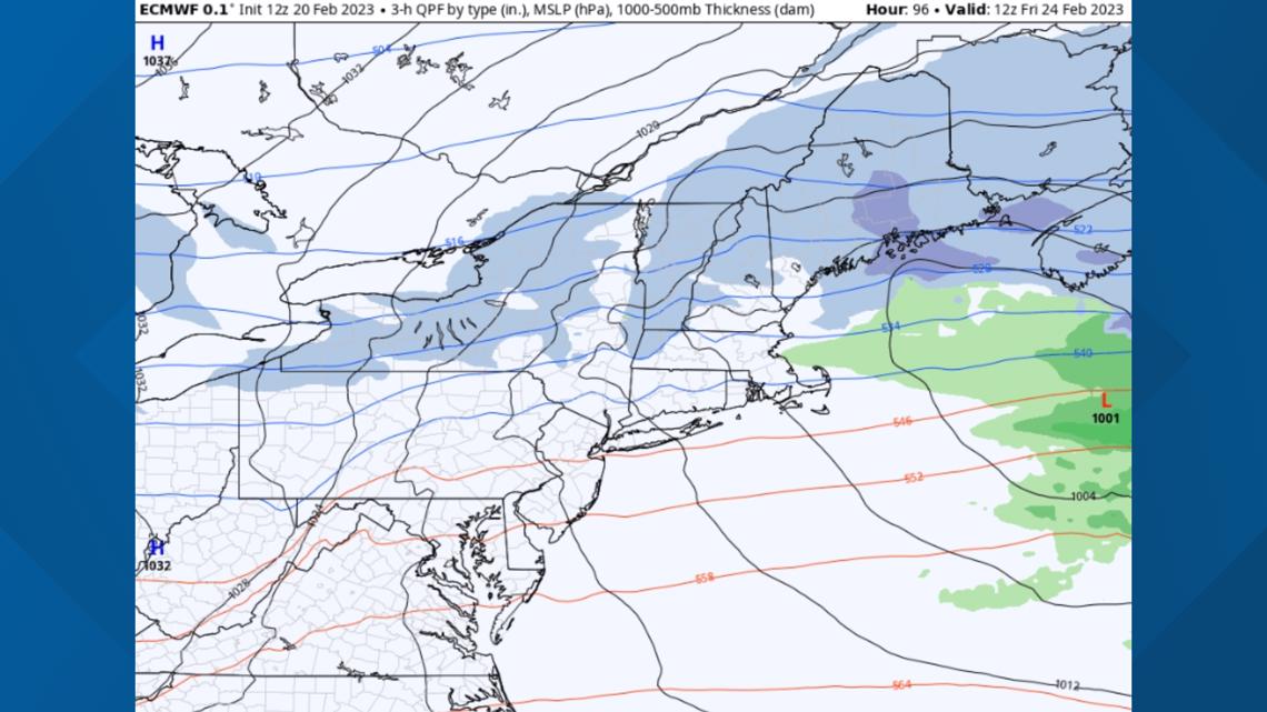
However, by Thursday night here comes the second wave of moisture. This one will likely target a bit farther north. So if you don't have a ton of snow by Thursday afternoon in central and northern Maine, don't worry about it.

That snow continues through the middle of the day or so on Friday.

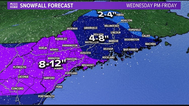
When it's all said and done, this is what I think snowfall totals will look like:


Caveats: It's still four days out, so if the front wiggles to the north there will be sleet involved across southern Maine. If it wiggles to the south, the heaviest snow will push farther south as well.
So stay with me. I only made a map this early because I've done it for the past 7 winters and it's a monster I can no longer control.
Carson out.
Click here to follow Keith Carson on Instagram.
