
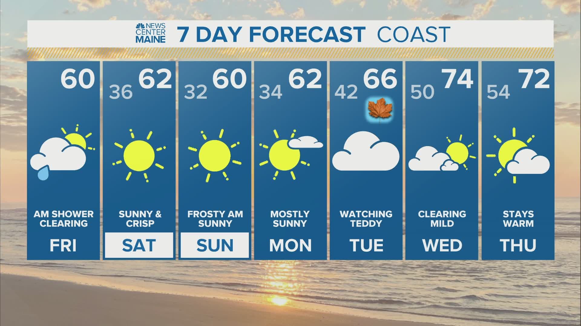
MAINE, USA — It's been a crazy hurricane season and the latest tropical system making noise in the Atlantic is Teddy. Teddy is a powerful Category 4 Hurricane located about 1000 miles southeast of Bermuda. It's expected to remain strong as it approaches Bermuda Sunday night. The official track from the National Hurricane Center keeps Teddy east of the island nation. This is good news considering Bermuda just took a direct hit from Hurricane Paulette.

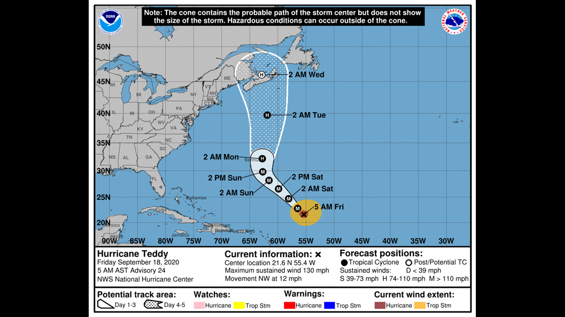
Usually, prevailing winds would push a tropical system out to sea and safely away from New England. However, blocking in the North Atlantic will prevent an escape route for Teddy and an approaching trough from the Great Lakes will keep Teddy on a northward path and may even suck it back to the west a bit. This creates a huge threat for the Canadian Maritimes and a small one for Maine too.

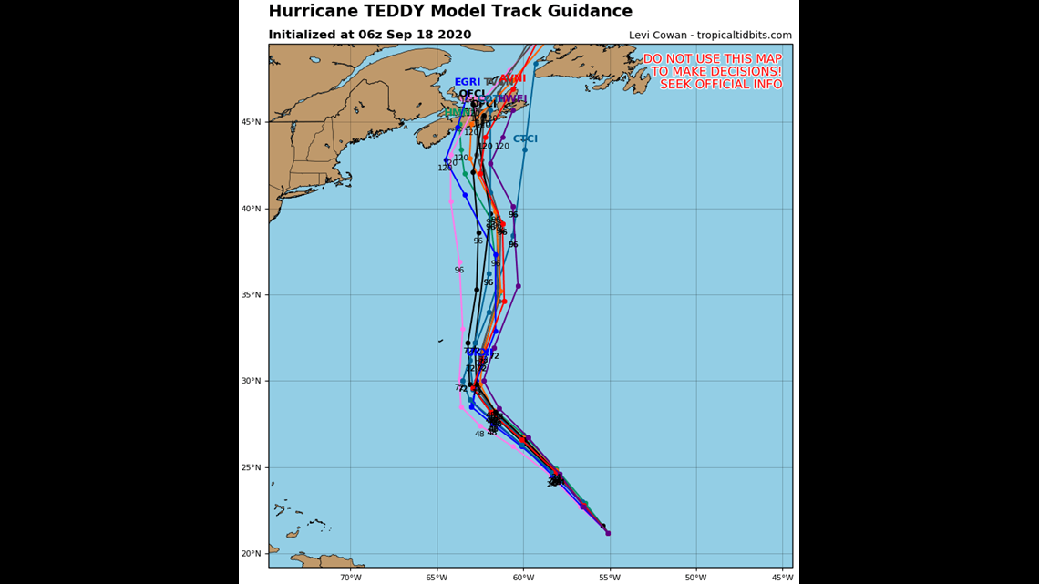
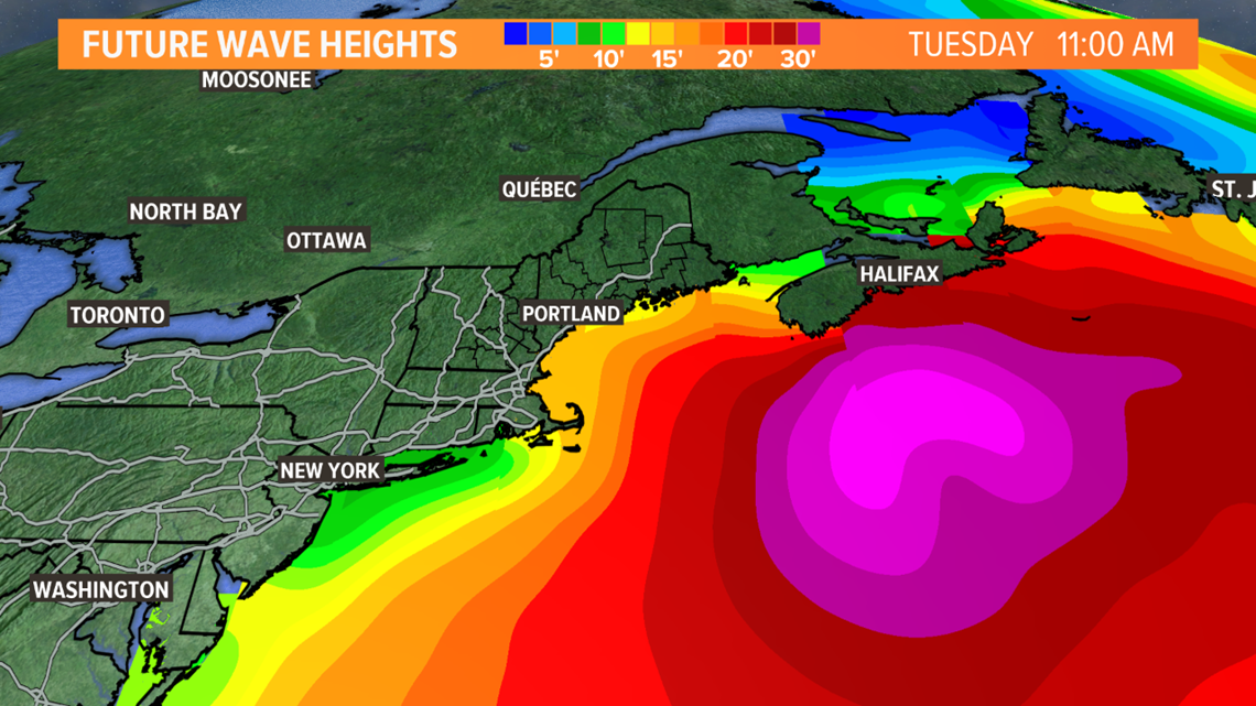
The good news is taking a direct hit from Teddy is highly unlikely. Almost all computer guidance keeps the core to our east with a big impact for Nova Scotia. Also, the east side of tropical storms are the least destructive. But there's still a chance that Maine, especially Downeast areas, experiences tropical storm force winds next Tuesday.

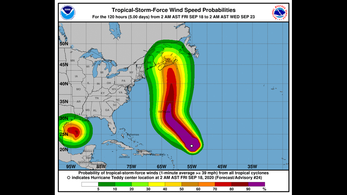
One certainty is that the ocean will get very churned up. Huge swell will propagate from Teddy's center and crash along our coast creating dangerous waves, surf and rip currents. There's also concern for some coastal flooding during high tides due to the new moon.

Follow us and the forecast closely over the weekend for any changes with Teddy.