
MAINE, USA — Late October has become known for wild weather around here, and another round of rain and wind is on the way.
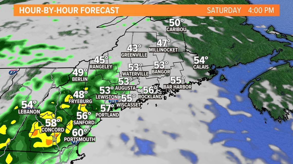
The daytime hours of today will be cloudy and damp, with mist, drizzle and occasional showers. The showers will be most numerous in New Hampshire and western Maine. Somewhat drier weather is expected in eastern Maine through the day.
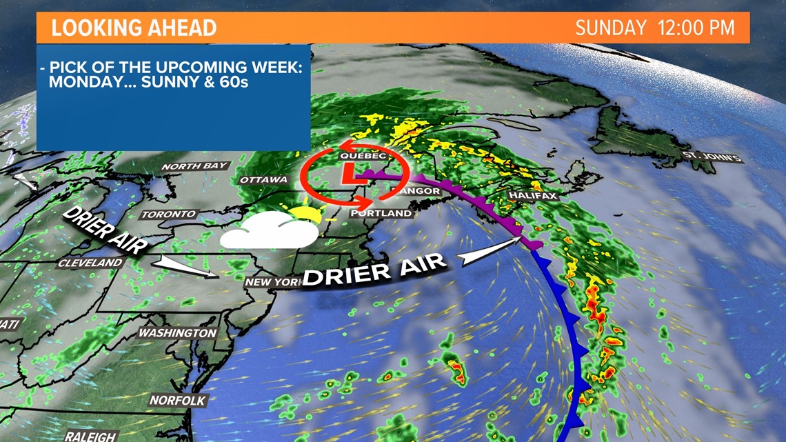
Heavier rain will arrive tonight, as an area of low pressure swells up to our south, and moves through. It will be tricky getting around overnight, with downpours and a gusty wind.
The National Weather Service has issued a Flash Flood Watch for southern and central Maine, through Sunday morning. If you can, check any storm drains in your neighborhood before the downpours arrive, to see if they're clogged with leaves.

It will be tough for the rain to drain tonight, as it'll be coming down in buckets at times.

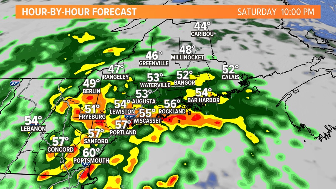
The worst of the rain will come through southern and central Maine between about 8 p.m. and 2 a.m. tomorrow.

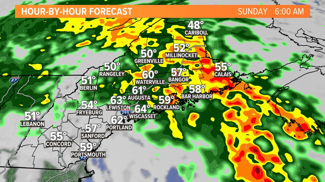
The heaviest then shifts north, moving through eastern and northern Maine early Sunday morning.
By sunrise Sunday, the rain will be done in most of southern Maine, and ending in central Maine.
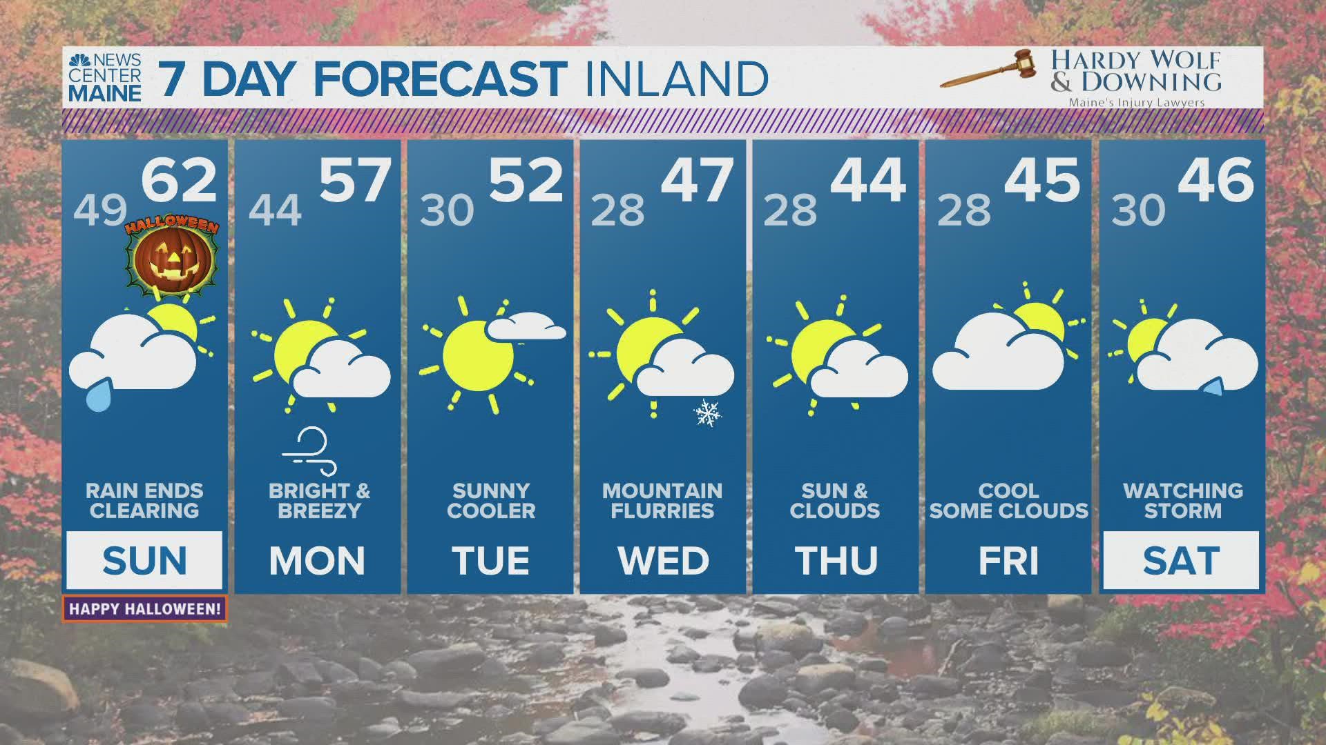
Sunday will turn out to be a decent day, with a mix of clouds and sun and high temperatures in the lower 60s. By trick-or-treat time Sunday evening, temperatures will be dropping into the 50s and it will be mainly dry. A sprinkle can't be ruled out in the mountains.

The potential is there for 2-4" of total rain in central and southern Maine. Lesser amounts are expected in eastern and northern Maine.


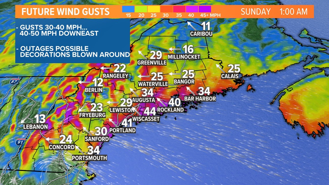
Wind will be worth watching, but I'm cautiously optimistic any power disruption will be isolated. Most wind gusts will top out between 30-40 mph. Some gusts over 40 mph are possible near the coast and especially in Downeast Maine. If you have any decorations outside, make sure they're secured.

Happy Halloween! Keep in touch with Mike for updates tonight.