
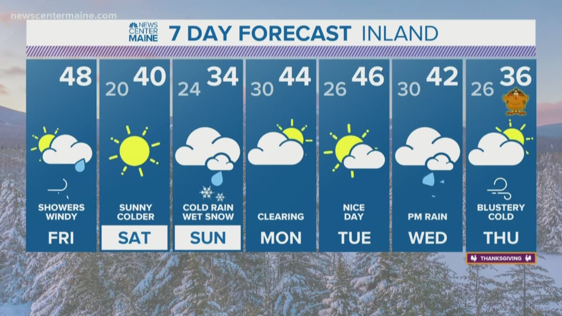
MAINE, USA — Another nor'easter is on track to impact Maine on Sunday.
Storm track is important when forecasting nor'easters. In general, we need it to be close enough to bring moisture to Maine.
This is just one ingredient, though. If it's too warm, parts of Maine can expect rain, while northern and western Maine see snow. As of now, this is what our setup favors for Sunday.
Light rain starts up early Sunday morning in southern Maine. Some isolated slick spots are possible in valleys, but warm air moves in too quickly for lasting issues. Moisture overspreads the area, allowing for steadier rain along most of the coastline by the middle of the day.

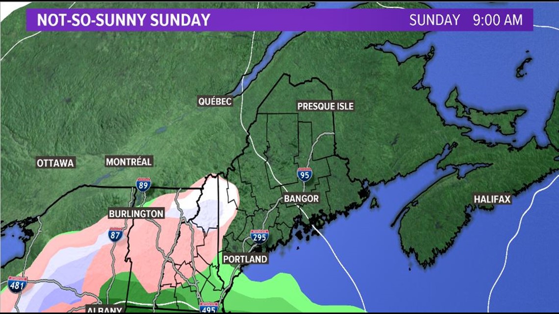
Rain and moisture continue to spread inland. The biggest thing to watch will be where the rain/snow line sets up. The coastline will likely remain as cold rain through the day. Mountains see a bit more snow, though the low-lying areas inland still see some snow.

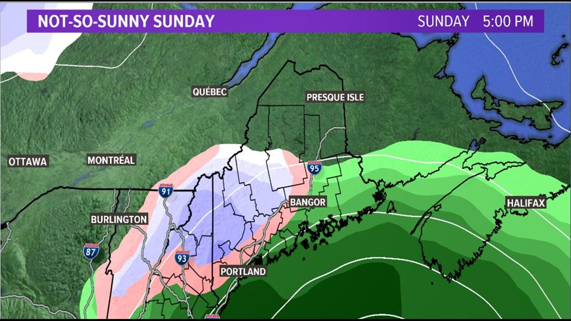
Through the evening, there is enough warm air to keep rain at the coastline. In the mountains and into central inland areas, snow will continue. The rain/snow line looks to set up around the Lewiston area and sticks around the I-95 corridor. Where there is mixing, the forecast calls for minimal accumulations.
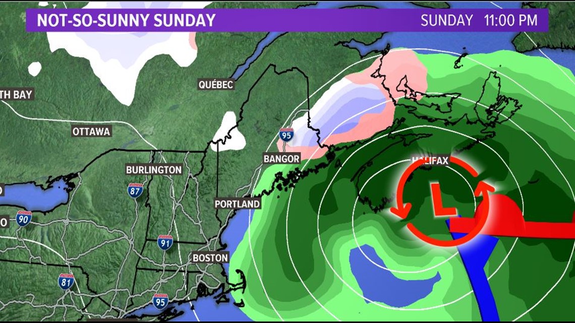
The moisture continues past dark as the system progresses east. Snow will be falling through northern Maine at this point. It likely will lead to some higher snow totals closer to the international border on the eastern side of the state. Coastal areas Downeast will stick around as cold rain.

Cold air is the real lacking ingredient here. There will be some spots through northern Maine that will be cold enough from the start to support snow. The southern half of Maine is where we have to watch closely, because the freezing line likely will be a bit further north.

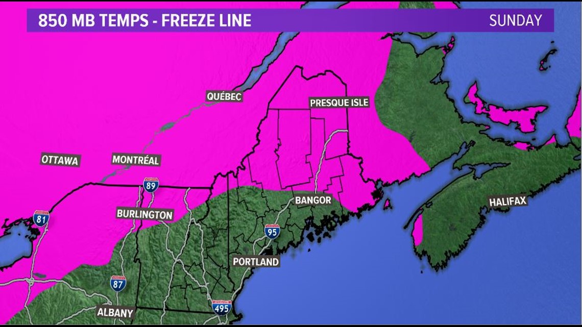
In the image above, areas highlighted in pink will be below freezing at 850 mb. This is where the column of air will be cold enough to support snow all the way to the surface, and also where snow is most likely to stick.
By the time all is said and done, some snow is expected to accumulate in Maine. The highest accumulations will be in the western mountains and through northeastern Maine.

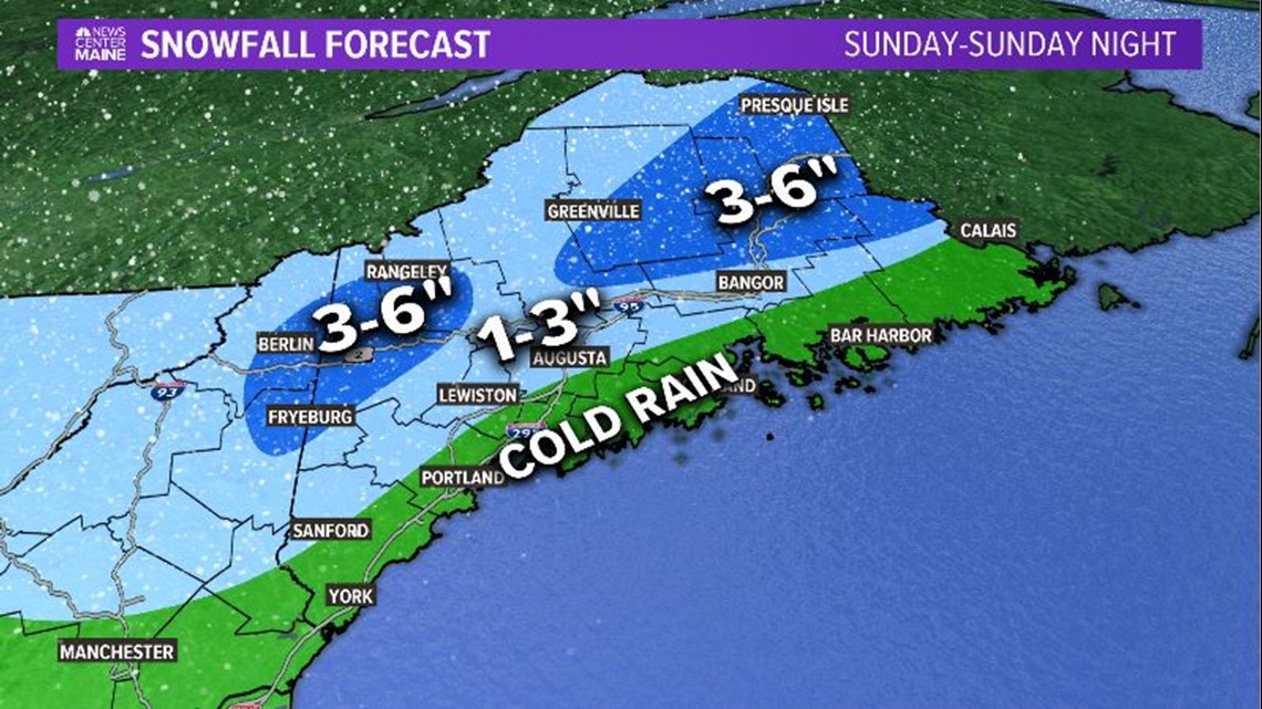
Slick roads can be expected throughout inland Maine on Sunday. While the snow totals aren't super high, they are high enough to impact travel. It could also be a little breezy in some spots. Reduced visibility is expected under heavier snow bands.
RELATED: Messy storm threatens the weekend
We calm down for Monday morning. Temperatures on Monday jump back into the 40s for most and snow will melt.