
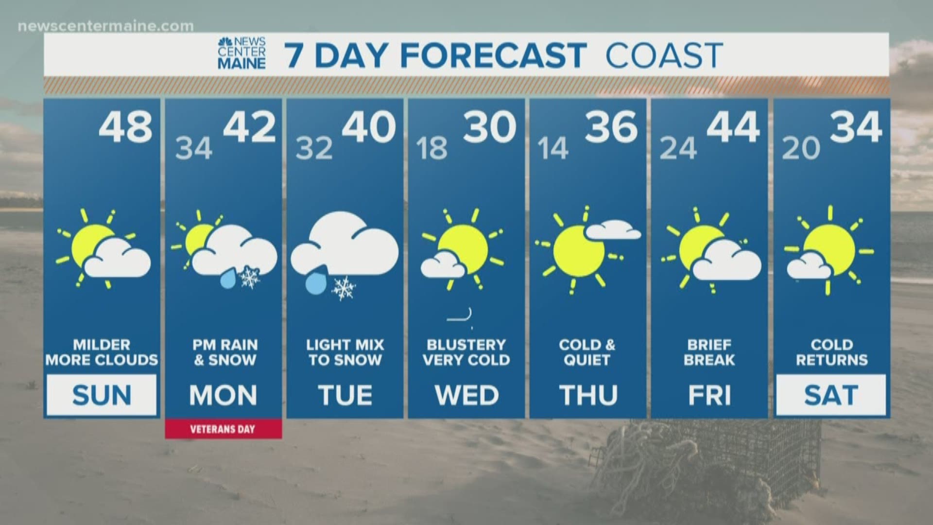
MAINE, USA — I hesitate to call this a "storm" -- it will lack heavy precipitation and behave a lot like the last system, spinning up on a cold front that's going to move through.
But it does look a little colder and a bit more organized than Thursday night's event.
The most snow will be in the mountains and far north. For central and southern Maine, I'm actually a little more concerned about ice Tuesday morning.
Here's the timeline:
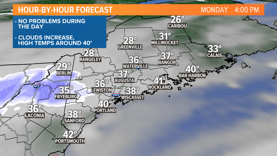
Monday looks fine. We'll have increasing clouds with high temperatures in the low 40s. By sunset, snow showers in New Hampshire start to move into western Maine.
Light snow moves in during the evening. It will be coldest inland, enough to grease up the roads, especially in the Oxford Hills and western mountains.
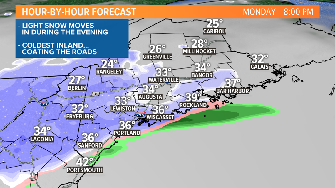
Snow reaches eastern Maine late in the evening. Temperatures will be marginal near the coast, so not much accumulation is expected. But inland, temperatures below freezing will allow the snow to cover the roads.
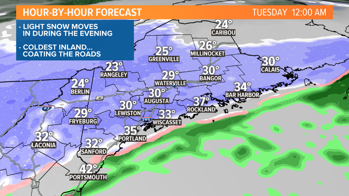
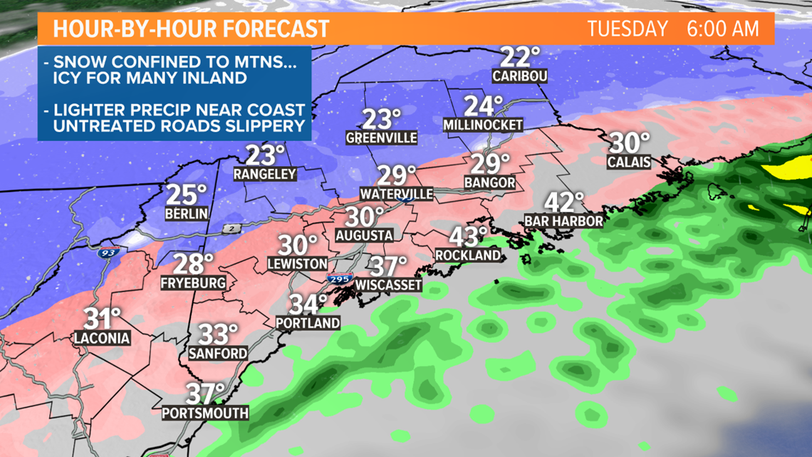
Warm air starts to move in aloft overnight, while temperatures at the ground stay near or below freezing. That'll change the snow to ice (sleet or freezing rain). Snow will become confined to the mountains and far north.
By Tuesday morning, I'm thinking the immediate coastline will warm to near or above freezing. The precipitation should also be lighter, avoiding any big issues.
But not far inland, from Sebago Lake through Lewiston, Augusta and central Maine, cold air may be stubborn at the surface. That means any untreated roads will be icy. Again, the precipitation doesn't look heavy, but it doesn't take much with ice.
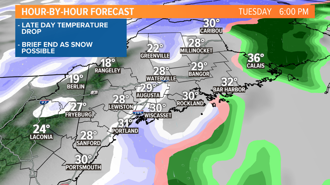
The cold front swings through during the day, that'll bring one last burst of precipitation through midday. A flip back to snow is briefly possible.
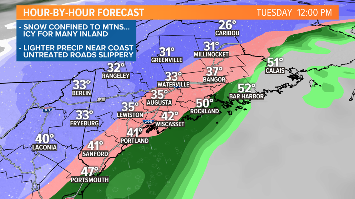
This will all come to an end from west to east during the afternoon.
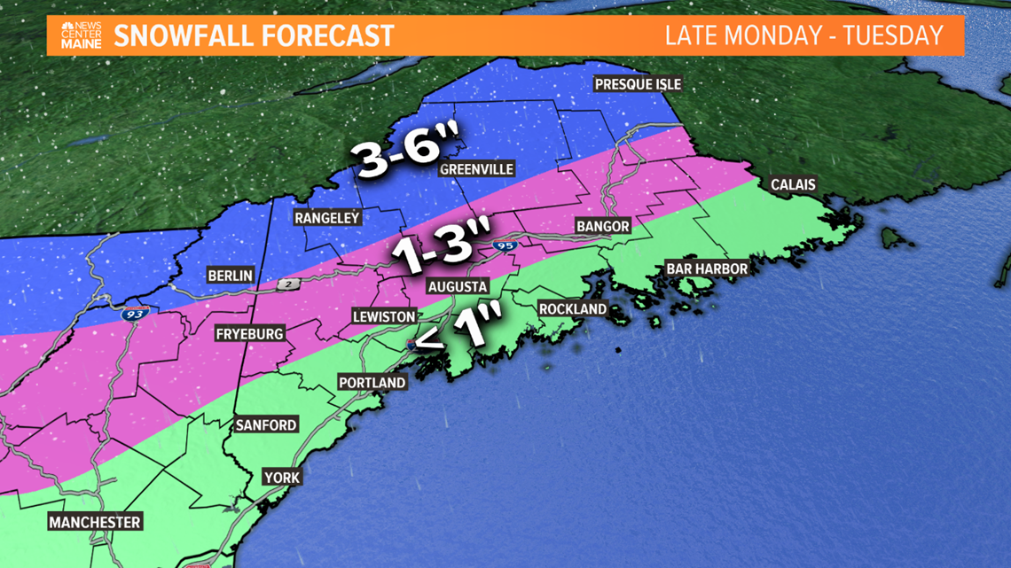
The most snow will be in the mountains and far north, with 3 to 6 inches possible.
Across the interior, plan on 1 to 3 inches of snow, but again, I'm more concerned about the potential for ice. The sanders will need to come out.
Near the coast, there won't be much snow; a coating to an inch in spots. We'll be keeping a close eye on how warm it is Tuesday morning. If the surface doesn't warm up, icy spots will still be around for the commute.
Another blast of cold follows for Wednesday and Thursday.
Stay with the NEWS CENTER Maine weather team for updates; Mike will have more tonight at 6 and 11.