
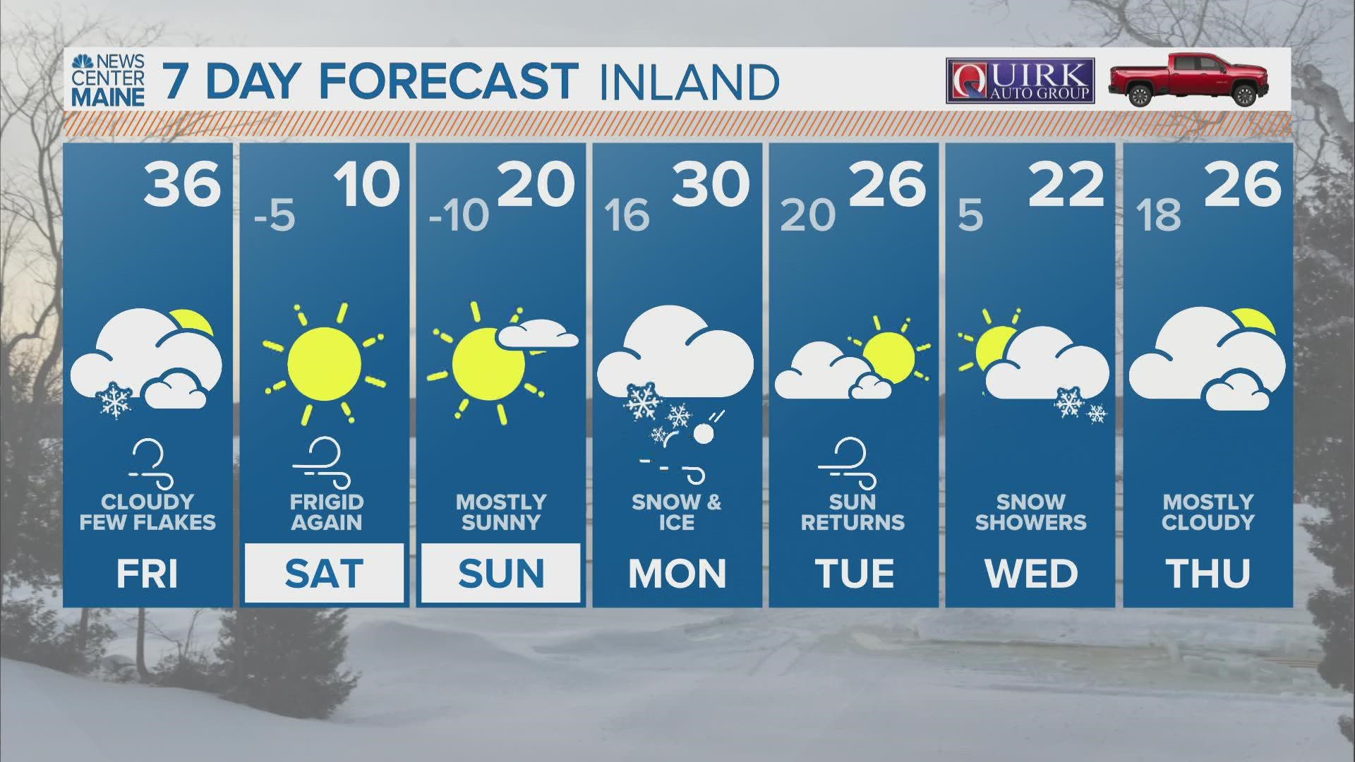
MAINE, USA — Let the active weather stretch begin!
There are three big pieces to this forecast:
I'm going to break it down in chronological order, as I feel like that makes the most sense.
In terms of impacts, however, I think Monday's impacts will be the most widespread. This is especially true if there is a bit of a wind threat at the coastline, especially since there is already a wind threat on Friday.
The wind threat and potential snow show why Friday should not be ignored but rather seen as a small piece in the bigger puzzle.

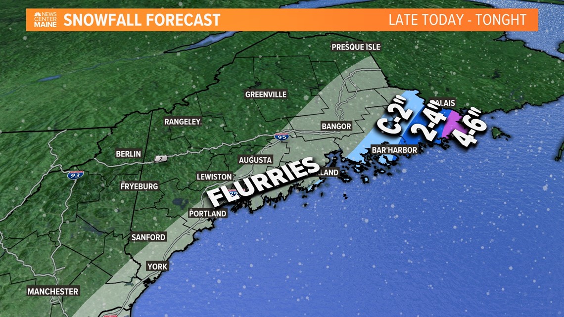
There's a section of Maine far Downeast that might even end up with near blizzard conditions Friday evening.
While Lubec and Eastport are some of the only towns that will receive 4" or more of snow, the additional wind gusts make blowing snow a concern right into Saturday morning.
This should be pretty light, fluffy snow.

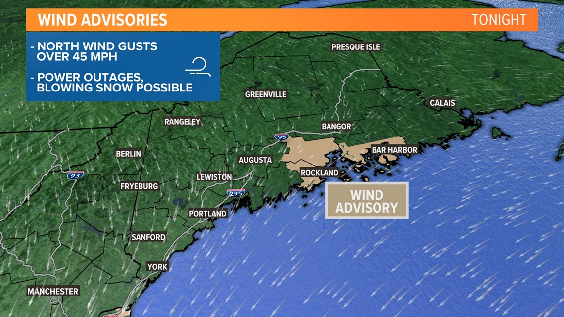
The National Weather Service is highlighting coastal counties for potentially strong winds out of the north on Friday.
Any areas highlighted in brown, and even a few spots further west toward Augusta or Bath, could see wind gusts approach or exceed 45 mph.

Gusts should relax a bit heading into Saturday morning.

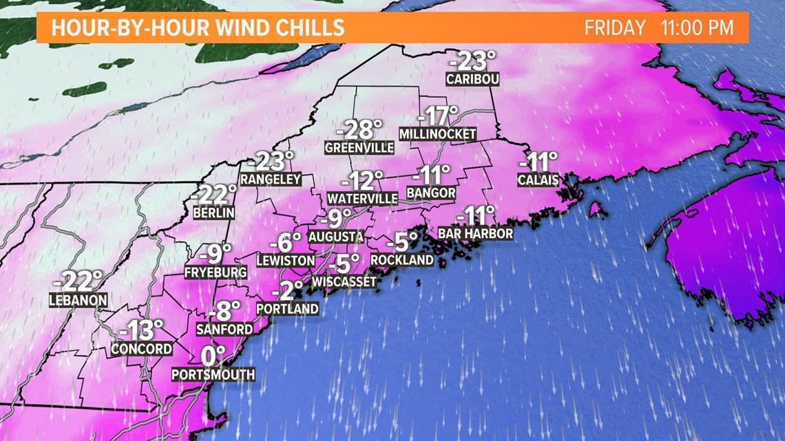
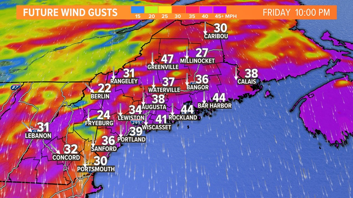
While the wind will not be quite as strong in other parts of Maine and New Hampshire Friday evening, it will certainly add a bite to the already bitter air.
Wind chills across the high peaks could drop down to as low as -40°F. This is the type of air that can cause frostbite to exposed skin in just 15 minutes.
Even at the coastline, wind chills will be well below zero.

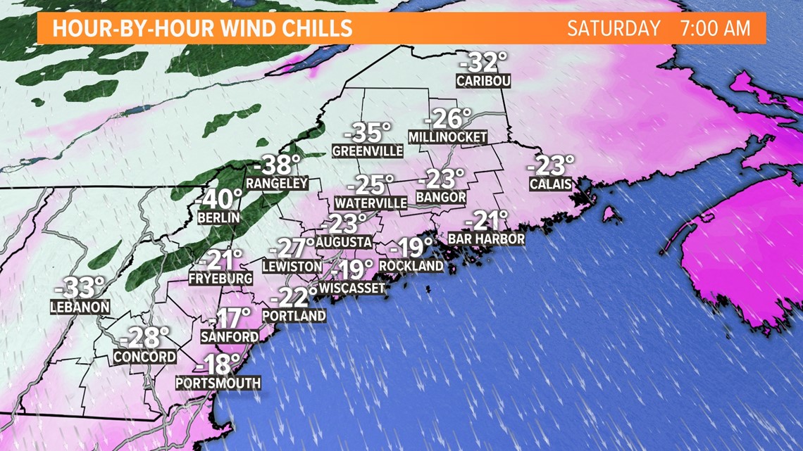
Saturday starts off with this Arctic air locked in place.
Since the wind will not completely relax until high pressure moves in Saturday afternoon, I expect the morning will be pretty brutal for most spots.
Wind chills again could dip below -30°F for a large portion of both Maine and New Hampshire.

Sunday will start off quite cold again. Most spots will be between -10°F and 0°F at sunrise, but the lack of wind will mean it might feel ever so slightly warmer than Saturday morning.
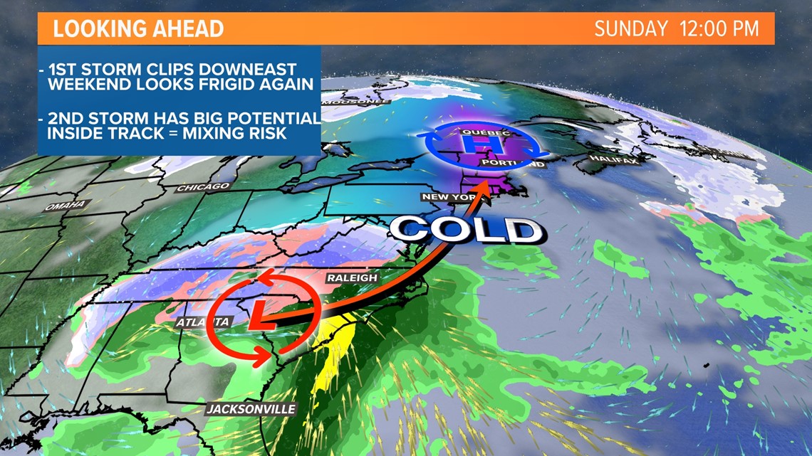
Clouds increase late in the day, and all eyes shift to Monday's storm potential.

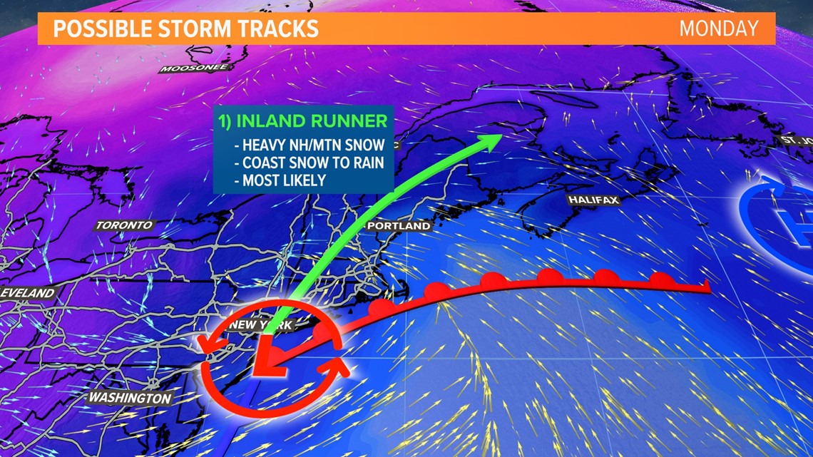
While new data is still coming in, and there could be some shifts, I think this is the most likely outcome.
Arctic air will be departing ahead of this storm. That almost ensures a thump of heavy snow before the warmer air can infiltrate and switch things over to rain.
Still, an inland track like this would mean that New Hampshire and Maine's mountains get dumped on.
I'm not ready to make a snow map just yet, but I could easily see a foot or more from Concord, NH to Rangeley, ME.
At the coastline, the impacts become more complicated.
Snow gives way to rain, and wind gusts pick up a bit. A strong southeasterly wind could cause some minor coastal flooding issues.
There might be some mixing or ice potential for inland sections of coastal counties, too.
Given the forecast, I expect travel impacts everywhere on Monday morning due to snow. However, things along I-95 south of Augusta and along the Midcoast should improve quickly in the late morning or early afternoon.

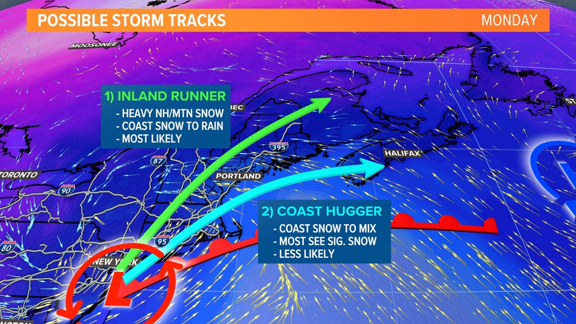
This scenario, while much less likely at this point, is still very important to consider.
If there's a transfer of energy that favors a southern storm track, the storm itself will be along or near the coastline.
This would cut down on icing potential as well as bump snow totals up inland.
This would still deliver a solid amount of snow to the mountains, so the skiers should be happy with this forecast.
Should there be a trend toward this solution, I will update as necessary.
For now, though, I'm expecting the inland track with a thump of snow for the coast and a switch to plain rain.

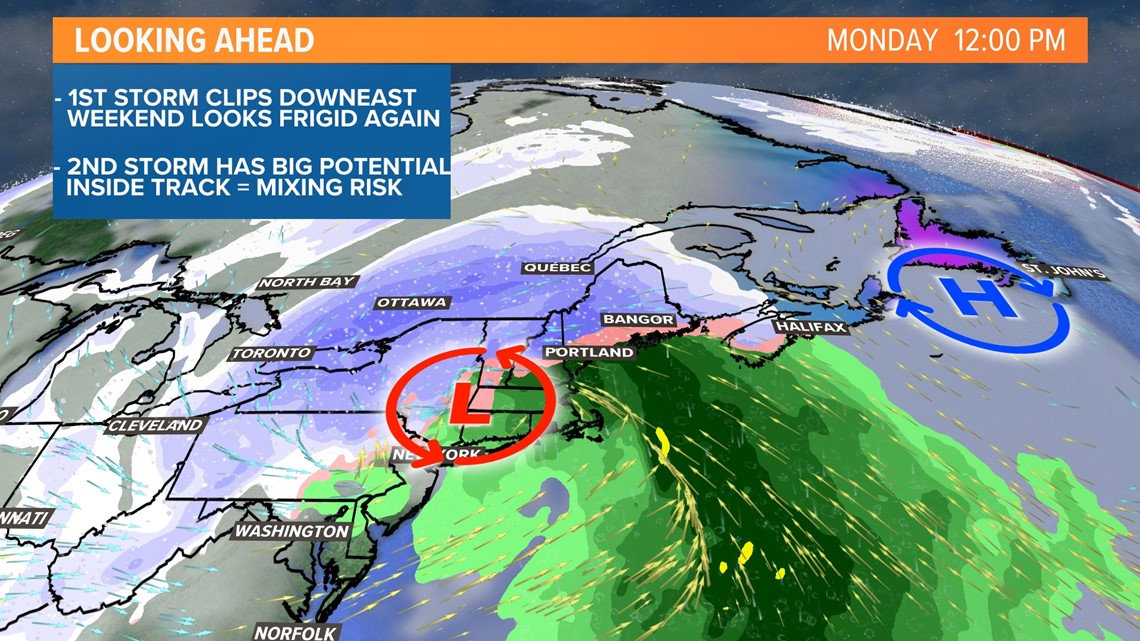
The timing of this will mostly be during the day Monday, beginning around sunrise and lasting into the evening.
Travel will be tough to matter which solution comes to fruition.
We'll be watching for changes as the storm becomes a bit clearer.
Behind this, signals point to another shot of Arctic air, keeping the rollercoaster of temperatures going.
- Mike Slifer, @MikeSliferWX
RELATED: NEWS CENTER Maine Weather Forecast