
MAINE, USA — December was pretty quiet for northern New England. January is trying to make up for that, though.
It comes in between two storms.
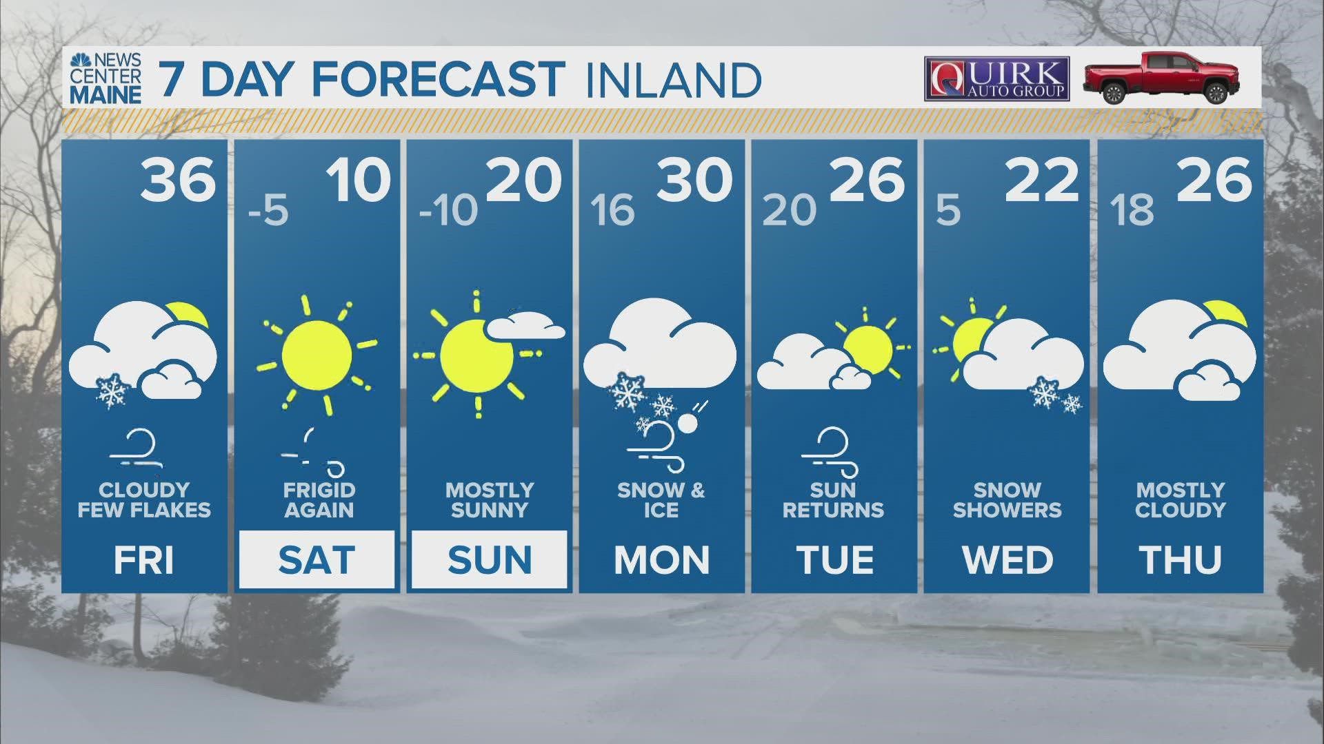
Friday's storm clips areas far Downeast.
Monday's storm is much, much more interesting. There are signals on Monday for all types of wintry precip, possibly some wind, and another Arctic blast behind it.
Let's run through the next few days and talk about weekend preps out ahead of Monday's storm.
The silver lining to this is that the mountains should finally get a significant snowstorm, which will be a huge help to areas that need fresh snow in order to thrive.

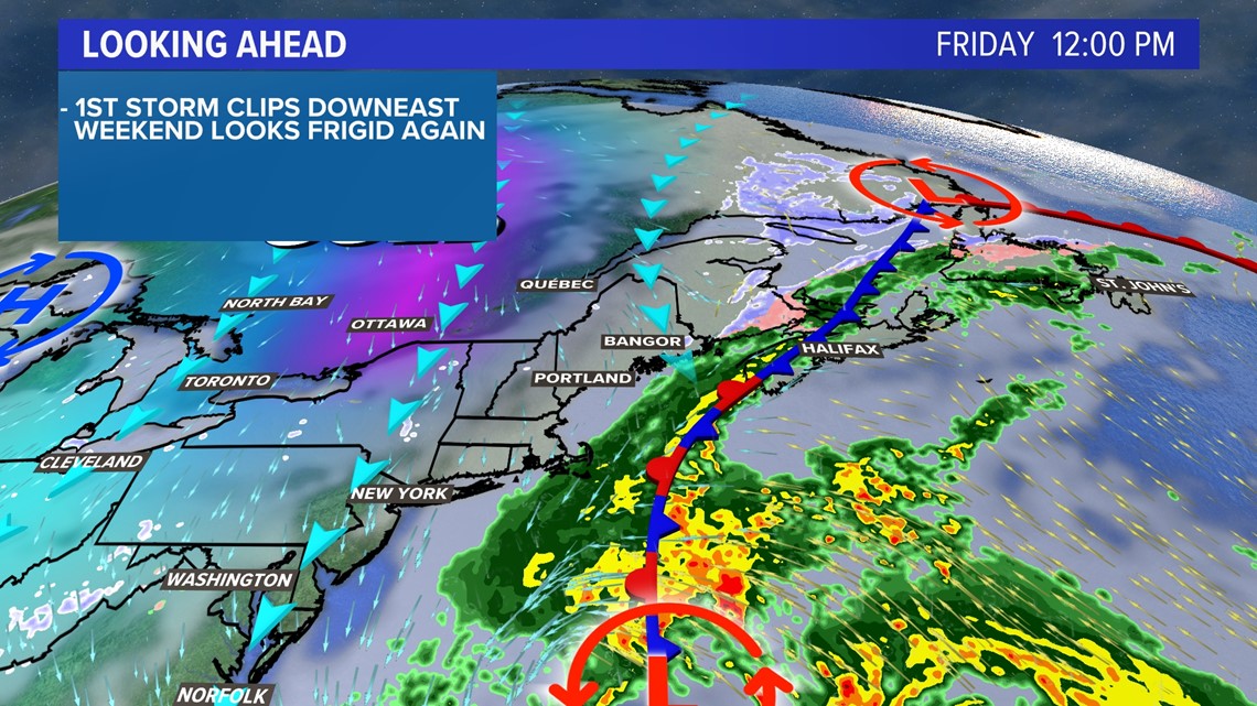
Friday kicks everything off with a storm passing south and east of Maine.
As it strengthens, some flakes are possible Downeast.

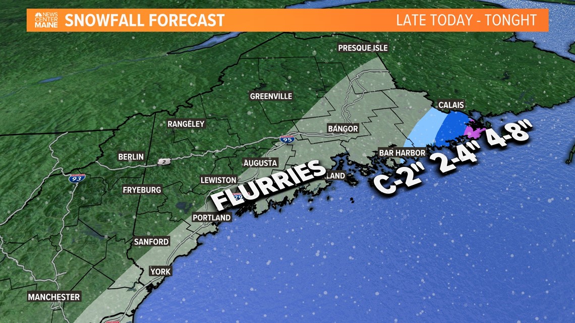
I think the best chance at seeing over 4" of snow will be the far reaches of Washington county.
Given how strong the wind is going to be, I wouldn't be shocked to hear of blizzard conditions at places like West Quoddy Headlight or in Eastport.
That also has implications for the rest of Maine and New Hampshire.

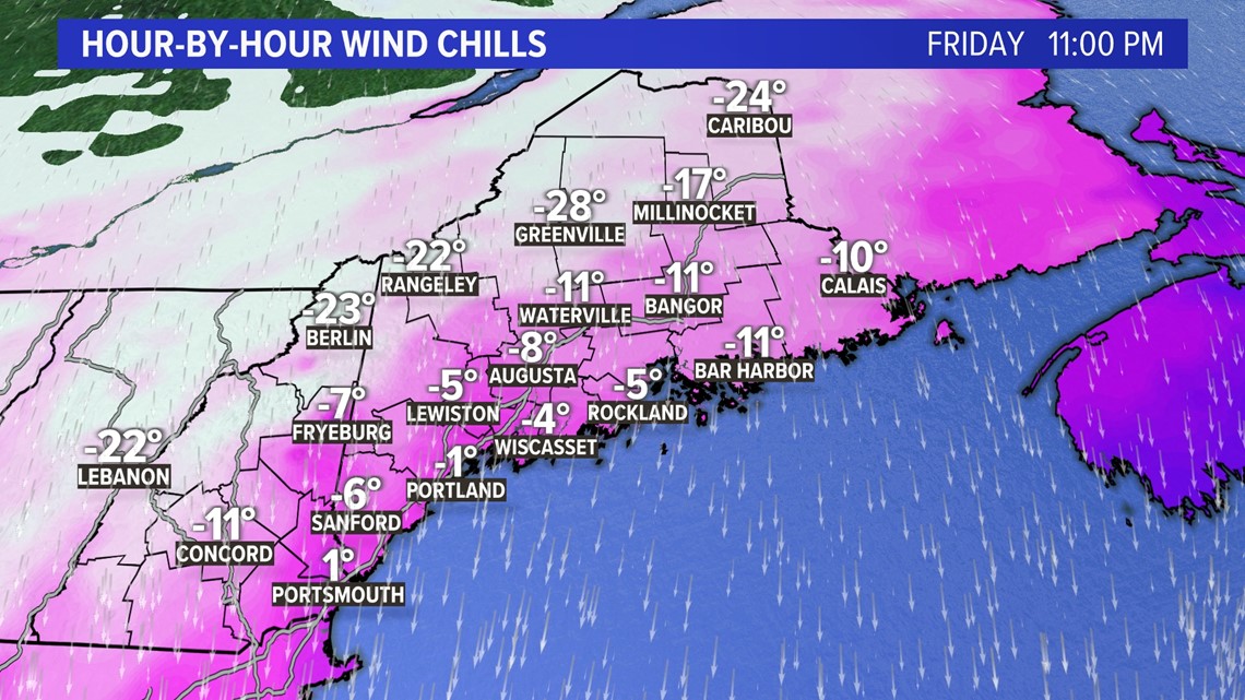
With strong northerly wind, cold air will move in quickly. Temperatures will be falling this afternoon..
Expect wind gusts to top out around 30-35 mph or so, making it feel like it's -30 or -40 degrees in parts of northern and western Maine.

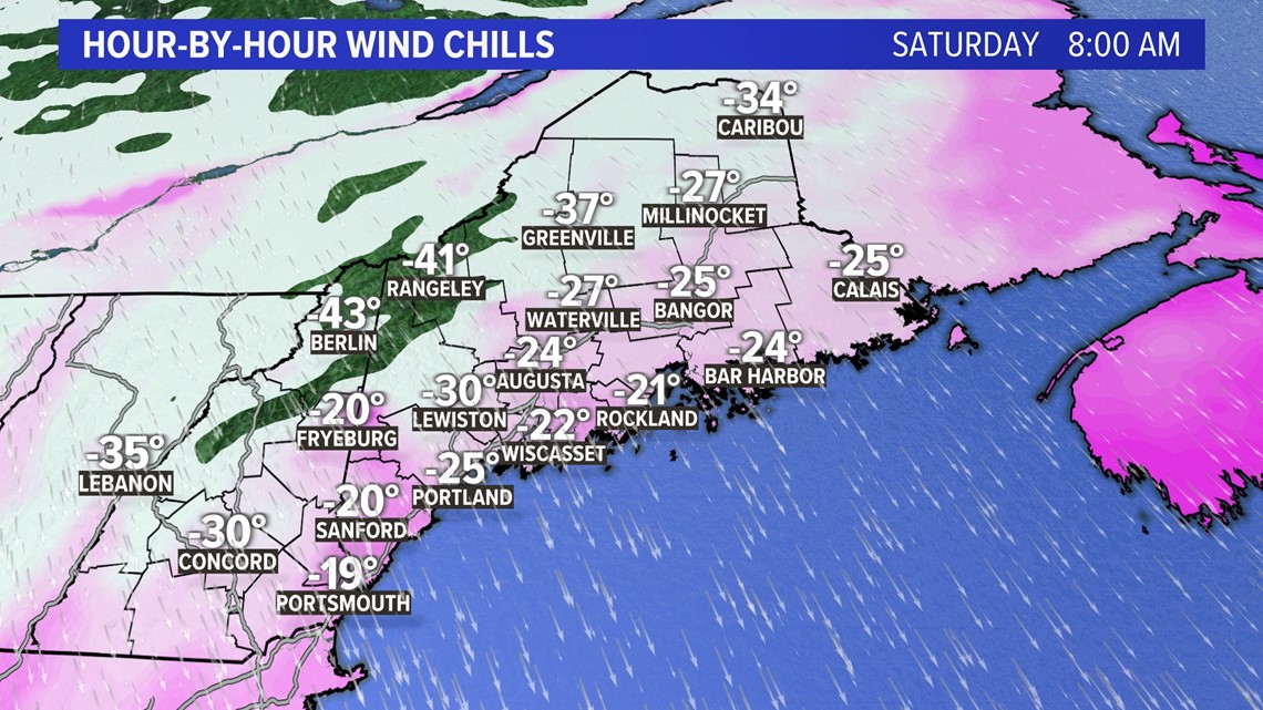
There will not be much of a break by Saturday morning.
Brutal cold sticks around straight through the morning. On the bright side, wind gusts do fall through the day.
Still, high temperatures will only be in the teens and single digits.

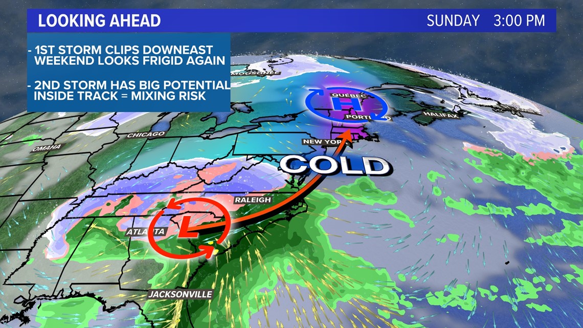
All eyes shift to developing low pressure near the Carolinas on Sunday.
This storm could actually have some pretty devastating effects on parts of the southern Appalachians. Freezing rain is going to be a big player down there and could lead to some big power outage issues.
This is all just a couple of weeks after heavy, wet snow left parts of Virginia without power for days.
So, what does it mean for Maine?

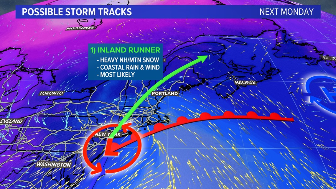
For now, there are two big possibilities. While it is likely the track ends up somewhere between these two solutions, it still gives an idea of if the storm tracks inland or stays offshore.
Track one, as shown above, is the more likely scenario right now.
This would favor an inland track for the storm, which would bring the heaviest snow to parts of New Hampshire and western Maine.
Elsewhere in Maine, there would be a risk for sleet and freezing rain. The only exception would be the coastline, where temperatures would be slightly above freezing.
This would also mean strong wind gusts out of the south are possible on Monday at the coast, adding in a coastal flooding and wind damage threat.

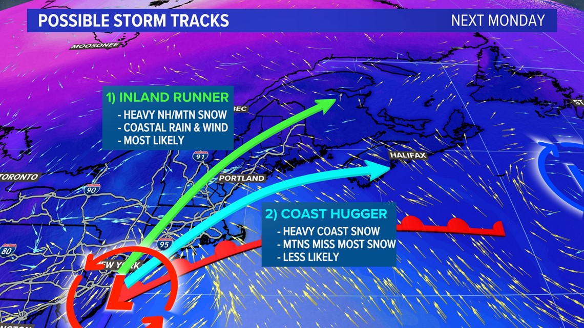
The second possibility, which is the less likely scenario right now, would be a track that stays mostly offshore.
This would keep Maine on the colder side of the system and bring heavy snow to most of central and southern Maine. A track like this would be a more classic winter nor'easter.
I still think that even this scenario could result in a bit of mixing at the coastline, but thankfully we have some time before we work out those finer details.
No matter which track verifies, there will be another shot of really cold air behind this storm.
We'll have more updates as the week goes on. Make sure to follow along here and on-air for updates!
RELATED: NEWS CENTER Maine Weather Forecast