
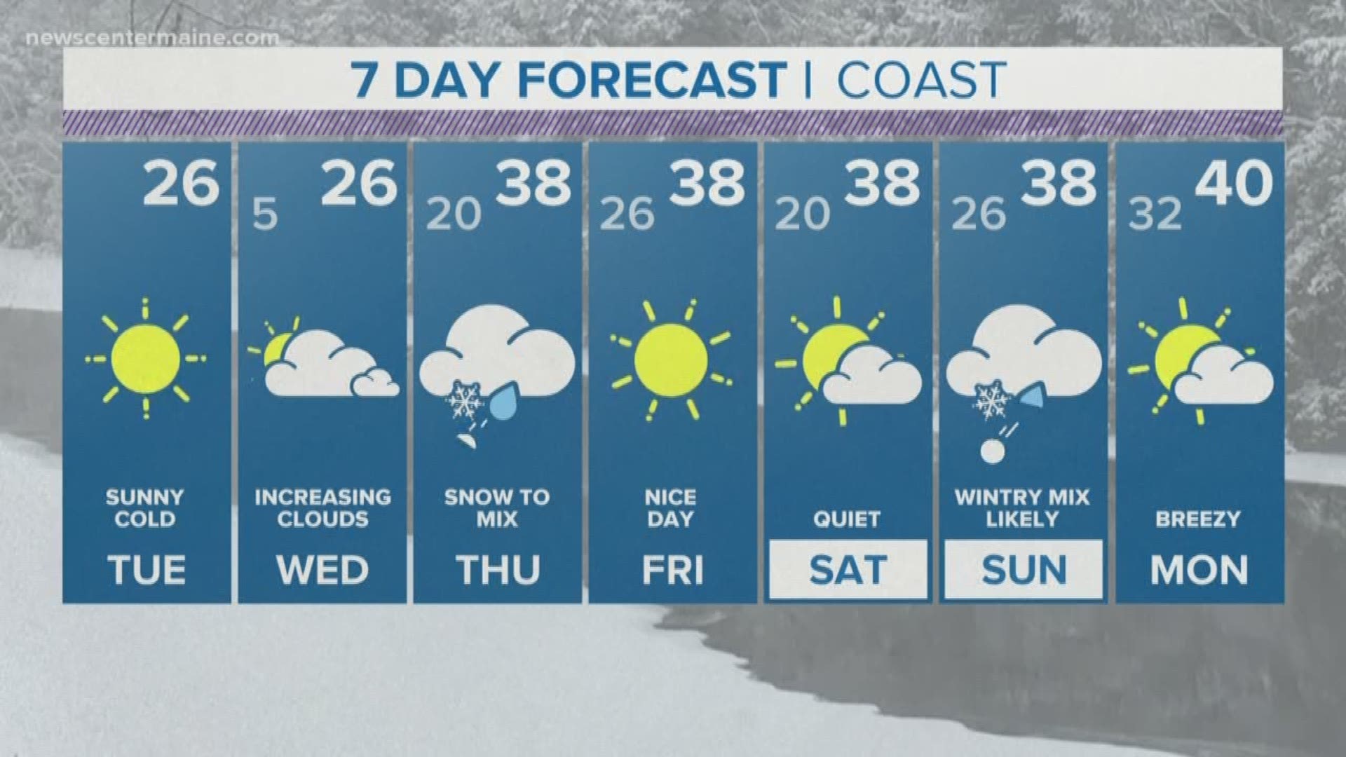
High pressure is working in right now giving us a nice break before our next system arrives later Wednesday night.

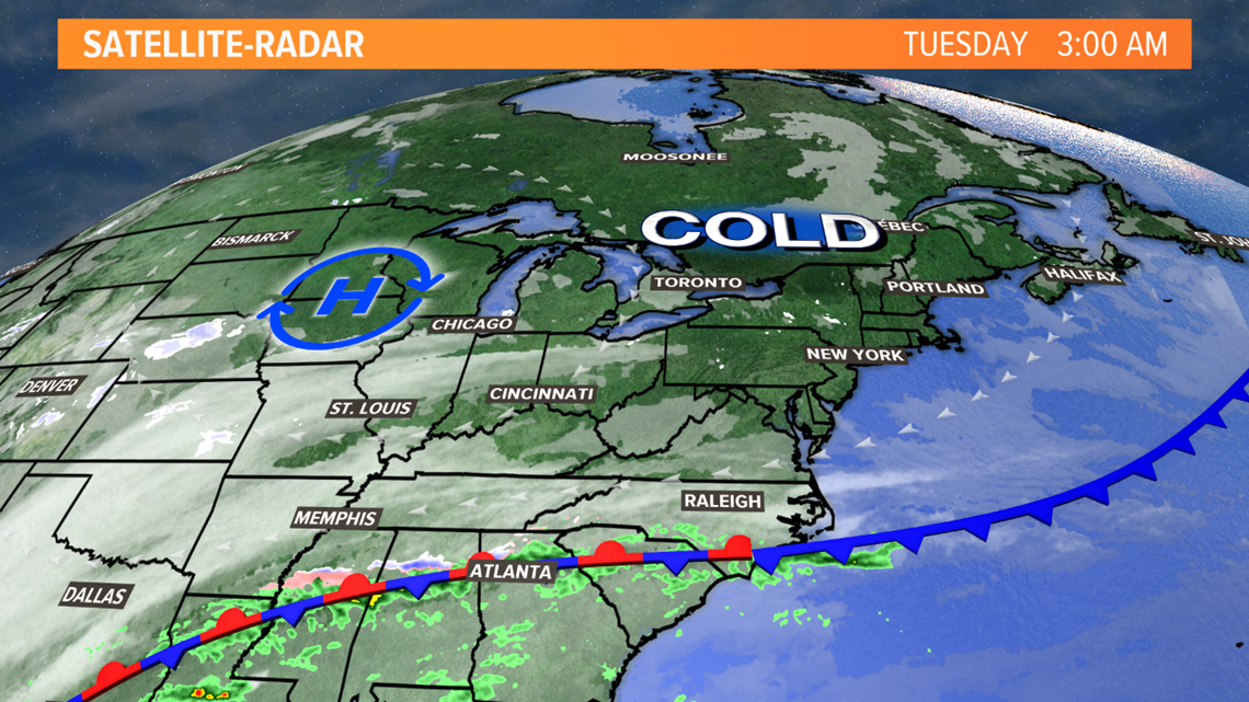
Moisture is pooling in the Deep South, awaiting energy from the West Coast. The two will merge tomorrow and travel up the Appalachians.

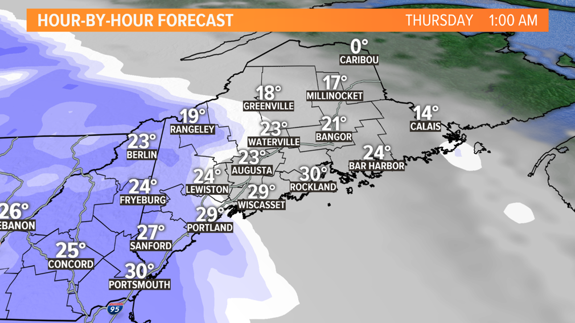
The cold will be thick over Northern New England and snow will break out Wednesday night around midnight and spread east during the overnight.

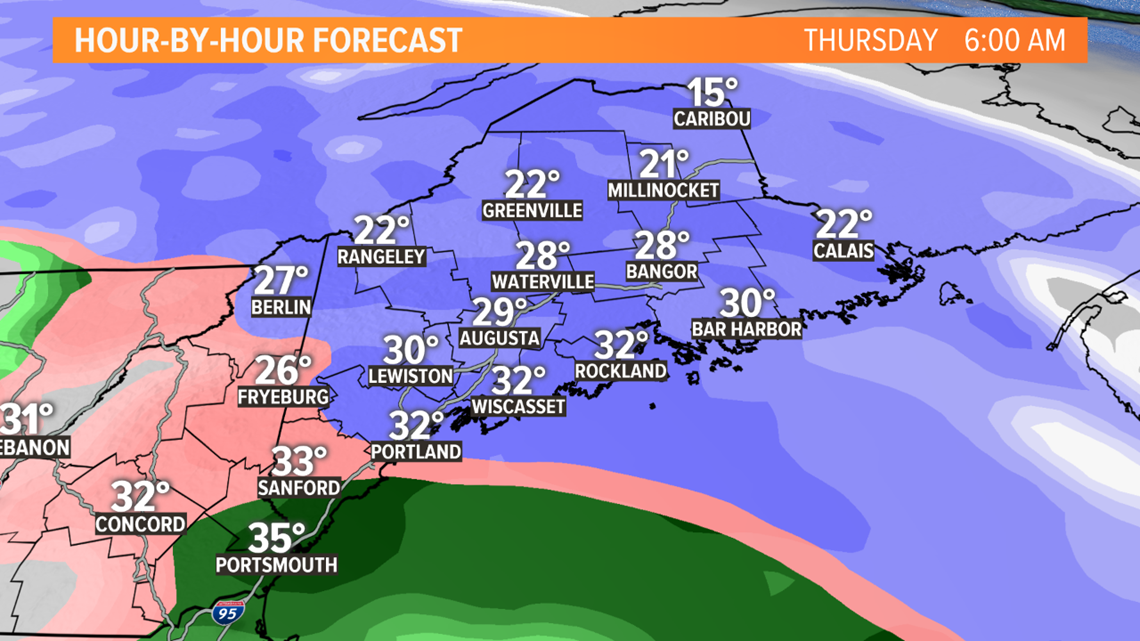
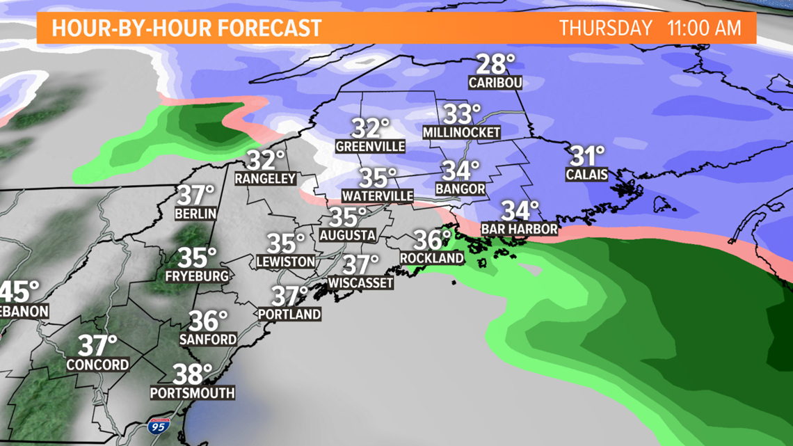
When you hit the roads Thursday morning, several inches of snow will already be on the ground making for a very messy commute. But, similar to almost every other storm this season, mid-level warm air will work in changing snow to mixed precipitation and rain. The change over will take place towards the tail end and as the storm is winding down.

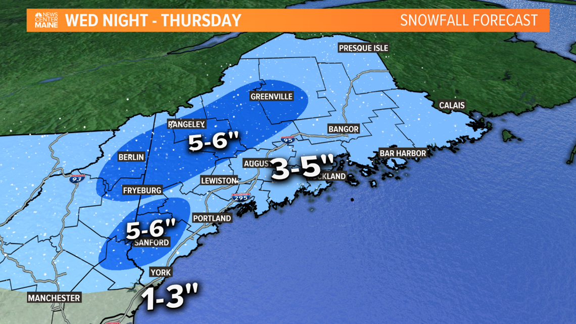
Right now, a general 3-6" of snow will fall. Highest chance to get 6" is in the Western Maine Foothills and Mountains and from the Sebago Lake area to Interior York County.

We'll fine tune and adjust today and tomorrow if needed.