
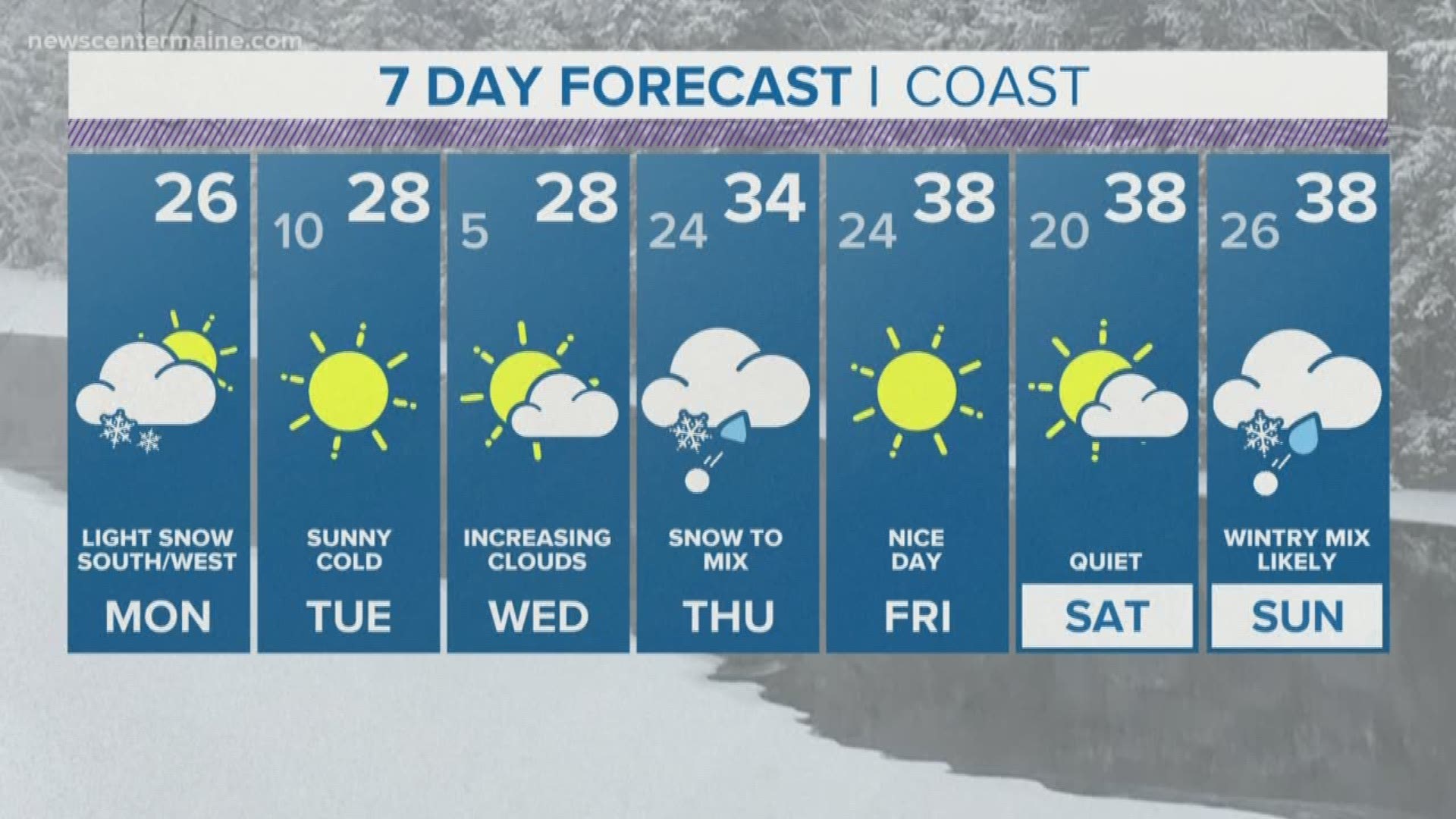
We're in a pattern that brings a system through about every three days.

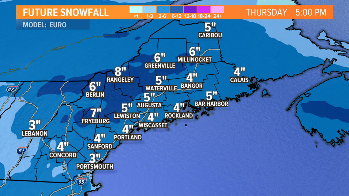
The next one arrives late Wednesday night into early Thursday morning. It doesn't look huge, and it should be pretty quick-moving. But a plowable snow looks likely statewide Thursday morning. Depending on the track, a change to rain may happen along the coast after some accumulation.

Tides will be some of the highest of the year, so the coastline will need to be watched for flooding and erosion.
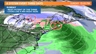
It looks like a general 3 to 6 inches of snow, with the most in the mountains. We'll have our own map out Tuesday, but here's the basic idea from the European model.

Friday and Saturday look quiet, but milder, with highs in the 30s to near 40.
The third system in this train looks likely to arrive Sunday. A lot can change between now and then, but this may become the most potent of the three.

Right now, I'm thinking it'll be a wintry mix, but if a secondary low is able to form and strengthen, more snow would come into play. We'll keep an eye on it for you.