JACKSONVILLE, Fla. — The Atlantic hurricane season is officially underway.
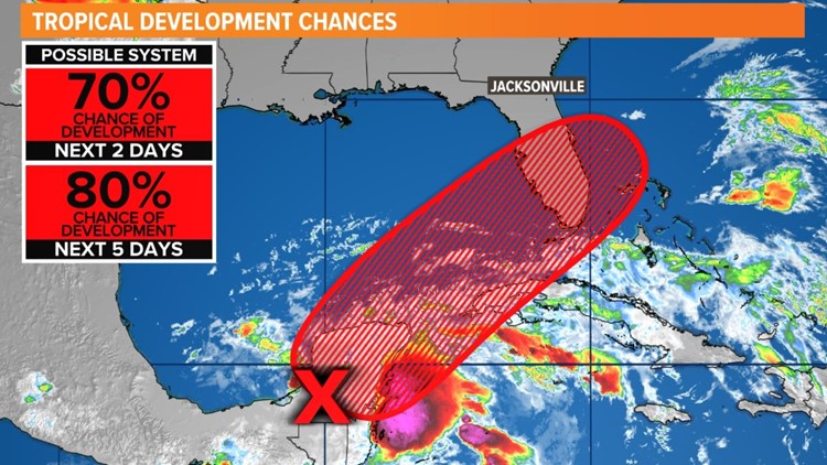
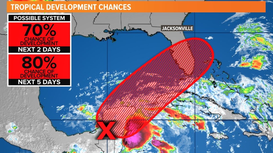
Right on cue... we are tracking an area with a high chance of development in the next 48 hours. There is also another area east of Florida with a low chance of development, but it is already moving farther away out to sea.
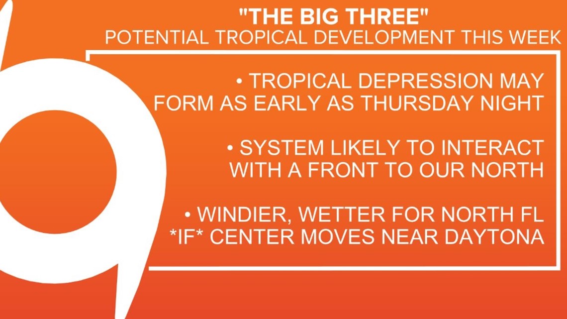
The remnants of Agatha from the eastern Pacific are now over the southern Gulf and southeast Mexico. This tropical moisture along with a large complex of low pressure in the area is expected to redevelop in the Gulf of Mexico by Thursday (or Friday) of this week. A tropical cyclone may form to our southwest and head east or northeastward over Florida into this weekend. Our local forecast will be highly dependent on how far north this cyclone travels. The most impactful timeframe here at home would be Saturday (rainiest) into Sunday morning (windiest).


From the National Hurricane Center as of 8 a.m. Wednesday:
Near the Yucatan Peninsula and Southeastern Gulf of Mexico: A large area of disorganized showers and thunderstorms located over the northwestern Caribbean Sea and Yucatan Peninsula is associated with a broad area of low pressure. Environmental conditions appear conducive for gradual development, and this system is likely to become a tropical depression while it moves northeastward over the northwestern Caribbean Sea and the southeastern Gulf of Mexico during the next couple of days. Regardless of development, locally heavy rainfall is likely across portions of southeastern Mexico, the Yucatan Peninsula, and Belize during the next day or so, spreading across western Cuba, South Florida, and the Florida Keys on Friday and Saturday. Interests in the Yucatan Peninsula, western Cuba, the Florida Keys, and the Florida Peninsula should monitor the progress of this system.
*Formation chance through 48 hours...high...70 percent.
*Formation chance through 5 days...high...80 percent.
RELATED: LOCAL WEATHER: Some inland fog
Interactive tropical radar:
SEASONAL OUTLOOK: NOAA's 2022 outlook calls for 14-21 named storms, 6-10 hurricanes, and 3-6 major hurricanes in total.
Last year, NOAA released the new seasonal averages for the Atlantic basin. According to the 30-year data from 1991 to 2020, the new averages include 14 named storms, 7 hurricanes, and 3 major hurricanes. The previous Atlantic storm averages, based on the period from 1981 to 2010, were 12 named storms, 6 hurricanes, and 3 major hurricanes. The averages from 1951-1980, were 11 named storms, 5 hurricanes, and 1 major.

Hurricane safety and preparedness are critically important even before the season begins on June 1. NOAA’s National Weather Service provides resources to prepare for hurricane hazards and real-time updates about active weather systems from the National Hurricane Center at www.hurricanes.gov.
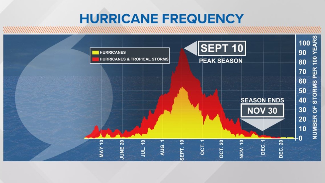
The Atlantic hurricane season officially runs from June 1 to November 30.
Download the First Coast News app and sign up for severe weather alerts