
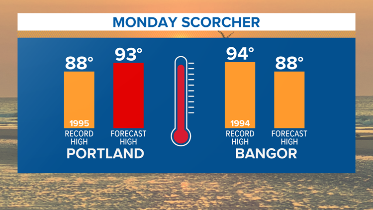
Temps will make a run at 90 degrees as heat and humidity surge in Monday, June 18. The last time it hit 90 in Portland was back on May 2. The last time it hit 90 in Bangor was nearly a year ago, June 11, 2017.

I don't expect the heat to get into eastern Maine due to an unfavorable SW wind direction off the chilly Gulf of Maine. But high levels of humidity and temps around 80 will create poor air quality. If you have breathing issues you are advised to stay indoors.
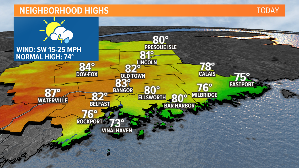
Much of southwestern Maine will roast today. Highs will approach or exceed 90. The record is 88 in Portland, and there's a good chance there will be a new record at the end of the day. The heat coupled with very high humidity will create heat index values or "feels like" temps near 100. Take it easy, drink water and seek out AC.


A coldfront will sweep in this evening triggering some potentially powerful thunderstorms. The timing appears to be 3 p.m. to 6 p.m. for northern Maine and 6 p.m. to 10 p.m. for southern Maine.


Torrential downpours, capable of inducing flash flooding on streams and roads, will be a big concern with these storms. Damaging wind gusts will be possible, too. If the sky looks threatening later today, best to get indoors out of the elements.

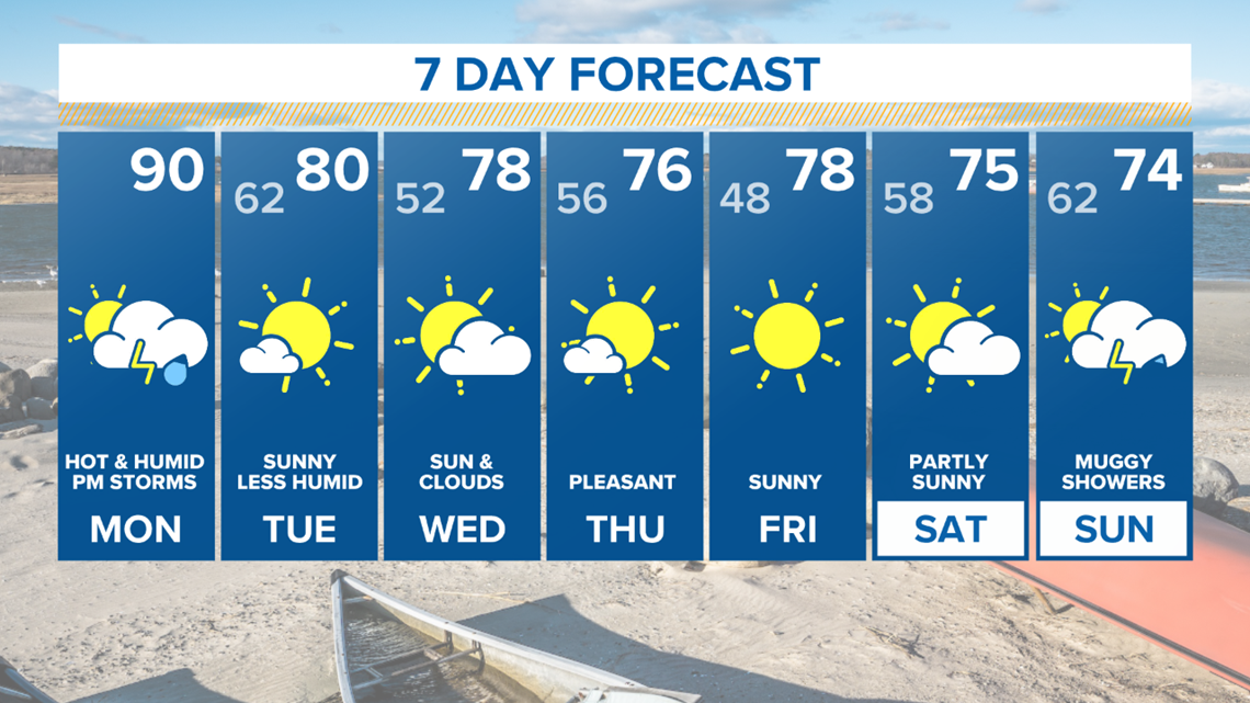
Following the frontal passage, it's going to get really nice again. The heat will diffuse and the humidity will break. Most of this week will be stellar.