MAINE, USA — Question: On a very cold morning recently, I drove to the waterfront to watch the sunrise. It looked like fog was rolling over the top of the water. What was it? From: Hillary
Most of the winter has been tame, but we've had a few exceptionally clear and cold mornings recently.
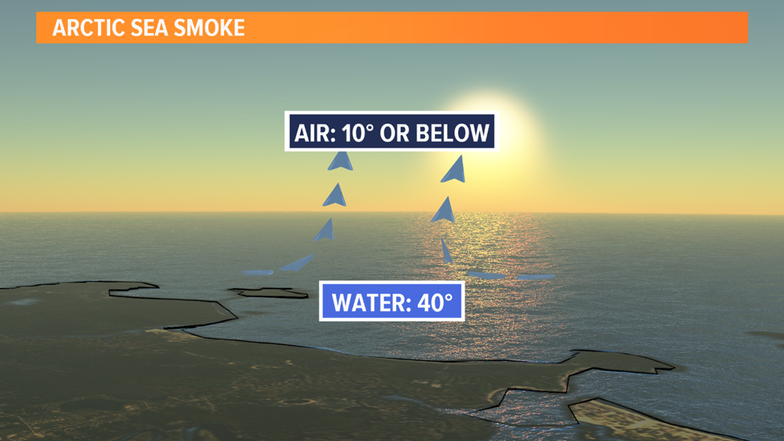
If you're by the water, especially around sunrise you may notice what appears to be fog, but it's actually called "arctic sea smoke".
It forms as the very cold air hovers over the relatively warm water surface. Warm air is less dense than cold air -- so the thin layer of warmer air above the water starts to rise. As this air rises into the arctic air, it cools and condenses. This isn't usually a uniform or big area of fog though. Instead, it often times appears as streaks of smoke, reforming over and over, as the warm and cold air try to balance each other out.
This sea smoke is usually most impressive when we have shots of arctic air early in the winter season. The greater the difference in temperature between the air and the ocean, the better chance you'll see it form. Usually there needs to be a difference of at least 30 degrees between the ocean temperature and the air temperature, which we've had the last few mornings.