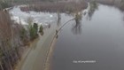
CARIBOU, Maine — Flood preparations are well underway in northern Maine. Rising water levels in rivers throughout Aroostook County are leaving multiple agencies on high alert.
"We know our vulnerable communities and we watch those first, but it doesn’t stop us from watching all areas along a body of water," said Aroostook County Emergency Management Director Darren Woods.
One high-risk area for flooding is Washburn along the Aroostook River.
Flooding in the county is common, but this year, with a higher than average snowfall, larger floods are expected.
"We started our preparation back in February," said Woods. "That means starting to meet with communities and partner agencies to organize our assets. Make sure things are in place, charged and ready, and ready to mobilize if it’s needed.”
One agency working closely with Aroostook County Emergency Management is the National Weather Service in Caribou.
"Obviously we had a pretty high snowpack, well above average so we always knew the threat going into it," said Donnie Dumont, a meteorologist at the NWS Caribou.
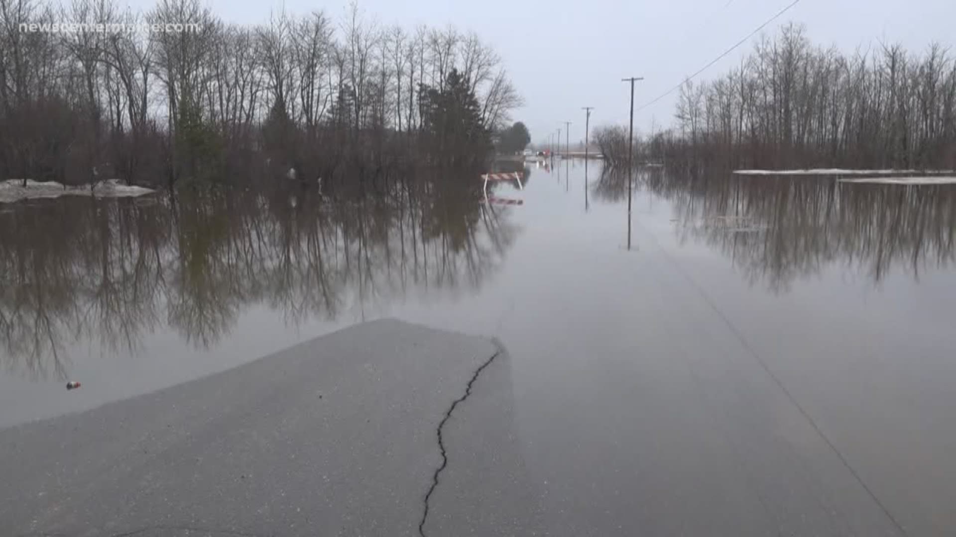
Floods are expected to begin in smaller creeks and streams, and then larger flooding with be impacted early next week in larger rivers and streams throughout northern and central Maine.
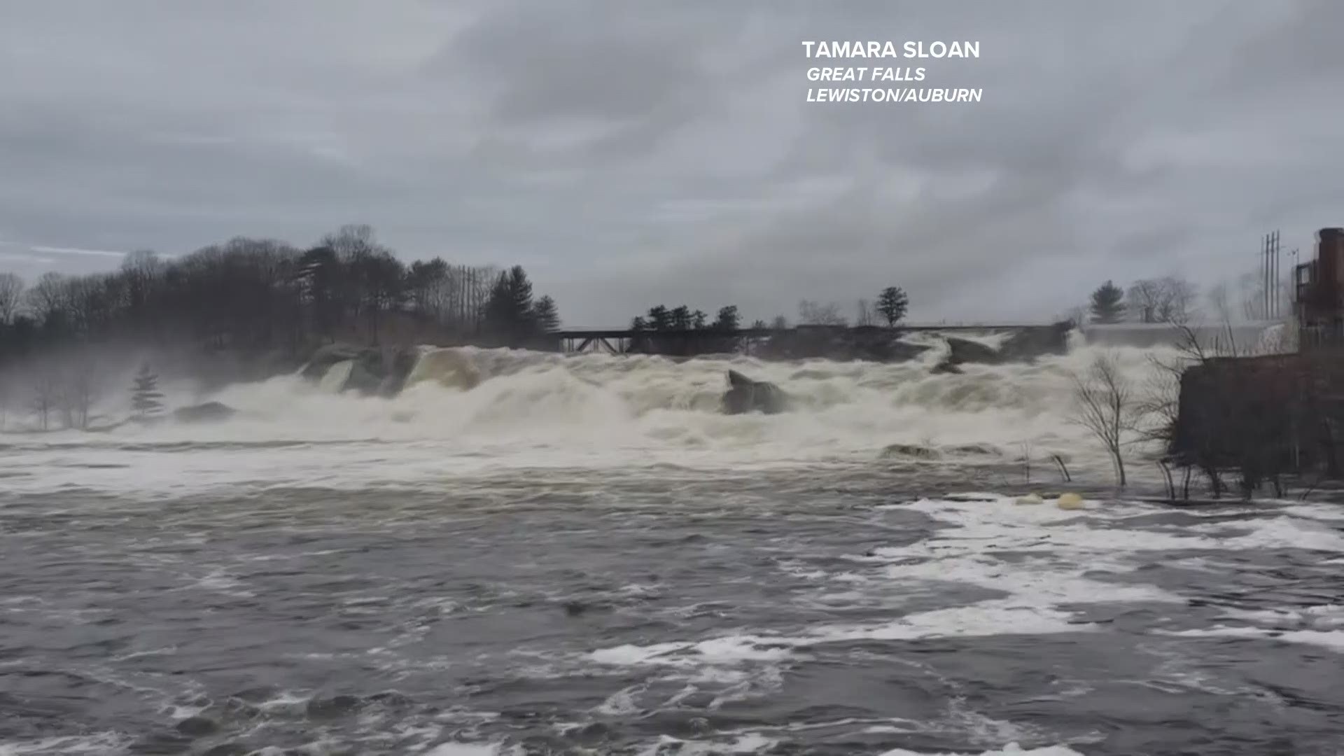
In Lewiston Auburn, Tamara Sloan captured spring runoff at Great Falls on Sunday, April 21.
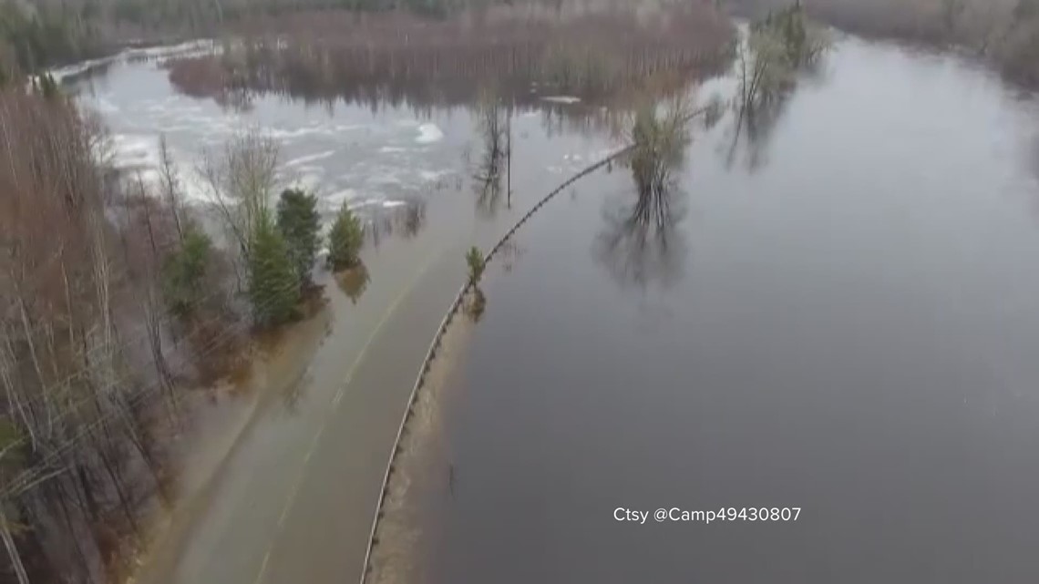
The Mattawamkeag River in Bancroft is covering much of the road as seen from this drone footage from @Camp49430807 on Twitter.