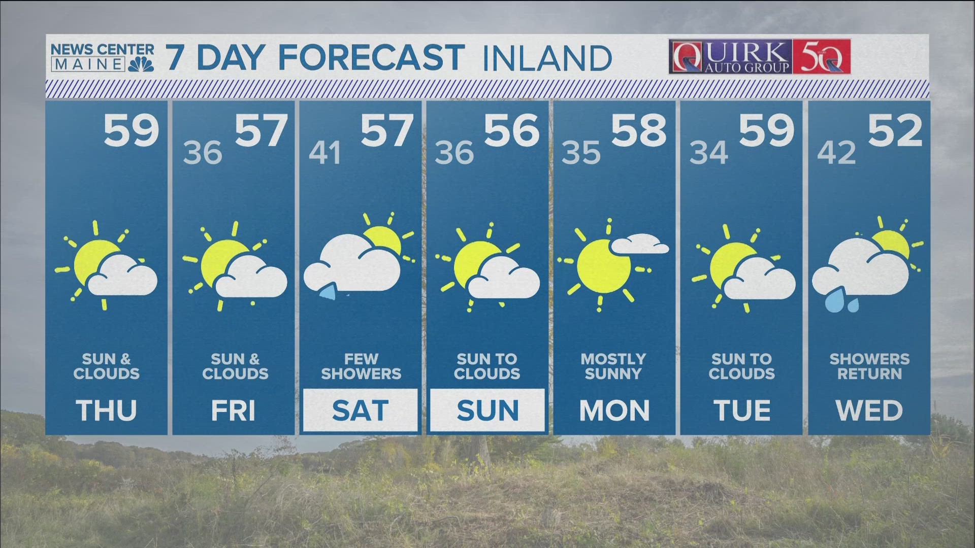
After spending weeks in the deep freeze, temps are moderating and will be above normal heading into the weekend. Highs on Thursday will reach the mid 40s. Highs on Friday will make a run at 50!
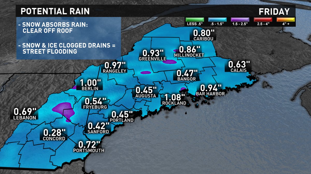
Along with the warmth, moisture will surge up the East Coast. Rain will break out Friday morning and fall through the afternoon and evening. This is looking like a pretty good soaking with up to an inch expected. Because of the rain and very warm temps, there will be a ton of melting. If you have a lot of snow still on the roof, I'd recommend taking some off, relieving weight and pressure. I'd also suggest clearing off your neighborhood storm drains, it's already going to be a sloppy mess and clogged drains will only exasperate the problem.
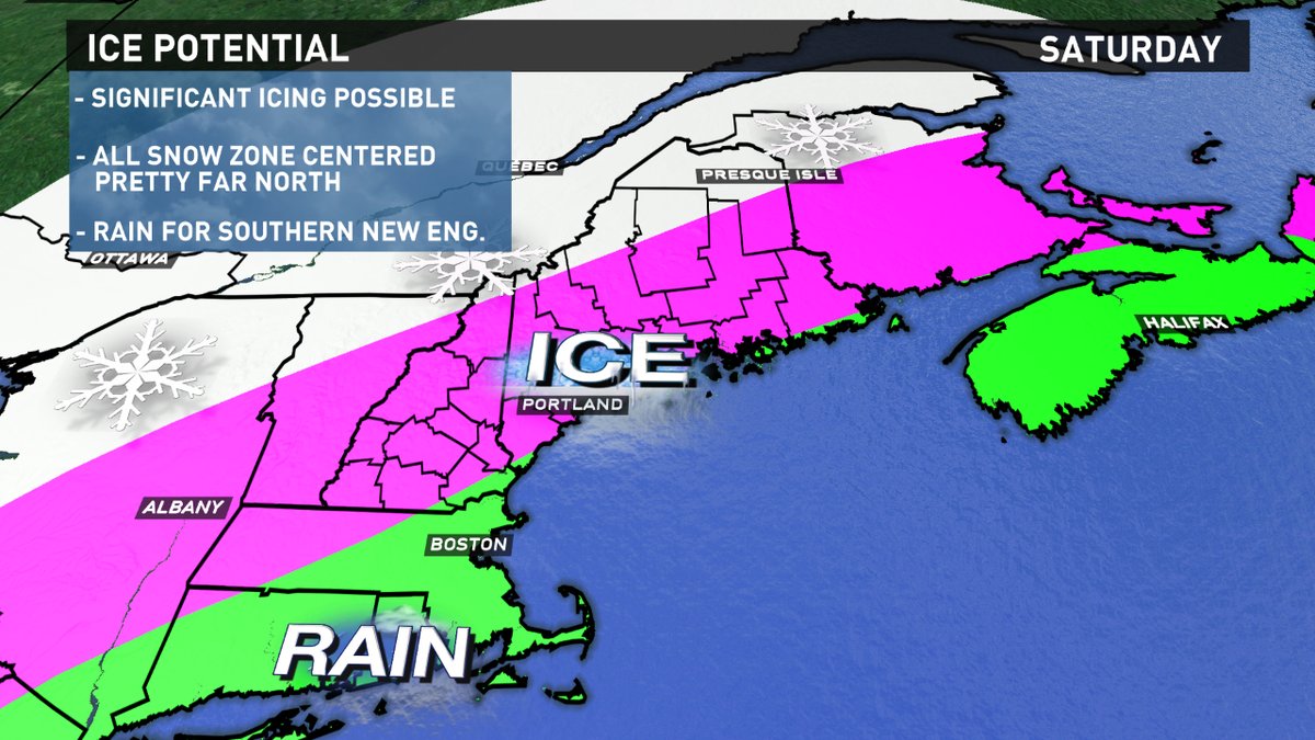
The storm turns more interesting Friday night and Saturday when a coldfront slips through. Temps near the surface will drop below freezing while staying above freezing thousands of feet in the air. This is a recipe for ice, both freezing rain and sleet. The timing of this temperature drop is critical. If it happens early Saturday morning we will be facing a significant ice problem. If it happens later in the day, it will be much more manageable.
Todd Gutner - https://twitter.com/Todd_Gutner https://www.instagram.com/tgutner/