
Spring is in the air right now over the Northeast but Winter will blast back in this weekend.
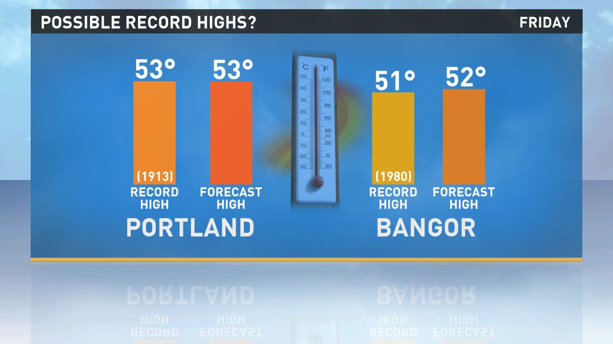
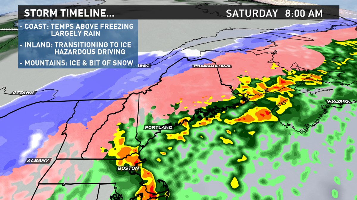
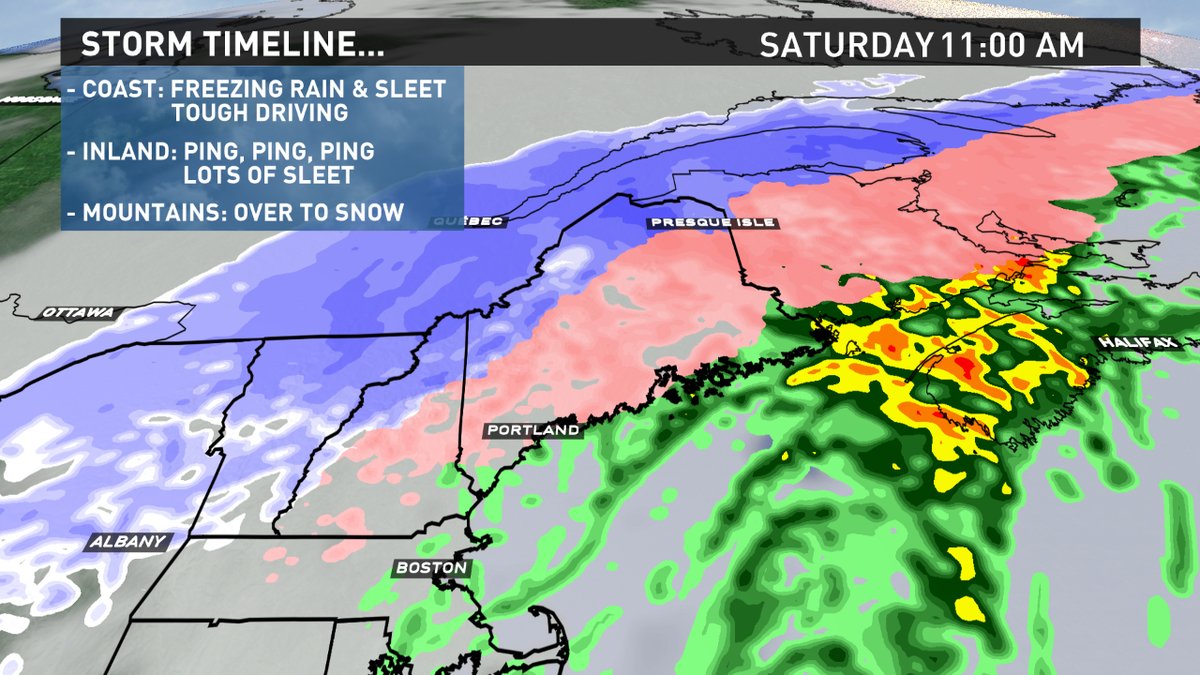
Temps will soar this afternoon and evening, preceding a cold front, into the 50s challenging records. But the record warmth won't stick around long. Late tonight, the front will slip through at the surface and winds will flip to the north. Temps will begin their dive, falling from the 50s to the 20s in about 12 hours. With the temperature fall, comes a precip type change from plain rain to ice and snow. Here's how I think the storm and transition will unfold.
SATURDAY MORNING:
SATURDAY LATE MORNING / MIDDAY:
SATURDAY AFTERNOON:
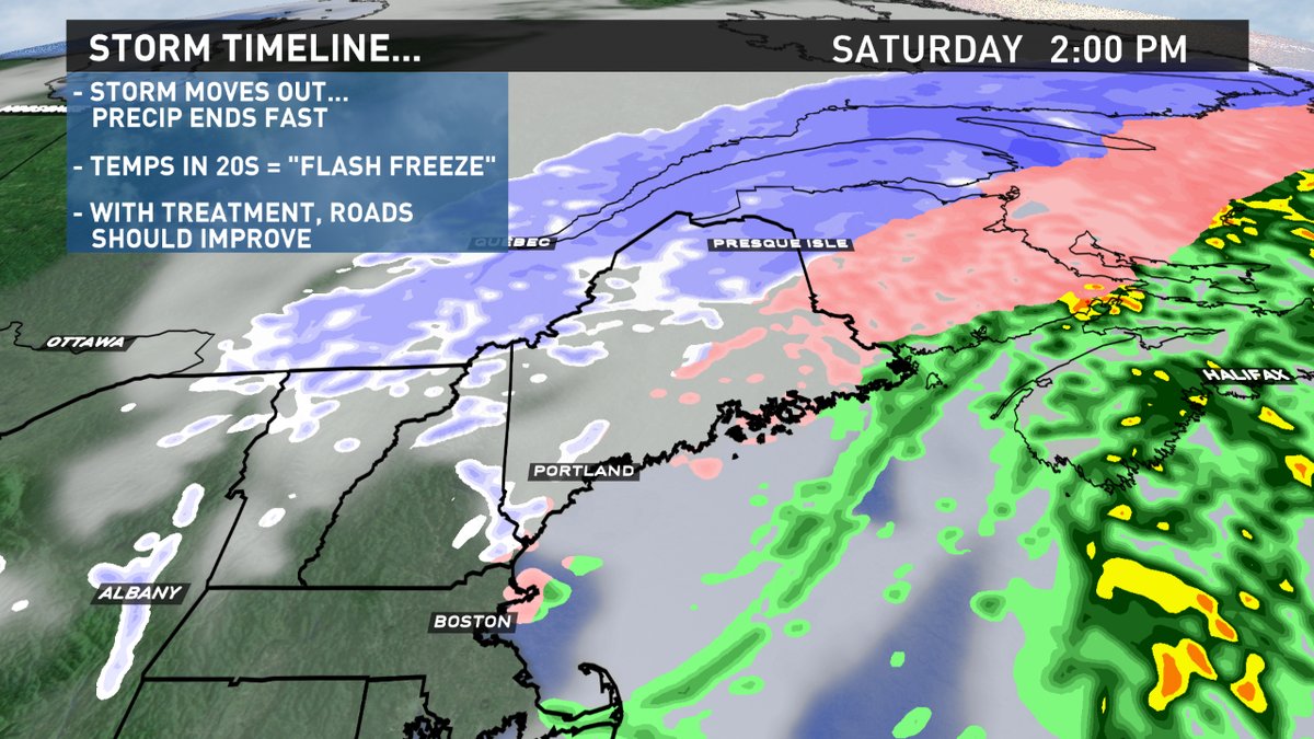
The worst travel and driving conditions will likely occur tomorrow morning. Between the freezing rain and sleet, it will be very slippery. If a surface is untreated, expect it to be icy. The storm will be fast moving and the precip will shut off quickly Saturday afternoon. Even though a flash freeze will be occurring, if roads, walkways and sidewalks are treated with salt, I'm thinking getting around will be a lot easier.
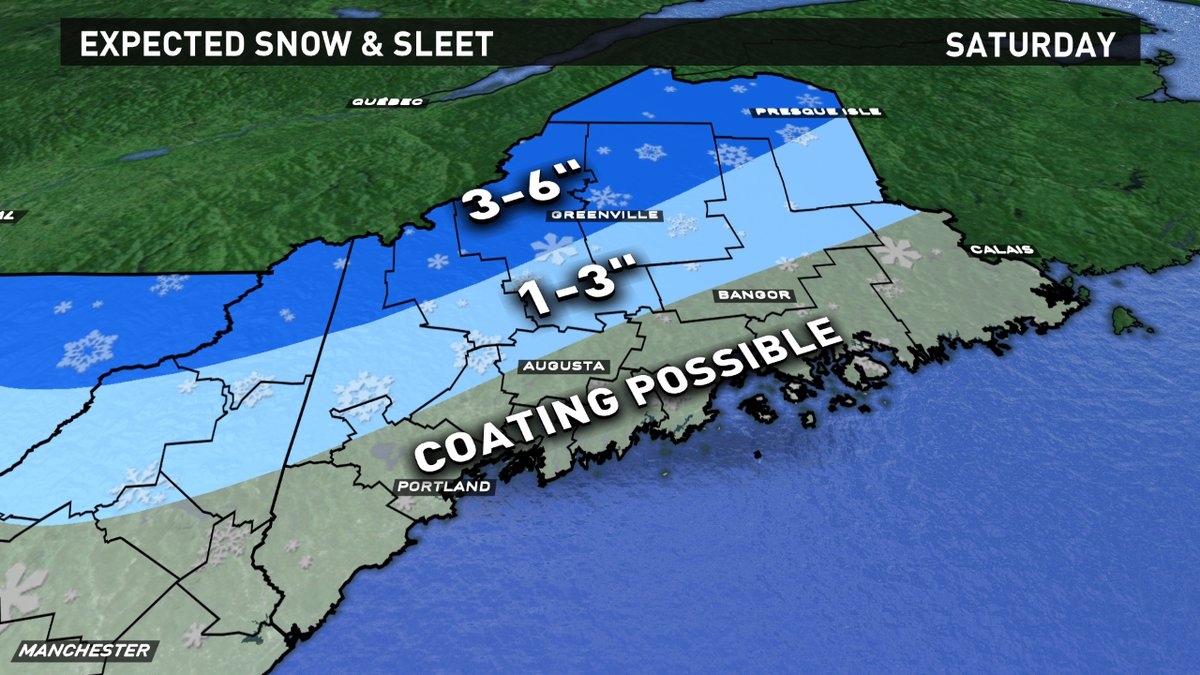
Snow accumulation is expected on the back end of the storm, when the deeper cold settles in. We will also see, somewhat rare, sleet accumulation. Highest amounts will be along the International border, with smaller amounts through the foothills.
Todd Gutner
https://twitter.com/Todd_Gutner
https://www.instagram.com/tgutner/