It's been a brutal stretch of cold, with back-to-back weekends that broke record low temperatures.
Say good-bye to the arctic air, for now.
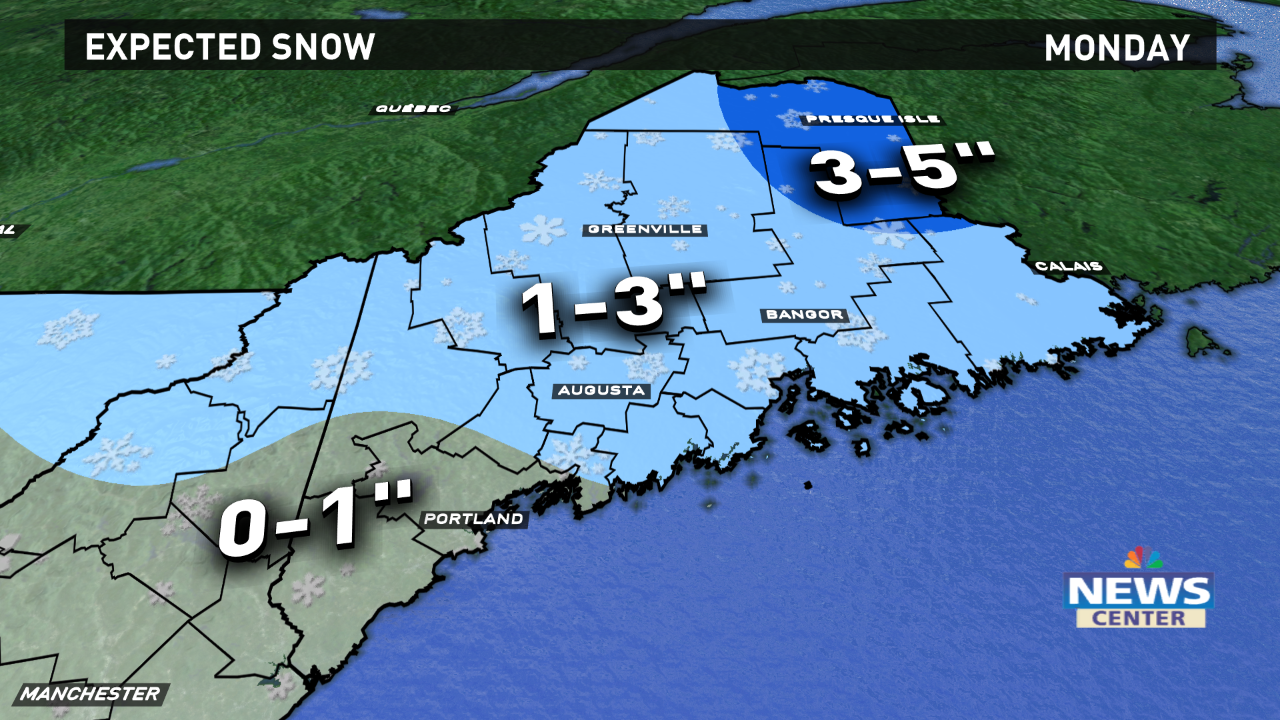
Our first step in bringing milder weather back to Maine comes Monday. A warm front will cross through the state with periods of light snow.
These snow showers will be off and on, but will be enough to cause slippery spots as they pass through, especially during the afternoon and early evening. The most snow will fall in central and eastern Maine, with most towns receiving between 1 and 3 inches. Parts of far northern Maine may see a bit more than that, while far southern areas may miss out on most of it.
On the back side of this system Tuesday, a gusty northwesterly wind will develop, but high temperatures will reach the 30s.
Wednesday looks quiet as high pressure settles overhead. It'll be a seasonably cool day with highs in the upper 20s to low 30s.
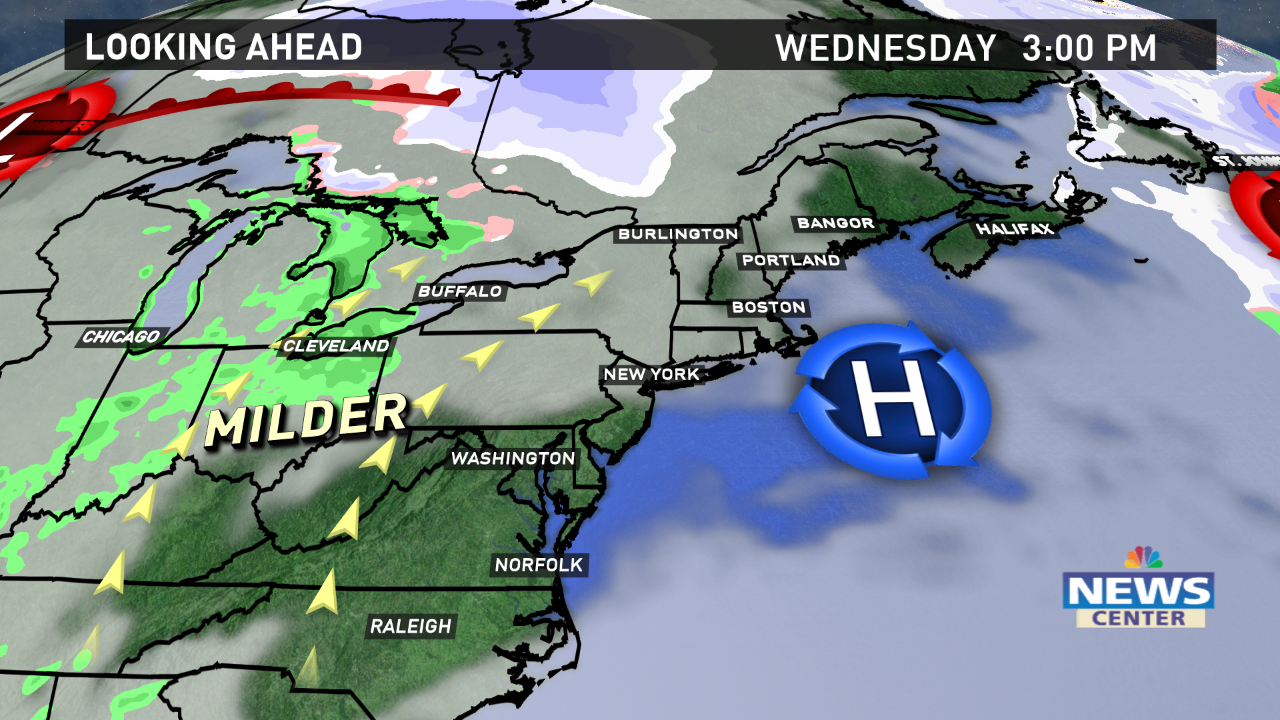
Once this area of high pressure passes to our south, we'll get a "return flow" from the southwest. This southwesterly wind will transport milder air into the region for Thursday and Friday.
Despite the milder air, we won't have a ton of sunshine. In fact, a system that arrives Friday should be warm enough for all rain.
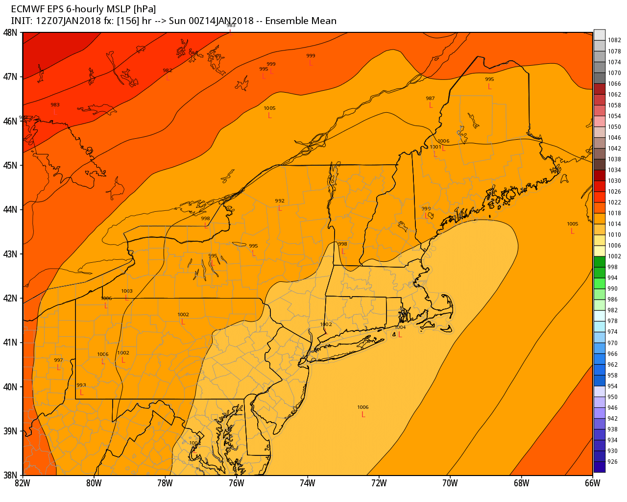
By the weekend, the forecast turns much more uncertain. Will warm air continue to win the battle or will cold return? A system on Saturday could be a messy mix, depending on its track. Each 'L' on the map below represents a European ensemble member's location of the storm center. They're spread far apart - even farther than usual for a day 6 forecast.
Follow our updates on this one throughout the week to see if it trends colder.