The snow pack took a huge hit in our recent warm spell. Some places lost about two feet of snow in two days! The cold air is back, and with it will come some snow during the middle part of the week.
There is still some uncertainty in both the timing and amount of snow. Here's an early look at our thoughts. Check in for updates as we get closer.
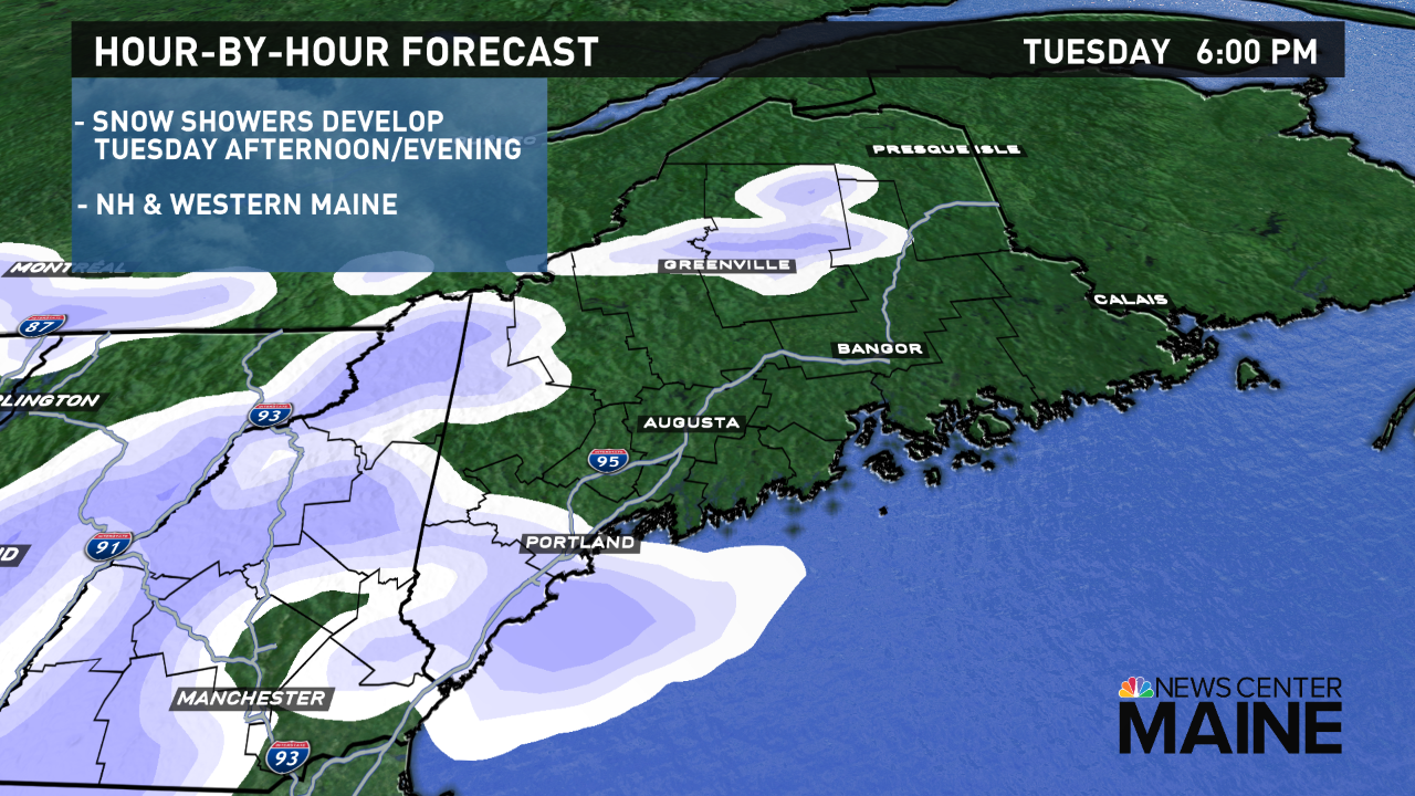
Snow showers will start to develop Tuesday afternoon in New Hampshire, moving into western Maine late in the afternoon and Tuesday evening.
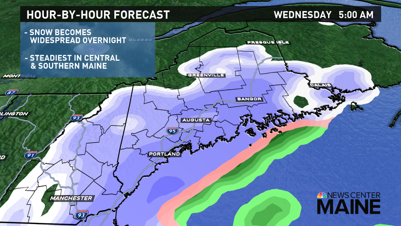
Overnight Tuesday night, the snow will start to become more widespread.
It won't be very heavy, but a light to occasionally moderate snow will cover central and southern Maine.
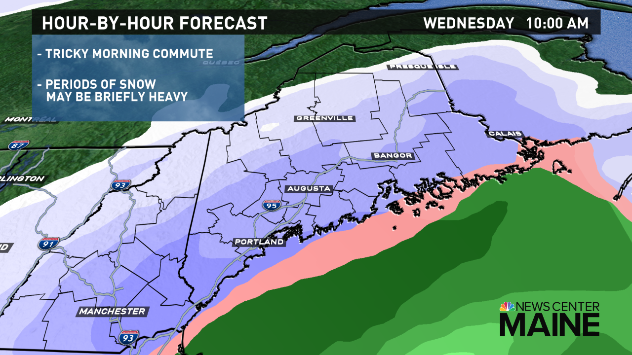
The Wednesday morning commute will be affected in most of the state, especially in central and western areas. Snow-covered roads will make it slippery. Delays or cancellations are possible. Snow will be lighter and more intermittent in the mountains and far north.
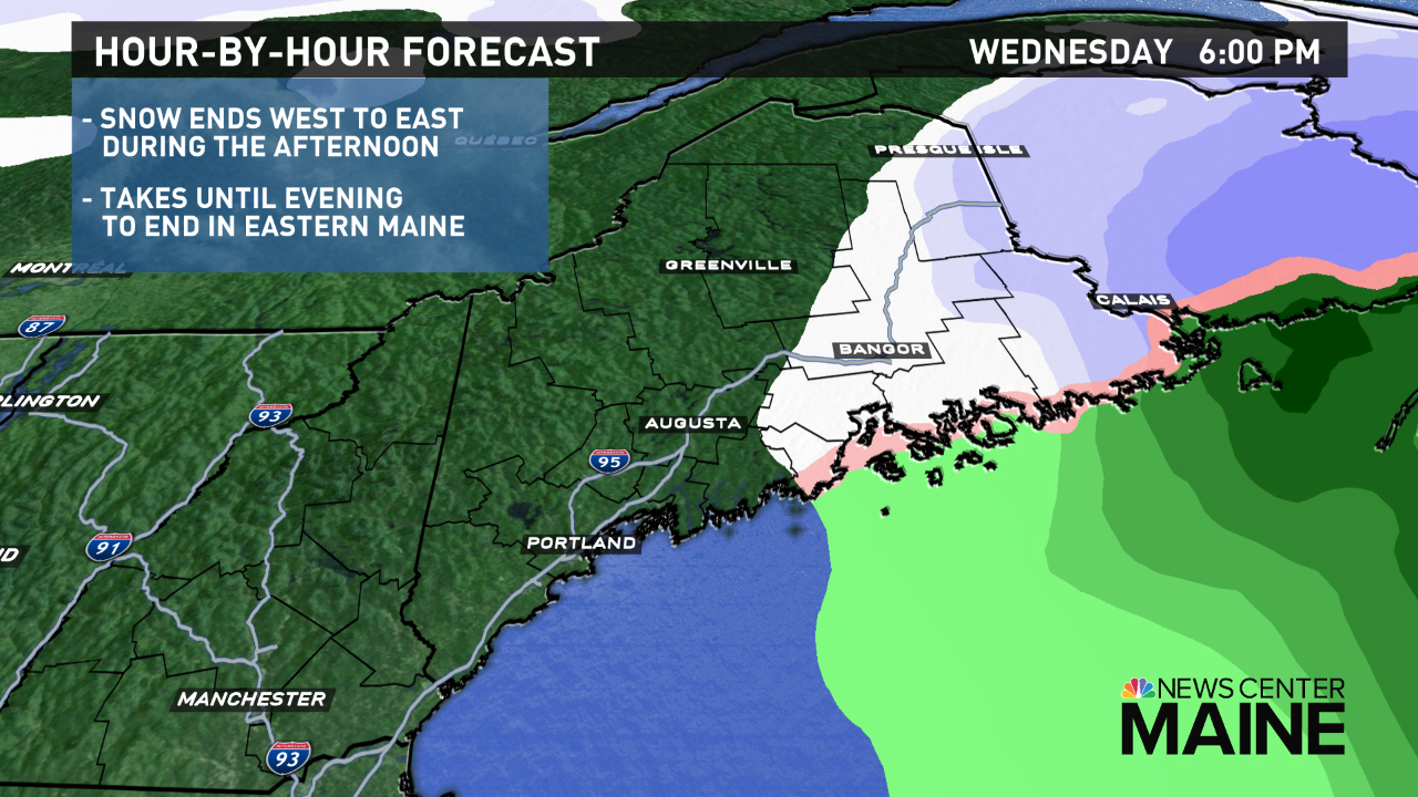
Snow will end from west to east during the afternoon.
Conditions should become better for the evening commute in western Maine, especially from Augusta south and west.
It will take until late afternoon or early evening for the snow to end in eastern Maine. This is where the evening commute will be most problematic.
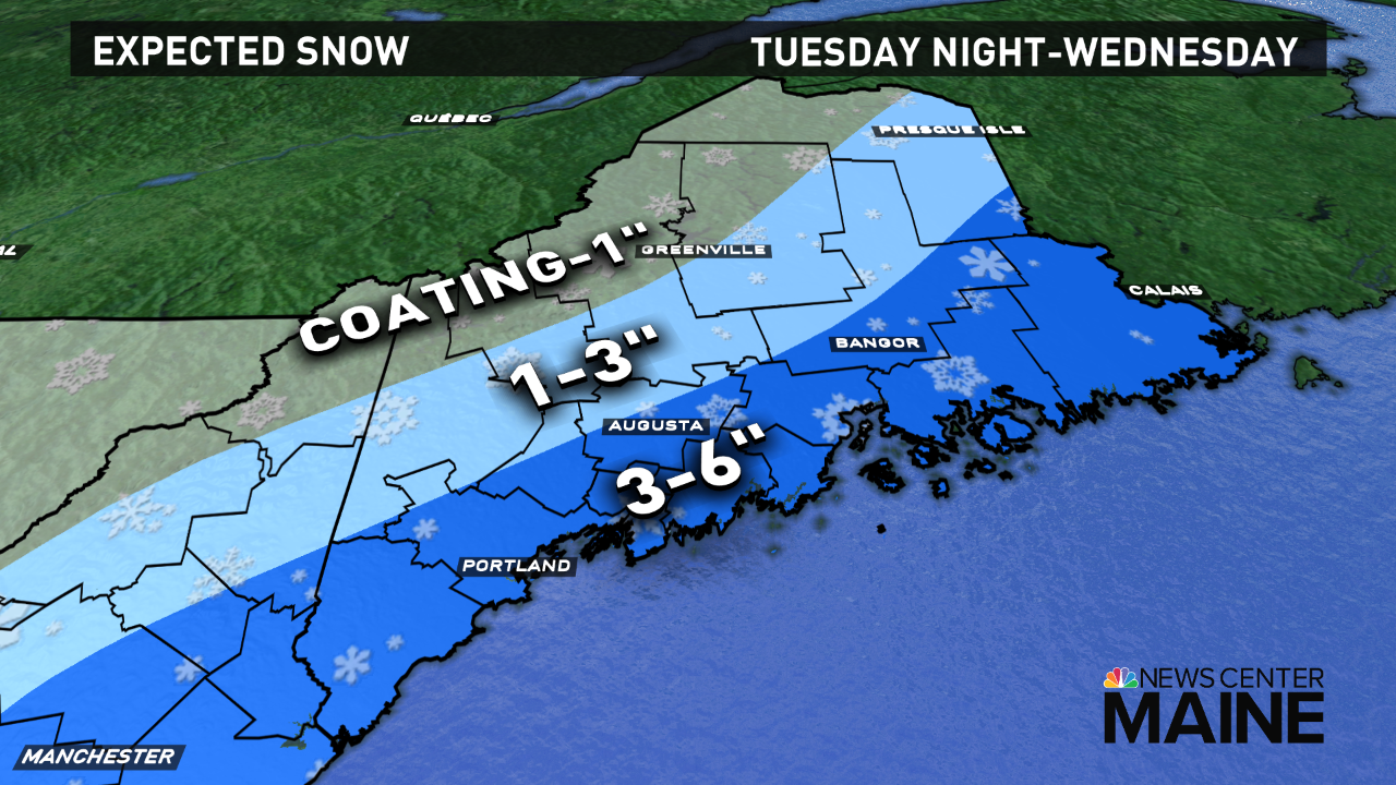
Snow totals look plowable, but manageable. 3 to 6 inches is expected in most of central and southern Maine. Less snow will make it farther north into the foothills and mountains, where totals will gradually taper down from a few inches to just a coating near the Canadian Border.
Temperatures will be in the upper 20s to low 30s for most; that means the consistency of the snow will be somewhat wetter, especially near the coast, and lighter farther inland.