Today will be a decent day, but cooler than Saturday. Expect a partly to at times mostly cloudy sky; most clouds in the south, most sun farther north. Highs will range from around 20 in Aroostook County to the low 30s in the Bangor area, low 40s in southern Maine.
A few snow showers may develop tonight. These aren't associated with our next storm. However, some towns may wake up to a coating of snow Monday morning.
Most of the state will be dry Monday. In western Maine and New Hampshire, snow showers will develop in the afternoon and evening.
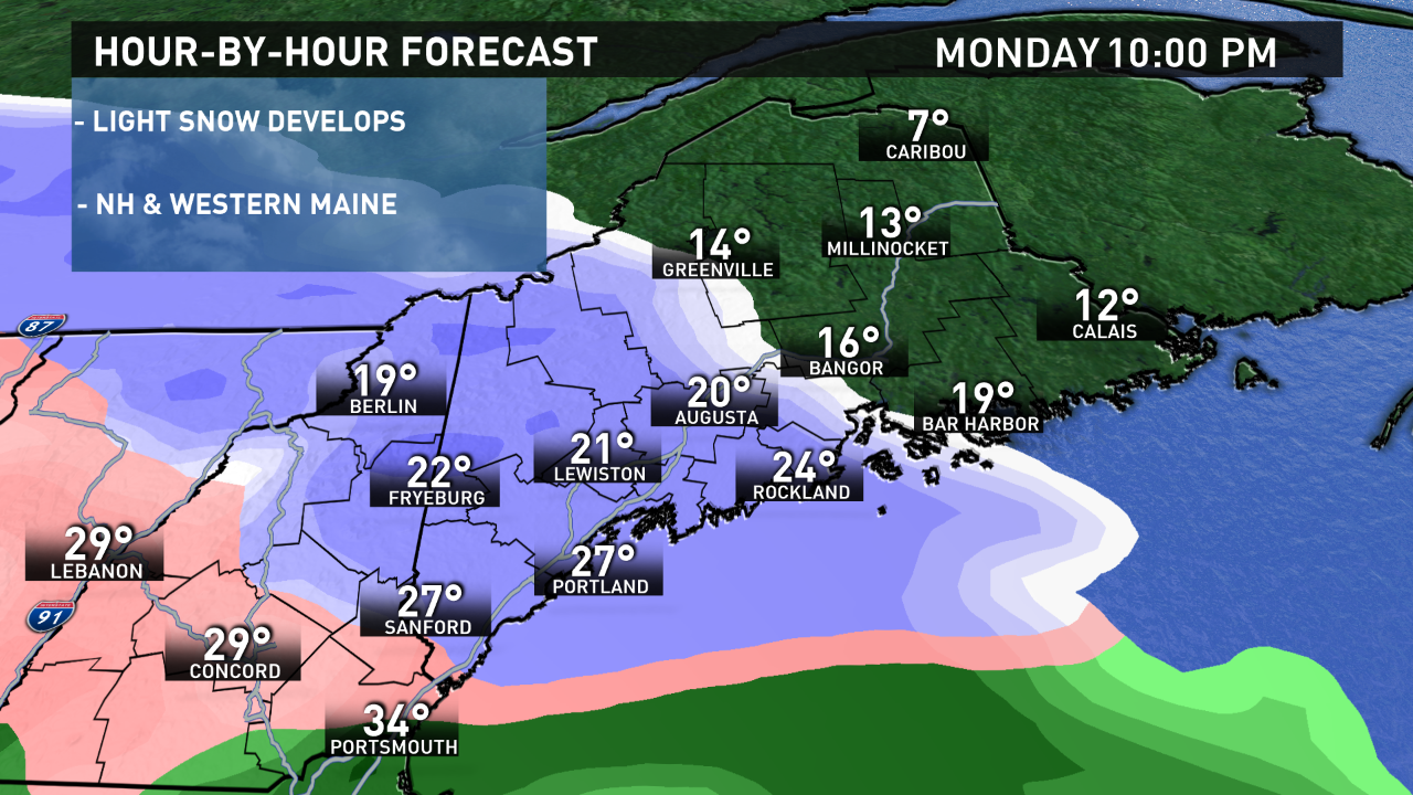
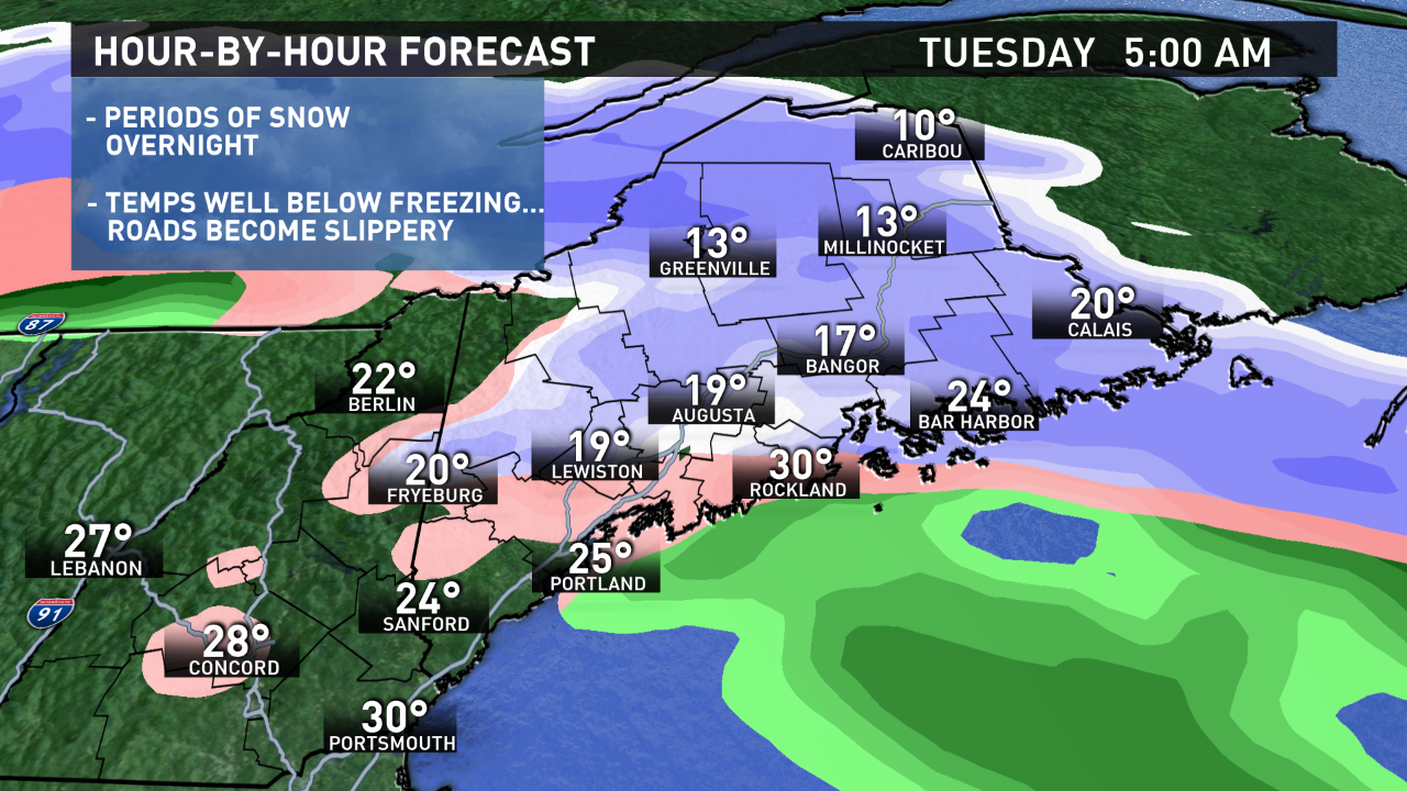
Light snow will overspread the state Monday night. The snow won't fall very heavily, but with temperatures below freezing, roads will become snow-covered and slippery during the night.
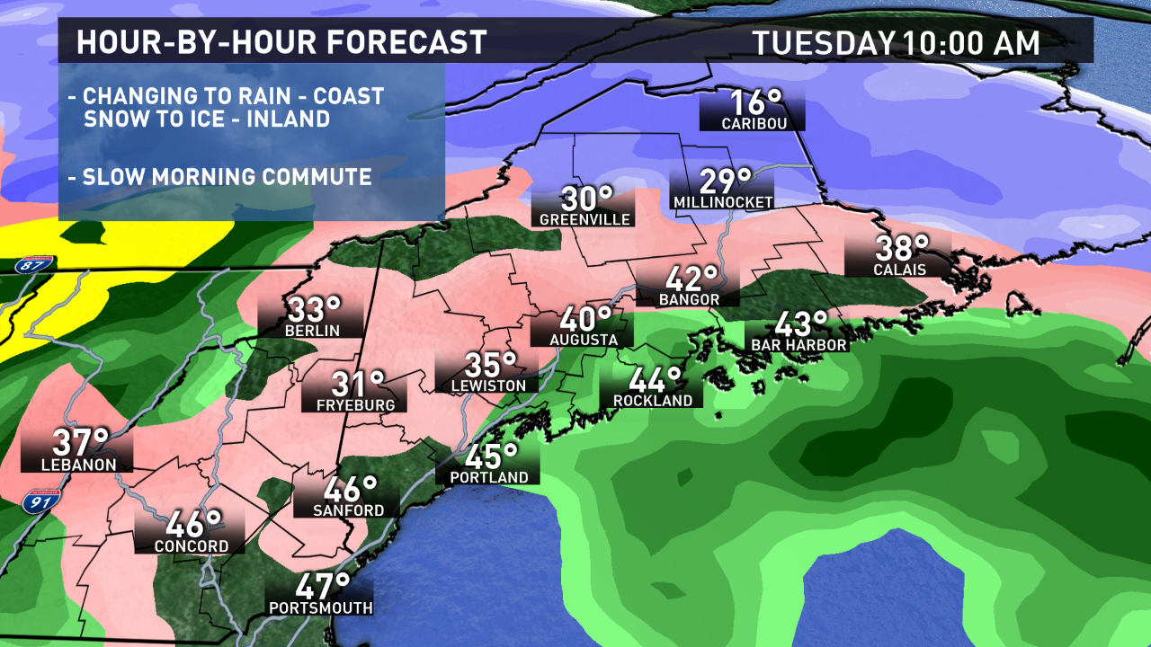
The Tuesday morning commute will be a slow one with slick roads.
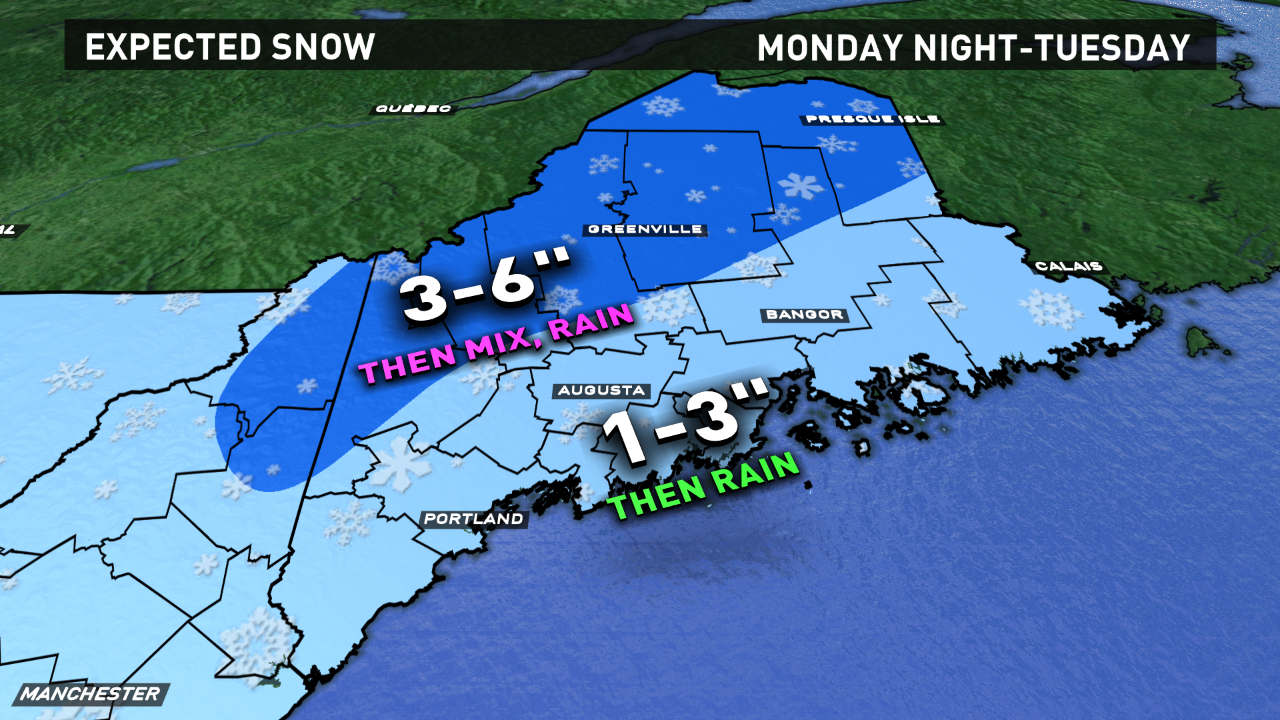
Snow will change to a mix and rain near the coast during Tuesday morning.
It will take longer to warm the surface farther inland and in the mountains. Expect snow to change to ice (sleet/freezing rain) during the morning. Ice accretion on trees and power lines isn't a real concern, because of the coating of snow before the ice. But it will be enough to make for slippery travel through the morning.
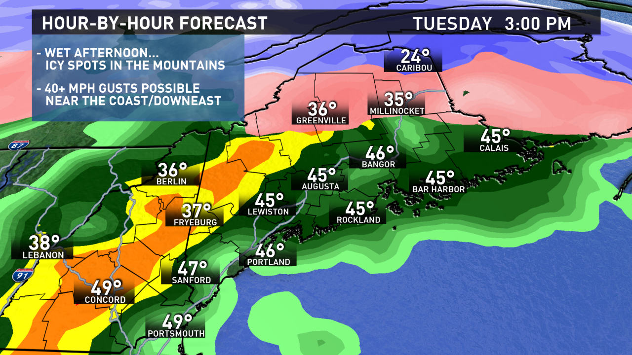
Warmer air tries to move far inland during the afternoon. It'll be a wet afternoon in central and southern Maine with periods of rain and temperatures hitting the 40s. Some downpours are expected. Rain totals may be over an inch along the coast.
It may remain icy in the mountains and far north. Sometimes, cold air can be tough to scour out of the valleys, so icy travel may continue here.
Near the coast, where warmer air does take over, there may be some southeasterly gusts to 40 MPH late Tuesday.
Before the change to ice and rain, I'm expecting 1 to 3 inches of snow in most of central and southern Maine. This will be on the ground for Tuesday morning's commute, then get washed away by rain later in the day.
Farther inland and north, especially north of Route 2, at least a few inches are possible before a change to sleet and freezing rain. Snow totals may be closer to 6 inches across the far north, in parts of Aroostook County.
Follow our updates on-air and online...timing the change from snow to ice to rain will be important.
Ryan
Follow me on Twitter, Facebook, Instagram @RyanBretonWX